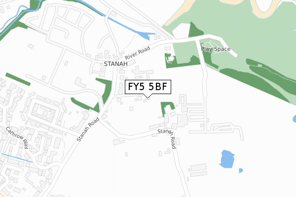
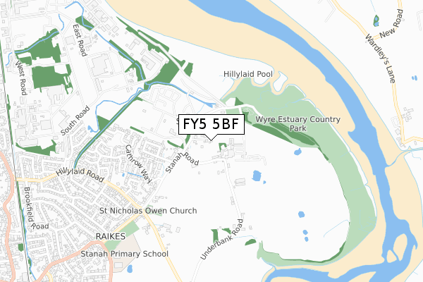
FY5 5BF is located in the Stanah electoral ward, within the local authority district of Wyre and the English Parliamentary constituency of Wyre and Preston North. The Sub Integrated Care Board (ICB) Location is NHS Lancashire and South Cumbria ICB - 02M and the police force is Lancashire. This postcode has been in use since November 2017.


GetTheData
Source: OS Open Zoomstack (Ordnance Survey)
Licence: Open Government Licence (requires attribution)
Attribution: Contains OS data © Crown copyright and database right 2025
Source: Open Postcode Geo
Licence: Open Government Licence (requires attribution)
Attribution: Contains OS data © Crown copyright and database right 2025; Contains Royal Mail data © Royal Mail copyright and database right 2025; Source: Office for National Statistics licensed under the Open Government Licence v.3.0
| Easting | 335427 |
| Northing | 442879 |
| Latitude | 53.878085 |
| Longitude | -2.983699 |
GetTheData
Source: Open Postcode Geo
Licence: Open Government Licence
| Country | England |
| Postcode District | FY5 |
➜ See where FY5 is on a map ➜ Where is Thornton? | |
GetTheData
Source: Land Registry Price Paid Data
Licence: Open Government Licence
| Ward | Stanah |
| Constituency | Wyre And Preston North |
GetTheData
Source: ONS Postcode Database
Licence: Open Government Licence
4, MEADOW CLOSE, THORNTON-CLEVELEYS, FY5 5BF 2018 28 SEP £395,000 |
2018 9 FEB £350,000 |
2, MEADOW CLOSE, THORNTON-CLEVELEYS, FY5 5BF 2017 17 NOV £299,950 |
3, MEADOW CLOSE, THORNTON-CLEVELEYS, FY5 5BF 2017 17 OCT £265,000 |
GetTheData
Source: HM Land Registry Price Paid Data
Licence: Contains HM Land Registry data © Crown copyright and database right 2025. This data is licensed under the Open Government Licence v3.0.
| Car Park (River Road) | Stanah | 214m |
| Stannah Road (Stanah Road) | Stanah | 218m |
| Four Lane Ends (Stanah Road) | Stanah | 518m |
| St Johns Church (Stanah Road) | Stanah | 847m |
| Brookfield Road (Hillylaid Road) | Thornton | 1,089m |
| Poulton-le-Fylde Station | 3.3km |
| Layton (Lancs) Station | 5.7km |
GetTheData
Source: NaPTAN
Licence: Open Government Licence
| Percentage of properties with Next Generation Access | 100.0% |
| Percentage of properties with Superfast Broadband | 100.0% |
| Percentage of properties with Ultrafast Broadband | 0.0% |
| Percentage of properties with Full Fibre Broadband | 0.0% |
Superfast Broadband is between 30Mbps and 300Mbps
Ultrafast Broadband is > 300Mbps
| Percentage of properties unable to receive 2Mbps | 0.0% |
| Percentage of properties unable to receive 5Mbps | 0.0% |
| Percentage of properties unable to receive 10Mbps | 0.0% |
| Percentage of properties unable to receive 30Mbps | 0.0% |
GetTheData
Source: Ofcom
Licence: Ofcom Terms of Use (requires attribution)
GetTheData
Source: ONS Postcode Database
Licence: Open Government Licence

➜ Get more ratings from the Food Standards Agency
GetTheData
Source: Food Standards Agency
Licence: FSA terms & conditions
| Last Collection | |||
|---|---|---|---|
| Location | Mon-Fri | Sat | Distance |
| Stanah Road | 16:00 | 11:30 | 877m |
| 32 Sandy Lane, Preesall | 16:30 | 11:00 | 1,042m |
| Staynall, Robinson Farm | 16:00 | 10:45 | 1,142m |
GetTheData
Source: Dracos
Licence: Creative Commons Attribution-ShareAlike
The below table lists the International Territorial Level (ITL) codes (formerly Nomenclature of Territorial Units for Statistics (NUTS) codes) and Local Administrative Units (LAU) codes for FY5 5BF:
| ITL 1 Code | Name |
|---|---|
| TLD | North West (England) |
| ITL 2 Code | Name |
| TLD4 | Lancashire |
| ITL 3 Code | Name |
| TLD44 | Lancaster and Wyre |
| LAU 1 Code | Name |
| E07000128 | Wyre |
GetTheData
Source: ONS Postcode Directory
Licence: Open Government Licence
The below table lists the Census Output Area (OA), Lower Layer Super Output Area (LSOA), and Middle Layer Super Output Area (MSOA) for FY5 5BF:
| Code | Name | |
|---|---|---|
| OA | E00129889 | |
| LSOA | E01025596 | Wyre 012E |
| MSOA | E02005330 | Wyre 012 |
GetTheData
Source: ONS Postcode Directory
Licence: Open Government Licence
| FY5 5LW | Stanah Road | 100m |
| FY5 5LR | River Road | 135m |
| FY5 5LP | Stanah Villas | 163m |
| FY5 5LJ | Underbank Road | 179m |
| FY5 5JG | Stanah Road | 240m |
| FY5 5NT | Redwood Gardens | 348m |
| FY5 5LN | Underbank Road | 358m |
| FY5 5JH | Stanah Gardens | 360m |
| FY5 5NY | Hurstleigh Heights | 405m |
| FY5 5NZ | Lindley Croft | 413m |
GetTheData
Source: Open Postcode Geo; Land Registry Price Paid Data
Licence: Open Government Licence