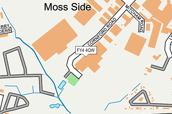
FY4 4QW is located in the Clifton electoral ward, within the unitary authority of Blackpool and the English Parliamentary constituency of Blackpool South. The Sub Integrated Care Board (ICB) Location is NHS Lancashire and South Cumbria ICB - 00R and the police force is Lancashire. This postcode has been in use since January 1980.


GetTheData
Source: OS OpenMap – Local (Ordnance Survey)
Source: OS VectorMap District (Ordnance Survey)
Licence: Open Government Licence (requires attribution)
| Easting | 333866 |
| Northing | 433948 |
| Latitude | 53.797630 |
| Longitude | -3.005515 |
GetTheData
Source: Open Postcode Geo
Licence: Open Government Licence
| Country | England |
| Postcode District | FY4 |
➜ See where FY4 is on a map ➜ Where is Blackpool? | |
GetTheData
Source: Land Registry Price Paid Data
Licence: Open Government Licence
Elevation or altitude of FY4 4QW as distance above sea level:
| Metres | Feet | |
|---|---|---|
| Elevation | 10m | 33ft |
Elevation is measured from the approximate centre of the postcode, to the nearest point on an OS contour line from OS Terrain 50, which has contour spacing of ten vertical metres.
➜ How high above sea level am I? Find the elevation of your current position using your device's GPS.
GetTheData
Source: Open Postcode Elevation
Licence: Open Government Licence
| Ward | Clifton |
| Constituency | Blackpool South |
GetTheData
Source: ONS Postcode Database
Licence: Open Government Licence
| Cornford Road (Clifton Road) | Mereside | 75m |
| Cornford Road (Clifton Road) | Mereside | 108m |
| Deepdale Road (Clifton Road) | Mereside | 192m |
| Deepdale Road (Clifton Road) | Mereside | 215m |
| Borrowdale Avenue (Langdale Road) | Mereside | 273m |
| Blackpool South Station | 2.9km |
| Blackpool Pleasure Beach Station | 3.4km |
| Squires Gate Station | 3.7km |
GetTheData
Source: NaPTAN
Licence: Open Government Licence
GetTheData
Source: ONS Postcode Database
Licence: Open Government Licence


➜ Get more ratings from the Food Standards Agency
GetTheData
Source: Food Standards Agency
Licence: FSA terms & conditions
| Last Collection | |||
|---|---|---|---|
| Location | Mon-Fri | Sat | Distance |
| Clifton Road | 18:15 | 76m | |
| Clifton Road | 17:30 | 12:00 | 78m |
| Clifton Avenue | 17:00 | 12:30 | 455m |
GetTheData
Source: Dracos
Licence: Creative Commons Attribution-ShareAlike
The below table lists the International Territorial Level (ITL) codes (formerly Nomenclature of Territorial Units for Statistics (NUTS) codes) and Local Administrative Units (LAU) codes for FY4 4QW:
| ITL 1 Code | Name |
|---|---|
| TLD | North West (England) |
| ITL 2 Code | Name |
| TLD4 | Lancashire |
| ITL 3 Code | Name |
| TLD42 | Blackpool |
| LAU 1 Code | Name |
| E06000009 | Blackpool |
GetTheData
Source: ONS Postcode Directory
Licence: Open Government Licence
The below table lists the Census Output Area (OA), Lower Layer Super Output Area (LSOA), and Middle Layer Super Output Area (MSOA) for FY4 4QW:
| Code | Name | |
|---|---|---|
| OA | E00063972 | |
| LSOA | E01012688 | Blackpool 014C |
| MSOA | E02002646 | Blackpool 014 |
GetTheData
Source: ONS Postcode Directory
Licence: Open Government Licence
| FY4 4QN | Mitcham Road | 81m |
| FY4 4QF | Clifton Road | 109m |
| FY4 4QS | Lee Road | 118m |
| FY4 4QA | Clifton Road | 173m |
| FY4 4QQ | Cornford Road | 181m |
| FY4 4RX | Newby Place | 189m |
| FY4 4RZ | Clifton Road | 192m |
| FY4 4RU | Borrowdale Road | 204m |
| FY4 4AL | Lindbeck Road | 205m |
| FY4 4UF | Lindbeck Road | 230m |
GetTheData
Source: Open Postcode Geo; Land Registry Price Paid Data
Licence: Open Government Licence