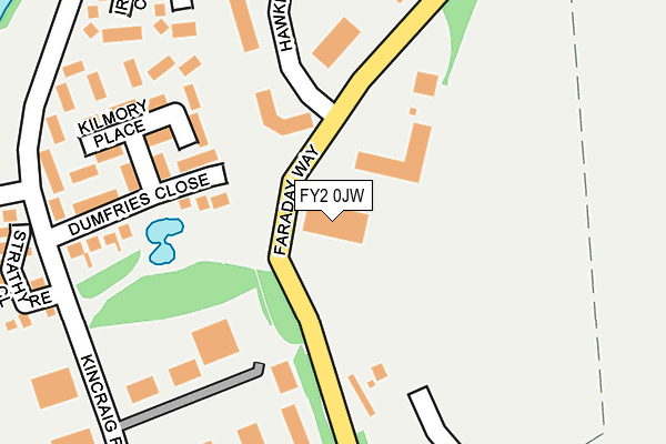
FY2 0JW lies on Blackpool Technology Centre in Blackpool. FY2 0JW is located in the Ingthorpe electoral ward, within the unitary authority of Blackpool and the English Parliamentary constituency of Blackpool North and Cleveleys. The Sub Integrated Care Board (ICB) Location is NHS Lancashire and South Cumbria ICB - 00R and the police force is Lancashire. This postcode has been in use since December 1998.


GetTheData
Source: OS OpenMap – Local (Ordnance Survey)
Source: OS VectorMap District (Ordnance Survey)
Licence: Open Government Licence (requires attribution)
| Easting | 332914 |
| Northing | 440087 |
| Latitude | 53.852661 |
| Longitude | -3.021311 |
GetTheData
Source: Open Postcode Geo
Licence: Open Government Licence
| Street | Blackpool Technology Centre |
| Town/City | Blackpool |
| Country | England |
| Postcode District | FY2 |
➜ See where FY2 is on a map ➜ Where is Blackpool? | |
GetTheData
Source: Land Registry Price Paid Data
Licence: Open Government Licence
Elevation or altitude of FY2 0JW as distance above sea level:
| Metres | Feet | |
|---|---|---|
| Elevation | 10m | 33ft |
Elevation is measured from the approximate centre of the postcode, to the nearest point on an OS contour line from OS Terrain 50, which has contour spacing of ten vertical metres.
➜ How high above sea level am I? Find the elevation of your current position using your device's GPS.
GetTheData
Source: Open Postcode Elevation
Licence: Open Government Licence
| Ward | Ingthorpe |
| Constituency | Blackpool North And Cleveleys |
GetTheData
Source: ONS Postcode Database
Licence: Open Government Licence
DIGITAL DESIGN BUREAU, BLACKPOOL TECHNOLOGY CENTRE, BLACKPOOL, FY2 0JW 2001 14 DEC £973,525 |
GetTheData
Source: HM Land Registry Price Paid Data
Licence: Contains HM Land Registry data © Crown copyright and database right 2025. This data is licensed under the Open Government Licence v3.0.
| Faraday Way | Kincraig Estate | 54m |
| Faraday Way | Kincraig Estate | 121m |
| Faraday Way | Kincraig Estate | 153m |
| Faraday Way (Farday Way) | Kincraig Estate | 170m |
| Dumfries Close (Kincraig Road) | Kincraig Estate | 248m |
| Layton (Lancs) Station | 2km |
| Poulton-le-Fylde Station | 2.1km |
| Blackpool North Station | 3.9km |
GetTheData
Source: NaPTAN
Licence: Open Government Licence
GetTheData
Source: ONS Postcode Database
Licence: Open Government Licence


➜ Get more ratings from the Food Standards Agency
GetTheData
Source: Food Standards Agency
Licence: FSA terms & conditions
| Last Collection | |||
|---|---|---|---|
| Location | Mon-Fri | Sat | Distance |
| Kincraig Road | 17:15 | 13:00 | 258m |
| Tarragon Drive | 16:00 | 11:00 | 530m |
| Hawthorne Grove, Carleton | 16:45 | 12:00 | 567m |
GetTheData
Source: Dracos
Licence: Creative Commons Attribution-ShareAlike
The below table lists the International Territorial Level (ITL) codes (formerly Nomenclature of Territorial Units for Statistics (NUTS) codes) and Local Administrative Units (LAU) codes for FY2 0JW:
| ITL 1 Code | Name |
|---|---|
| TLD | North West (England) |
| ITL 2 Code | Name |
| TLD4 | Lancashire |
| ITL 3 Code | Name |
| TLD42 | Blackpool |
| LAU 1 Code | Name |
| E06000009 | Blackpool |
GetTheData
Source: ONS Postcode Directory
Licence: Open Government Licence
The below table lists the Census Output Area (OA), Lower Layer Super Output Area (LSOA), and Middle Layer Super Output Area (MSOA) for FY2 0JW:
| Code | Name | |
|---|---|---|
| OA | E00064069 | |
| LSOA | E01012704 | Blackpool 002C |
| MSOA | E02002634 | Blackpool 002 |
GetTheData
Source: ONS Postcode Directory
Licence: Open Government Licence
| FY2 0JN | Hawking Place | 177m |
| FY2 0XT | Kilmory Place | 194m |
| FY2 0XU | Dumfries Close | 204m |
| FY2 0XS | Kilmory Place | 233m |
| FY2 0PJ | Kincraig Road | 247m |
| FY2 0FY | Kincraig Court | 285m |
| FY2 0YB | Strathyre Close | 305m |
| FY2 0BS | Glendale Close | 346m |
| FY2 0DU | Briarwood Drive | 358m |
| FY2 0DX | Ingleton Avenue | 367m |
GetTheData
Source: Open Postcode Geo; Land Registry Price Paid Data
Licence: Open Government Licence