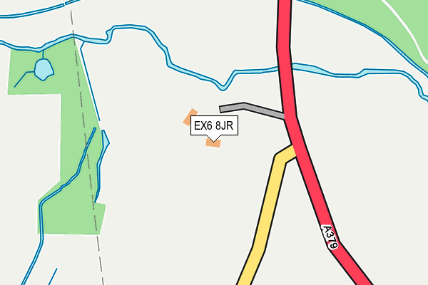
EX6 8JR is located in the Kenton & Starcross electoral ward, within the local authority district of Teignbridge and the English Parliamentary constituency of Newton Abbot. The Sub Integrated Care Board (ICB) Location is NHS Devon ICB - 15N and the police force is Devon & Cornwall. This postcode has been in use since January 1980.


GetTheData
Source: OS OpenMap – Local (Ordnance Survey)
Source: OS VectorMap District (Ordnance Survey)
Licence: Open Government Licence (requires attribution)
| Easting | 295202 |
| Northing | 84414 |
| Latitude | 50.649952 |
| Longitude | -3.483721 |
GetTheData
Source: Open Postcode Geo
Licence: Open Government Licence
| Country | England |
| Postcode District | EX6 |
➜ See where EX6 is on a map | |
GetTheData
Source: Land Registry Price Paid Data
Licence: Open Government Licence
Elevation or altitude of EX6 8JR as distance above sea level:
| Metres | Feet | |
|---|---|---|
| Elevation | 10m | 33ft |
Elevation is measured from the approximate centre of the postcode, to the nearest point on an OS contour line from OS Terrain 50, which has contour spacing of ten vertical metres.
➜ How high above sea level am I? Find the elevation of your current position using your device's GPS.
GetTheData
Source: Open Postcode Elevation
Licence: Open Government Licence
| Ward | Kenton & Starcross |
| Constituency | Newton Abbot |
GetTheData
Source: ONS Postcode Database
Licence: Open Government Licence
| Powderham Arch (A379) | Kenton | 375m |
| Powderham Arch (A379) | Kenton | 544m |
| Red Lodge (A379) | Powderham | 1,067m |
| Red Lodge (A379) | Powderham | 1,072m |
| Triangle (Exeter Hill) | Kenton | 1,215m |
| Lympstone Commando Station | 3.3km |
| Exton Station | 3.5km |
| Starcross Station | 3.5km |
GetTheData
Source: NaPTAN
Licence: Open Government Licence
GetTheData
Source: ONS Postcode Database
Licence: Open Government Licence


➜ Get more ratings from the Food Standards Agency
GetTheData
Source: Food Standards Agency
Licence: FSA terms & conditions
| Last Collection | |||
|---|---|---|---|
| Location | Mon-Fri | Sat | Distance |
| Starcross Post Office | 17:30 | 11:30 | 3,592m |
| French Box | 16:30 | 08:45 | 3,595m |
| Strand | 18:00 | 11:30 | 3,638m |
GetTheData
Source: Dracos
Licence: Creative Commons Attribution-ShareAlike
The below table lists the International Territorial Level (ITL) codes (formerly Nomenclature of Territorial Units for Statistics (NUTS) codes) and Local Administrative Units (LAU) codes for EX6 8JR:
| ITL 1 Code | Name |
|---|---|
| TLK | South West (England) |
| ITL 2 Code | Name |
| TLK4 | Devon |
| ITL 3 Code | Name |
| TLK43 | Devon CC |
| LAU 1 Code | Name |
| E07000045 | Teignbridge |
GetTheData
Source: ONS Postcode Directory
Licence: Open Government Licence
The below table lists the Census Output Area (OA), Lower Layer Super Output Area (LSOA), and Middle Layer Super Output Area (MSOA) for EX6 8JR:
| Code | Name | |
|---|---|---|
| OA | E00102535 | |
| LSOA | E01020245 | Teignbridge 002E |
| MSOA | E02004202 | Teignbridge 002 |
GetTheData
Source: ONS Postcode Directory
Licence: Open Government Licence
| EX6 8NJ | 936m | |
| EX6 8NG | Higher Down | 1096m |
| EX6 8NH | 1156m | |
| EX6 8SH | Blackheath Court | 1163m |
| EX6 8NF | Torrington Place | 1166m |
| EX6 8NQ | Manor Gardens | 1177m |
| EX6 8JN | 1185m | |
| EX6 8JT | East Town Lane | 1193m |
| EX6 8ND | High Street | 1209m |
| EX6 8LA | 1235m |
GetTheData
Source: Open Postcode Geo; Land Registry Price Paid Data
Licence: Open Government Licence