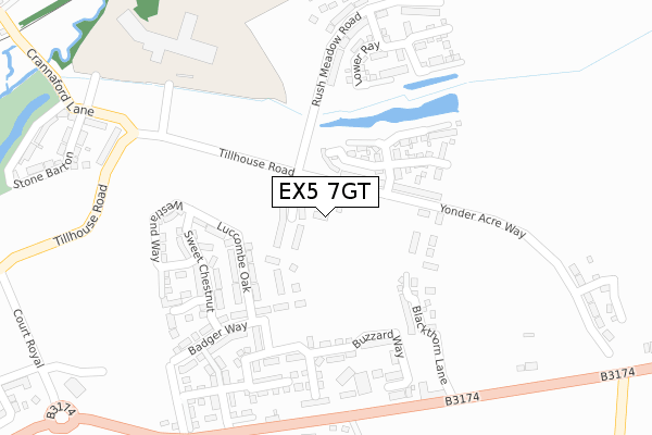
EX5 7GT is located in the Cranbrook electoral ward, within the local authority district of East Devon and the English Parliamentary constituency of East Devon. The Sub Integrated Care Board (ICB) Location is NHS Devon ICB - 15N and the police force is Devon & Cornwall. This postcode has been in use since September 2019.


GetTheData
Source: OS Open Zoomstack (Ordnance Survey)
Licence: Open Government Licence (requires attribution)
Attribution: Contains OS data © Crown copyright and database right 2025
Source: Open Postcode Geo
Licence: Open Government Licence (requires attribution)
Attribution: Contains OS data © Crown copyright and database right 2025; Contains Royal Mail data © Royal Mail copyright and database right 2025; Source: Office for National Statistics licensed under the Open Government Licence v.3.0
| Easting | 301726 |
| Northing | 95718 |
| Latitude | 50.752704 |
| Longitude | -3.394494 |
GetTheData
Source: Open Postcode Geo
Licence: Open Government Licence
| Country | England |
| Postcode District | EX5 |
➜ See where EX5 is on a map ➜ Where is Cranbrook? | |
GetTheData
Source: Land Registry Price Paid Data
Licence: Open Government Licence
| Ward | Cranbrook |
| Constituency | East Devon |
GetTheData
Source: ONS Postcode Database
Licence: Open Government Licence
10, LINNET PARK, CRANBROOK, EXETER, EX5 7GT 2021 30 SEP £339,950 |
9, LINNET PARK, CRANBROOK, EXETER, EX5 7GT 2020 21 DEC £339,950 |
2, LINNET PARK, CRANBROOK, EXETER, EX5 7GT 2020 28 AUG £294,950 |
GetTheData
Source: HM Land Registry Price Paid Data
Licence: Contains HM Land Registry data © Crown copyright and database right 2025. This data is licensed under the Open Government Licence v3.0.
| Garage (B3174) | Rockbeare | 361m |
| Garage (B3174) | Rockbeare | 362m |
| Shareford Way | Cranbrook | 480m |
| Shareford Way | Cranbrook | 487m |
| Jack In The Green Inn (Honiton Road) | Rockbeare | 497m |
| Cranbrook Station | 1.9km |
| Whimple Station | 3.3km |
GetTheData
Source: NaPTAN
Licence: Open Government Licence
GetTheData
Source: ONS Postcode Database
Licence: Open Government Licence


➜ Get more ratings from the Food Standards Agency
GetTheData
Source: Food Standards Agency
Licence: FSA terms & conditions
| Last Collection | |||
|---|---|---|---|
| Location | Mon-Fri | Sat | Distance |
| Hand & Pen | 16:30 | 09:00 | 3,750m |
| Broadclyst Post Office | 17:25 | 11:45 | 3,820m |
| Scotchmead | 18:15 | 08:45 | 4,225m |
GetTheData
Source: Dracos
Licence: Creative Commons Attribution-ShareAlike
The below table lists the International Territorial Level (ITL) codes (formerly Nomenclature of Territorial Units for Statistics (NUTS) codes) and Local Administrative Units (LAU) codes for EX5 7GT:
| ITL 1 Code | Name |
|---|---|
| TLK | South West (England) |
| ITL 2 Code | Name |
| TLK4 | Devon |
| ITL 3 Code | Name |
| TLK43 | Devon CC |
| LAU 1 Code | Name |
| E07000040 | East Devon |
GetTheData
Source: ONS Postcode Directory
Licence: Open Government Licence
The below table lists the Census Output Area (OA), Lower Layer Super Output Area (LSOA), and Middle Layer Super Output Area (MSOA) for EX5 7GT:
| Code | Name | |
|---|---|---|
| OA | E00100675 | |
| LSOA | E01019893 | East Devon 006C |
| MSOA | E02004134 | East Devon 006 |
GetTheData
Source: ONS Postcode Directory
Licence: Open Government Licence
| EX5 2EE | London Road | 238m |
| EX5 2ED | London Road | 317m |
| EX5 2EA | London Road | 399m |
| EX5 2EB | London Road | 414m |
| EX5 2DZ | New Cottages | 419m |
| EX5 2EF | 513m | |
| EX5 7DX | Radfords Turf | 537m |
| EX5 7EY | Russet Loop | 594m |
| EX5 3BD | 610m | |
| EX5 2FP | London Road | 613m |
GetTheData
Source: Open Postcode Geo; Land Registry Price Paid Data
Licence: Open Government Licence