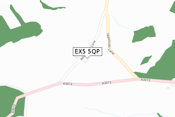
EX5 5QP is located in the Cadbury electoral ward, within the local authority district of Mid Devon and the English Parliamentary constituency of Central Devon. The Sub Integrated Care Board (ICB) Location is NHS Devon ICB - 15N and the police force is Devon & Cornwall. This postcode has been in use since October 2018.


GetTheData
Source: OS Open Zoomstack (Ordnance Survey)
Licence: Open Government Licence (requires attribution)
Attribution: Contains OS data © Crown copyright and database right 2025
Source: Open Postcode Geo
Licence: Open Government Licence (requires attribution)
Attribution: Contains OS data © Crown copyright and database right 2025; Contains Royal Mail data © Royal Mail copyright and database right 2025; Source: Office for National Statistics licensed under the Open Government Licence v.3.0
| Easting | 289971 |
| Northing | 105443 |
| Latitude | 50.838014 |
| Longitude | -3.563987 |
GetTheData
Source: Open Postcode Geo
Licence: Open Government Licence
| Country | England |
| Postcode District | EX5 |
➜ See where EX5 is on a map | |
GetTheData
Source: Land Registry Price Paid Data
Licence: Open Government Licence
| Ward | Cadbury |
| Constituency | Central Devon |
GetTheData
Source: ONS Postcode Database
Licence: Open Government Licence
| Cadbury Cross (A3072) | Cadbury | 792m |
| Cadbury Cross | Cadbury | 819m |
GetTheData
Source: NaPTAN
Licence: Open Government Licence
| Percentage of properties with Next Generation Access | 100.0% |
| Percentage of properties with Superfast Broadband | 0.0% |
| Percentage of properties with Ultrafast Broadband | 0.0% |
| Percentage of properties with Full Fibre Broadband | 0.0% |
Superfast Broadband is between 30Mbps and 300Mbps
Ultrafast Broadband is > 300Mbps
| Percentage of properties unable to receive 2Mbps | 100.0% |
| Percentage of properties unable to receive 5Mbps | 100.0% |
| Percentage of properties unable to receive 10Mbps | 100.0% |
| Percentage of properties unable to receive 30Mbps | 100.0% |
GetTheData
Source: Ofcom
Licence: Ofcom Terms of Use (requires attribution)
GetTheData
Source: ONS Postcode Database
Licence: Open Government Licence
| Last Collection | |||
|---|---|---|---|
| Location | Mon-Fri | Sat | Distance |
| Latchmore | 17:45 | 07:20 | 5,551m |
GetTheData
Source: Dracos
Licence: Creative Commons Attribution-ShareAlike
The below table lists the International Territorial Level (ITL) codes (formerly Nomenclature of Territorial Units for Statistics (NUTS) codes) and Local Administrative Units (LAU) codes for EX5 5QP:
| ITL 1 Code | Name |
|---|---|
| TLK | South West (England) |
| ITL 2 Code | Name |
| TLK4 | Devon |
| ITL 3 Code | Name |
| TLK43 | Devon CC |
| LAU 1 Code | Name |
| E07000042 | Mid Devon |
GetTheData
Source: ONS Postcode Directory
Licence: Open Government Licence
The below table lists the Census Output Area (OA), Lower Layer Super Output Area (LSOA), and Middle Layer Super Output Area (MSOA) for EX5 5QP:
| Code | Name | |
|---|---|---|
| OA | E00101469 | |
| LSOA | E01020044 | Mid Devon 008B |
| MSOA | E02004171 | Mid Devon 008 |
GetTheData
Source: ONS Postcode Directory
Licence: Open Government Licence
| EX5 5QH | 438m | |
| EX5 5PZ | Castle Cottages | 795m |
| EX5 5PX | 827m | |
| EX5 5LA | 1203m | |
| EX17 4JS | 1612m | |
| EX5 5JZ | 1703m | |
| EX16 8HS | 1888m | |
| EX17 4BA | 2158m | |
| EX16 8HR | 2199m | |
| EX17 4AY | 2222m |
GetTheData
Source: Open Postcode Geo; Land Registry Price Paid Data
Licence: Open Government Licence