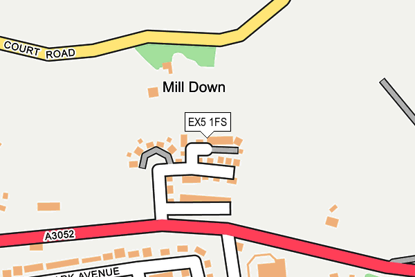
EX5 1FS is located in the Clyst Valley electoral ward, within the local authority district of East Devon and the English Parliamentary constituency of East Devon. The Sub Integrated Care Board (ICB) Location is NHS Devon ICB - 15N and the police force is Devon & Cornwall. This postcode has been in use since July 2017.


GetTheData
Source: OS OpenMap – Local (Ordnance Survey)
Source: OS VectorMap District (Ordnance Survey)
Licence: Open Government Licence (requires attribution)
| Easting | 297858 |
| Northing | 91082 |
| Latitude | 50.710358 |
| Longitude | -3.448022 |
GetTheData
Source: Open Postcode Geo
Licence: Open Government Licence
| Country | England |
| Postcode District | EX5 |
➜ See where EX5 is on a map | |
GetTheData
Source: Land Registry Price Paid Data
Licence: Open Government Licence
| Ward | Clyst Valley |
| Constituency | East Devon |
GetTheData
Source: ONS Postcode Database
Licence: Open Government Licence
| St. Bridgets Nursery (A3052) | Clyst St Mary | 186m |
| St. Bridgets Nursery (A3052) | Clyst St Mary | 194m |
| Shelter (A3052) | Clyst St Mary | 305m |
| Shelter (A3052) | Clyst St Mary | 351m |
| Westpoint (A3052) | Clyst St Mary | 511m |
| Newcourt Station | 1.8km |
| Digby & Sowton Station | 1.8km |
| Topsham Station | 2.9km |
GetTheData
Source: NaPTAN
Licence: Open Government Licence
| Percentage of properties with Next Generation Access | 100.0% |
| Percentage of properties with Superfast Broadband | 100.0% |
| Percentage of properties with Ultrafast Broadband | 100.0% |
| Percentage of properties with Full Fibre Broadband | 100.0% |
Superfast Broadband is between 30Mbps and 300Mbps
Ultrafast Broadband is > 300Mbps
| Percentage of properties unable to receive 2Mbps | 0.0% |
| Percentage of properties unable to receive 5Mbps | 0.0% |
| Percentage of properties unable to receive 10Mbps | 0.0% |
| Percentage of properties unable to receive 30Mbps | 0.0% |
GetTheData
Source: Ofcom
Licence: Ofcom Terms of Use (requires attribution)
GetTheData
Source: ONS Postcode Database
Licence: Open Government Licence


➜ Get more ratings from the Food Standards Agency
GetTheData
Source: Food Standards Agency
Licence: FSA terms & conditions
| Last Collection | |||
|---|---|---|---|
| Location | Mon-Fri | Sat | Distance |
| Blue Ball | 18:15 | 12:30 | 1,180m |
| Kestrel Way | 19:30 | 1,484m | |
| Kestrel Way | 19:00 | 12:30 | 1,484m |
GetTheData
Source: Dracos
Licence: Creative Commons Attribution-ShareAlike
The below table lists the International Territorial Level (ITL) codes (formerly Nomenclature of Territorial Units for Statistics (NUTS) codes) and Local Administrative Units (LAU) codes for EX5 1FS:
| ITL 1 Code | Name |
|---|---|
| TLK | South West (England) |
| ITL 2 Code | Name |
| TLK4 | Devon |
| ITL 3 Code | Name |
| TLK43 | Devon CC |
| LAU 1 Code | Name |
| E07000040 | East Devon |
GetTheData
Source: ONS Postcode Directory
Licence: Open Government Licence
The below table lists the Census Output Area (OA), Lower Layer Super Output Area (LSOA), and Middle Layer Super Output Area (MSOA) for EX5 1FS:
| Code | Name | |
|---|---|---|
| OA | E00100706 | |
| LSOA | E01019898 | East Devon 014A |
| MSOA | E02004142 | East Devon 014 |
GetTheData
Source: ONS Postcode Directory
Licence: Open Government Licence
| EX5 1DB | Winslade Park Avenue | 210m |
| EX5 1AA | 223m | |
| EX5 1AE | 297m | |
| EX5 1DA | Winslade Park Avenue | 337m |
| EX5 1BB | 343m | |
| EX5 1BD | 388m | |
| EX5 1BE | Craigs Cottages | 405m |
| EX5 1DF | Grindle Way | 415m |
| EX5 1DE | Clyst Valley Road | 423m |
| EX5 1BQ | The Village | 424m |
GetTheData
Source: Open Postcode Geo; Land Registry Price Paid Data
Licence: Open Government Licence