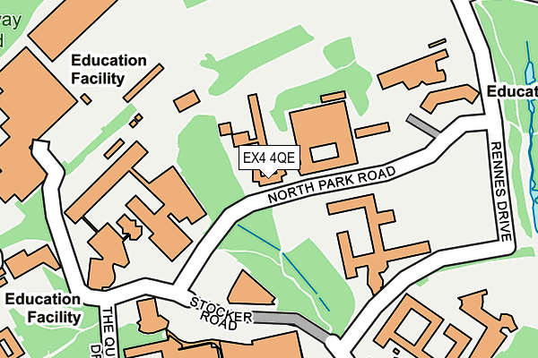
EX4 4QE is located in the Duryard and St James electoral ward, within the local authority district of Exeter and the English Parliamentary constituency of Exeter. The Sub Integrated Care Board (ICB) Location is NHS Devon ICB - 15N and the police force is Devon & Cornwall. This postcode has been in use since January 1980.


GetTheData
Source: OS OpenMap – Local (Ordnance Survey)
Source: OS VectorMap District (Ordnance Survey)
Licence: Open Government Licence (requires attribution)
| Easting | 291890 |
| Northing | 94191 |
| Latitude | 50.737237 |
| Longitude | -3.533415 |
GetTheData
Source: Open Postcode Geo
Licence: Open Government Licence
| Country | England |
| Postcode District | EX4 |
➜ See where EX4 is on a map ➜ Where is Exeter? | |
GetTheData
Source: Land Registry Price Paid Data
Licence: Open Government Licence
Elevation or altitude of EX4 4QE as distance above sea level:
| Metres | Feet | |
|---|---|---|
| Elevation | 80m | 262ft |
Elevation is measured from the approximate centre of the postcode, to the nearest point on an OS contour line from OS Terrain 50, which has contour spacing of ten vertical metres.
➜ How high above sea level am I? Find the elevation of your current position using your device's GPS.
GetTheData
Source: Open Postcode Elevation
Licence: Open Government Licence
| Ward | Duryard And St James |
| Constituency | Exeter |
GetTheData
Source: ONS Postcode Database
Licence: Open Government Licence
| North Park Road | Pennsylvania | 147m |
| Streatham Court (Rennes Drive) | Pennsylvania | 194m |
| Innovation Centre (North Park Road) | Pennsylvania | 235m |
| The Queen's Drive | Pennsylvania | 324m |
| Poole Gate (Prince Of Wales Road) | Pennsylvania | 432m |
| St James Park (Devon) Station | 1.1km |
| Exeter St Davids Station | 1.1km |
| Exeter Central Station | 1.2km |
GetTheData
Source: NaPTAN
Licence: Open Government Licence
GetTheData
Source: ONS Postcode Database
Licence: Open Government Licence


➜ Get more ratings from the Food Standards Agency
GetTheData
Source: Food Standards Agency
Licence: FSA terms & conditions
| Last Collection | |||
|---|---|---|---|
| Location | Mon-Fri | Sat | Distance |
| Reed Hall | 19:00 | 12:30 | 414m |
| Hillcrest Park | 18:45 | 12:15 | 494m |
| Pennsylvania Road | 18:15 | 12:15 | 699m |
GetTheData
Source: Dracos
Licence: Creative Commons Attribution-ShareAlike
The below table lists the International Territorial Level (ITL) codes (formerly Nomenclature of Territorial Units for Statistics (NUTS) codes) and Local Administrative Units (LAU) codes for EX4 4QE:
| ITL 1 Code | Name |
|---|---|
| TLK | South West (England) |
| ITL 2 Code | Name |
| TLK4 | Devon |
| ITL 3 Code | Name |
| TLK43 | Devon CC |
| LAU 1 Code | Name |
| E07000041 | Exeter |
GetTheData
Source: ONS Postcode Directory
Licence: Open Government Licence
The below table lists the Census Output Area (OA), Lower Layer Super Output Area (LSOA), and Middle Layer Super Output Area (MSOA) for EX4 4QE:
| Code | Name | |
|---|---|---|
| OA | E00101124 | |
| LSOA | E01033233 | Exeter 001F |
| MSOA | E02004149 | Exeter 001 |
GetTheData
Source: ONS Postcode Directory
Licence: Open Government Licence
| EX4 4SQ | Higher Hoopern Lane | 459m |
| EX4 4JR | High Croft | 463m |
| EX4 4PD | Streatham Drive | 494m |
| EX4 4SH | Hillcrest Park | 513m |
| EX4 4JQ | High Croft | 527m |
| EX4 4QX | Clydesdale Road | 544m |
| EX4 4RW | Highcroft Court | 548m |
| EX4 4PR | Prince Of Wales Road | 554m |
| EX4 4SU | Clydesdale Road | 604m |
| EX4 4AB | Lodge Hill | 608m |
GetTheData
Source: Open Postcode Geo; Land Registry Price Paid Data
Licence: Open Government Licence