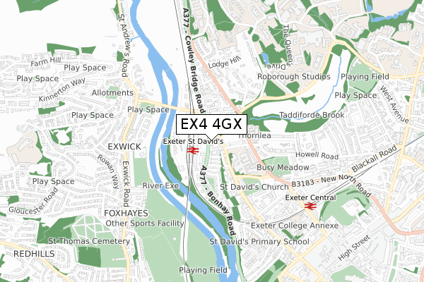
EX4 4GX is located in the Duryard and St James electoral ward, within the local authority district of Exeter and the English Parliamentary constituency of Exeter. The Sub Integrated Care Board (ICB) Location is NHS Devon ICB - 15N and the police force is Devon & Cornwall. This postcode has been in use since April 2020.


GetTheData
Source: OS Open Zoomstack (Ordnance Survey)
Licence: Open Government Licence (requires attribution)
Attribution: Contains OS data © Crown copyright and database right 2025
Source: Open Postcode Geo
Licence: Open Government Licence (requires attribution)
Attribution: Contains OS data © Crown copyright and database right 2025; Contains Royal Mail data © Royal Mail copyright and database right 2025; Source: Office for National Statistics licensed under the Open Government Licence v.3.0
| Easting | 292309 |
| Northing | 94279 |
| Latitude | 50.738095 |
| Longitude | -3.527520 |
GetTheData
Source: Open Postcode Geo
Licence: Open Government Licence
| Country | England |
| Postcode District | EX4 |
➜ See where EX4 is on a map ➜ Where is Exeter? | |
GetTheData
Source: Land Registry Price Paid Data
Licence: Open Government Licence
| Ward | Duryard And St James |
| Constituency | Exeter |
GetTheData
Source: ONS Postcode Database
Licence: Open Government Licence
| Innovation Centre (North Park Road) | Pennsylvania | 194m |
| Beech Avenue | Pennsylvania | 364m |
| Streatham Court (Rennes Drive) | Pennsylvania | 410m |
| Pennsylvania Road (Rosebarn Avenue) | Pennsylvania | 425m |
| Pennsylvania Park (Sylvan Road) | Pennsylvania | 481m |
| St James Park (Devon) Station | 0.9km |
| Exeter Central Station | 1.4km |
| Exeter St Davids Station | 1.5km |
GetTheData
Source: NaPTAN
Licence: Open Government Licence
GetTheData
Source: ONS Postcode Database
Licence: Open Government Licence


➜ Get more ratings from the Food Standards Agency
GetTheData
Source: Food Standards Agency
Licence: FSA terms & conditions
| Last Collection | |||
|---|---|---|---|
| Location | Mon-Fri | Sat | Distance |
| Hillcrest Park | 18:45 | 12:15 | 132m |
| Higher Kings Avenue | 18:15 | 12:15 | 432m |
| Pennsylvania Road | 18:15 | 12:15 | 454m |
GetTheData
Source: Dracos
Licence: Creative Commons Attribution-ShareAlike
The below table lists the International Territorial Level (ITL) codes (formerly Nomenclature of Territorial Units for Statistics (NUTS) codes) and Local Administrative Units (LAU) codes for EX4 4GX:
| ITL 1 Code | Name |
|---|---|
| TLK | South West (England) |
| ITL 2 Code | Name |
| TLK4 | Devon |
| ITL 3 Code | Name |
| TLK43 | Devon CC |
| LAU 1 Code | Name |
| E07000041 | Exeter |
GetTheData
Source: ONS Postcode Directory
Licence: Open Government Licence
The below table lists the Census Output Area (OA), Lower Layer Super Output Area (LSOA), and Middle Layer Super Output Area (MSOA) for EX4 4GX:
| Code | Name | |
|---|---|---|
| OA | E00171927 | |
| LSOA | E01033233 | Exeter 001F |
| MSOA | E02004149 | Exeter 001 |
GetTheData
Source: ONS Postcode Directory
Licence: Open Government Licence
| EX4 6DU | Pennsylvania Road | 198m |
| EX4 4SQ | Higher Hoopern Lane | 209m |
| EX4 4SG | Higher Hoopern Lane | 211m |
| EX4 4SH | Hillcrest Park | 246m |
| EX4 4SR | Raven Close | 262m |
| EX4 6DN | Hoopern Avenue | 279m |
| EX4 6DT | Pennsylvania Road | 295m |
| EX4 4SL | Lark Close | 305m |
| EX4 4SW | Curlew Way | 315m |
| EX4 6DW | Pennsylvania Road | 350m |
GetTheData
Source: Open Postcode Geo; Land Registry Price Paid Data
Licence: Open Government Licence