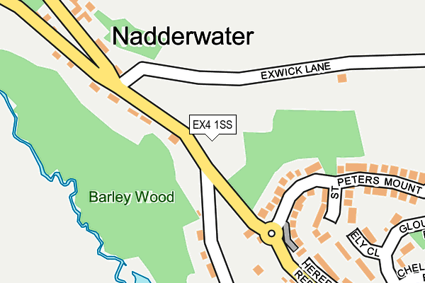
EX4 1SS is located in the Exwick electoral ward, within the local authority district of Exeter and the English Parliamentary constituency of Exeter. The Sub Integrated Care Board (ICB) Location is NHS Devon ICB - 15N and the police force is Devon & Cornwall. This postcode has been in use since April 1985.


GetTheData
Source: OS OpenMap – Local (Ordnance Survey)
Source: OS VectorMap District (Ordnance Survey)
Licence: Open Government Licence (requires attribution)
| Easting | 289642 |
| Northing | 93049 |
| Latitude | 50.726537 |
| Longitude | -3.564932 |
GetTheData
Source: Open Postcode Geo
Licence: Open Government Licence
| Country | England |
| Postcode District | EX4 |
➜ See where EX4 is on a map ➜ Where is Nadderwater? | |
GetTheData
Source: Land Registry Price Paid Data
Licence: Open Government Licence
Elevation or altitude of EX4 1SS as distance above sea level:
| Metres | Feet | |
|---|---|---|
| Elevation | 90m | 295ft |
Elevation is measured from the approximate centre of the postcode, to the nearest point on an OS contour line from OS Terrain 50, which has contour spacing of ten vertical metres.
➜ How high above sea level am I? Find the elevation of your current position using your device's GPS.
GetTheData
Source: Open Postcode Elevation
Licence: Open Government Licence
| Ward | Exwick |
| Constituency | Exeter |
GetTheData
Source: ONS Postcode Database
Licence: Open Government Licence
| Lichfield Road | Exwick | 317m |
| Gloucester Road | Exwick | 331m |
| Lichfield Road | Exwick | 340m |
| Guildford Close (Gloucester Road) | Exwick | 419m |
| Guildford Close (Gloucester Road) | Exwick | 480m |
| Exeter St Davids Station | 1.6km |
| Exeter St Thomas Station | 2.1km |
| Exeter Central Station | 2.2km |
GetTheData
Source: NaPTAN
Licence: Open Government Licence
GetTheData
Source: ONS Postcode Database
Licence: Open Government Licence


➜ Get more ratings from the Food Standards Agency
GetTheData
Source: Food Standards Agency
Licence: FSA terms & conditions
| Last Collection | |||
|---|---|---|---|
| Location | Mon-Fri | Sat | Distance |
| Redhills | 18:00 | 12:15 | 651m |
| Farm Hill | 17:30 | 12:15 | 727m |
| Gloucester Road | 17:45 | 12:15 | 745m |
GetTheData
Source: Dracos
Licence: Creative Commons Attribution-ShareAlike
The below table lists the International Territorial Level (ITL) codes (formerly Nomenclature of Territorial Units for Statistics (NUTS) codes) and Local Administrative Units (LAU) codes for EX4 1SS:
| ITL 1 Code | Name |
|---|---|
| TLK | South West (England) |
| ITL 2 Code | Name |
| TLK4 | Devon |
| ITL 3 Code | Name |
| TLK43 | Devon CC |
| LAU 1 Code | Name |
| E07000041 | Exeter |
GetTheData
Source: ONS Postcode Directory
Licence: Open Government Licence
The below table lists the Census Output Area (OA), Lower Layer Super Output Area (LSOA), and Middle Layer Super Output Area (MSOA) for EX4 1SS:
| Code | Name | |
|---|---|---|
| OA | E00101153 | |
| LSOA | E01019981 | Exeter 012E |
| MSOA | E02004160 | Exeter 012 |
GetTheData
Source: ONS Postcode Directory
Licence: Open Government Licence
| EX4 1SY | Barley Lane | 115m |
| EX4 1SU | Redhills | 115m |
| EX4 1SX | Barley Villas | 122m |
| EX4 2JD | St Peters Mount | 160m |
| EX4 2JF | 170m | |
| EX4 2EY | Ely Close | 232m |
| EX4 2EX | Hereford Road | 267m |
| EX4 2EU | Lichfield Road | 299m |
| EX4 2JB | Gloucester Road | 361m |
| EX4 2LT | Westminster Road | 397m |
GetTheData
Source: Open Postcode Geo; Land Registry Price Paid Data
Licence: Open Government Licence