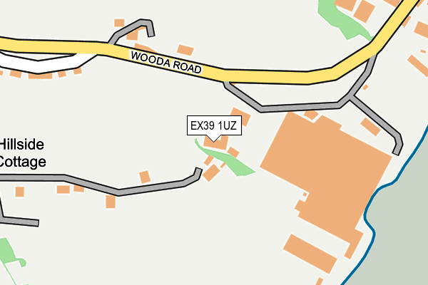
EX39 1UZ is located in the Appledore electoral ward, within the local authority district of Torridge and the English Parliamentary constituency of Torridge and West Devon. The Sub Integrated Care Board (ICB) Location is NHS Devon ICB - 15N and the police force is Devon & Cornwall. This postcode has been in use since May 1994.


GetTheData
Source: OS OpenMap – Local (Ordnance Survey)
Source: OS VectorMap District (Ordnance Survey)
Licence: Open Government Licence (requires attribution)
| Easting | 246498 |
| Northing | 129700 |
| Latitude | 51.046081 |
| Longitude | -4.191204 |
GetTheData
Source: Open Postcode Geo
Licence: Open Government Licence
| Country | England |
| Postcode District | EX39 |
➜ See where EX39 is on a map ➜ Where is Appledore? | |
GetTheData
Source: Land Registry Price Paid Data
Licence: Open Government Licence
Elevation or altitude of EX39 1UZ as distance above sea level:
| Metres | Feet | |
|---|---|---|
| Elevation | 10m | 33ft |
Elevation is measured from the approximate centre of the postcode, to the nearest point on an OS contour line from OS Terrain 50, which has contour spacing of ten vertical metres.
➜ How high above sea level am I? Find the elevation of your current position using your device's GPS.
GetTheData
Source: Open Postcode Elevation
Licence: Open Government Licence
| Ward | Appledore |
| Constituency | Torridge And West Devon |
GetTheData
Source: ONS Postcode Database
Licence: Open Government Licence
| Marine Parade | Appledore | 653m |
| Marine Parade | Appledore | 656m |
| Pitt Hill (Myrtle Street) | Appledore | 698m |
| Pitt Hill (Myrtle Street) | Appledore | 713m |
| Football Ground (Churchill Way) | Appledore | 736m |
GetTheData
Source: NaPTAN
Licence: Open Government Licence
GetTheData
Source: ONS Postcode Database
Licence: Open Government Licence


➜ Get more ratings from the Food Standards Agency
GetTheData
Source: Food Standards Agency
Licence: FSA terms & conditions
| Last Collection | |||
|---|---|---|---|
| Location | Mon-Fri | Sat | Distance |
| J H Taylor Drive | 17:00 | 11:00 | 1,312m |
| Northam Post Office | 17:00 | 12:00 | 1,677m |
| Westleigh School | 17:00 | 07:30 | 1,688m |
GetTheData
Source: Dracos
Licence: Creative Commons Attribution-ShareAlike
| Risk of EX39 1UZ flooding from rivers and sea | Low |
| ➜ EX39 1UZ flood map | |
GetTheData
Source: Open Flood Risk by Postcode
Licence: Open Government Licence
The below table lists the International Territorial Level (ITL) codes (formerly Nomenclature of Territorial Units for Statistics (NUTS) codes) and Local Administrative Units (LAU) codes for EX39 1UZ:
| ITL 1 Code | Name |
|---|---|
| TLK | South West (England) |
| ITL 2 Code | Name |
| TLK4 | Devon |
| ITL 3 Code | Name |
| TLK43 | Devon CC |
| LAU 1 Code | Name |
| E07000046 | Torridge |
GetTheData
Source: ONS Postcode Directory
Licence: Open Government Licence
The below table lists the Census Output Area (OA), Lower Layer Super Output Area (LSOA), and Middle Layer Super Output Area (MSOA) for EX39 1UZ:
| Code | Name | |
|---|---|---|
| OA | E00102699 | |
| LSOA | E01020276 | Torridge 001B |
| MSOA | E02004220 | Torridge 001 |
GetTheData
Source: ONS Postcode Directory
Licence: Open Government Licence
| EX39 1LZ | Hubbastone Road | 73m |
| EX39 1QH | South Road | 377m |
| EX39 1QG | Tomouth Crescent | 401m |
| EX39 1QQ | South Road | 421m |
| EX39 1QF | Tomouth Terrace | 454m |
| EX39 1WH | Tomouth Road | 472m |
| EX39 1NU | Bidna Lane | 475m |
| EX39 1NB | Wooda Road | 480m |
| EX39 1QE | Tomouth Square | 491m |
| EX39 1QL | Sea View Place | 498m |
GetTheData
Source: Open Postcode Geo; Land Registry Price Paid Data
Licence: Open Government Licence