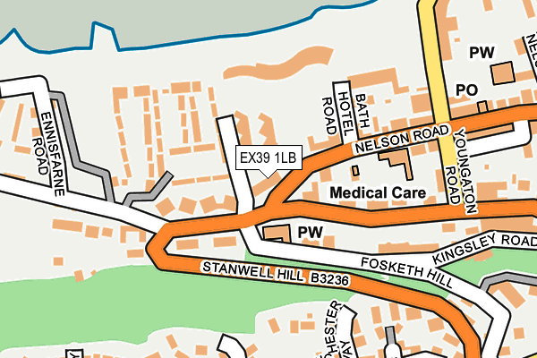
EX39 1LB is in Westward Ho, Bideford. EX39 1LB is located in the Westward Ho! electoral ward, within the local authority district of Torridge and the English Parliamentary constituency of Torridge and West Devon. The Sub Integrated Care Board (ICB) Location is NHS Devon ICB - 15N and the police force is Devon & Cornwall. This postcode has been in use since January 1980.


GetTheData
Source: OS OpenMap – Local (Ordnance Survey)
Source: OS VectorMap District (Ordnance Survey)
Licence: Open Government Licence (requires attribution)
| Easting | 243030 |
| Northing | 129064 |
| Latitude | 51.039429 |
| Longitude | -4.240361 |
GetTheData
Source: Open Postcode Geo
Licence: Open Government Licence
| Locality | Westward Ho |
| Town/City | Bideford |
| Country | England |
| Postcode District | EX39 |
➜ See where EX39 is on a map ➜ Where is Westward Ho!? | |
GetTheData
Source: Land Registry Price Paid Data
Licence: Open Government Licence
Elevation or altitude of EX39 1LB as distance above sea level:
| Metres | Feet | |
|---|---|---|
| Elevation | 20m | 66ft |
Elevation is measured from the approximate centre of the postcode, to the nearest point on an OS contour line from OS Terrain 50, which has contour spacing of ten vertical metres.
➜ How high above sea level am I? Find the elevation of your current position using your device's GPS.
GetTheData
Source: Open Postcode Elevation
Licence: Open Government Licence
| Ward | Westward Ho! |
| Constituency | Torridge And West Devon |
GetTheData
Source: ONS Postcode Database
Licence: Open Government Licence
| Nelson Road | Westward Ho! | 62m |
| Atlantic Way | Westward Ho! | 129m |
| Car Park (Golf Links Road) | Westward Ho! | 218m |
| Francis Drive (Cornborough Road) | Westward Ho! | 324m |
| Francis Drive (Cornborough Road) | Westward Ho! | 329m |
GetTheData
Source: NaPTAN
Licence: Open Government Licence
GetTheData
Source: ONS Postcode Database
Licence: Open Government Licence


➜ Get more ratings from the Food Standards Agency
GetTheData
Source: Food Standards Agency
Licence: FSA terms & conditions
| Last Collection | |||
|---|---|---|---|
| Location | Mon-Fri | Sat | Distance |
| Bayview Road | 16:15 | 11:30 | 1,778m |
| Northam Post Office | 17:00 | 12:00 | 1,891m |
| J H Taylor Drive | 17:00 | 11:00 | 2,221m |
GetTheData
Source: Dracos
Licence: Creative Commons Attribution-ShareAlike
The below table lists the International Territorial Level (ITL) codes (formerly Nomenclature of Territorial Units for Statistics (NUTS) codes) and Local Administrative Units (LAU) codes for EX39 1LB:
| ITL 1 Code | Name |
|---|---|
| TLK | South West (England) |
| ITL 2 Code | Name |
| TLK4 | Devon |
| ITL 3 Code | Name |
| TLK43 | Devon CC |
| LAU 1 Code | Name |
| E07000046 | Torridge |
GetTheData
Source: ONS Postcode Directory
Licence: Open Government Licence
The below table lists the Census Output Area (OA), Lower Layer Super Output Area (LSOA), and Middle Layer Super Output Area (MSOA) for EX39 1LB:
| Code | Name | |
|---|---|---|
| OA | E00102892 | |
| LSOA | E01020310 | Torridge 002C |
| MSOA | E02004221 | Torridge 002 |
GetTheData
Source: ONS Postcode Directory
Licence: Open Government Licence
| EX39 1LD | Nelson Road | 2m |
| EX39 1NA | Atlantic Way | 74m |
| EX39 1LT | Trinity Court | 111m |
| EX39 1LF | Nelson Road | 118m |
| EX39 1GX | Bath Hotel Road | 121m |
| EX39 1LE | Bath Hotel Road | 128m |
| EX39 1UQ | The Rocks | 160m |
| EX39 1JB | Kingsley Road | 160m |
| EX39 1GW | Bath Hotel Road | 178m |
| EX39 1HU | Youngaton Road | 192m |
GetTheData
Source: Open Postcode Geo; Land Registry Price Paid Data
Licence: Open Government Licence