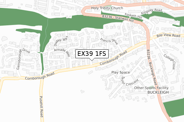
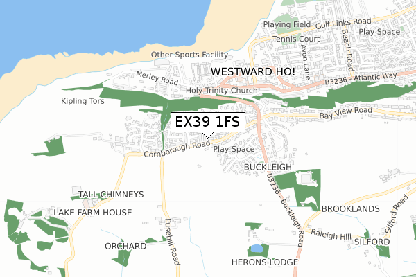
EX39 1FS is located in the Westward Ho! electoral ward, within the local authority district of Torridge and the English Parliamentary constituency of Torridge and West Devon. The Sub Integrated Care Board (ICB) Location is NHS Devon ICB - 15N and the police force is Devon & Cornwall. This postcode has been in use since August 2019.


GetTheData
Source: OS Open Zoomstack (Ordnance Survey)
Licence: Open Government Licence (requires attribution)
Attribution: Contains OS data © Crown copyright and database right 2025
Source: Open Postcode Geo
Licence: Open Government Licence (requires attribution)
Attribution: Contains OS data © Crown copyright and database right 2025; Contains Royal Mail data © Royal Mail copyright and database right 2025; Source: Office for National Statistics licensed under the Open Government Licence v.3.0
| Easting | 242958 |
| Northing | 128736 |
| Latitude | 51.036462 |
| Longitude | -4.241245 |
GetTheData
Source: Open Postcode Geo
Licence: Open Government Licence
| Country | England |
| Postcode District | EX39 |
➜ See where EX39 is on a map ➜ Where is Westward Ho!? | |
GetTheData
Source: Land Registry Price Paid Data
Licence: Open Government Licence
| Ward | Westward Ho! |
| Constituency | Torridge And West Devon |
GetTheData
Source: ONS Postcode Database
Licence: Open Government Licence
| Francis Drive (Cornborough Road) | Westward Ho! | 141m |
| Francis Drive (Cornborough Road) | Westward Ho! | 143m |
| Atlantic Way | Westward Ho! | 342m |
| Nelson Road | Westward Ho! | 376m |
| Buckleigh Cross (Bay View Road) | Buckleigh | 384m |
GetTheData
Source: NaPTAN
Licence: Open Government Licence
GetTheData
Source: ONS Postcode Database
Licence: Open Government Licence


➜ Get more ratings from the Food Standards Agency
GetTheData
Source: Food Standards Agency
Licence: FSA terms & conditions
| Last Collection | |||
|---|---|---|---|
| Location | Mon-Fri | Sat | Distance |
| Bayview Road | 16:15 | 11:30 | 1,780m |
| Northam Post Office | 17:00 | 12:00 | 2,002m |
| J H Taylor Drive | 17:00 | 11:00 | 2,357m |
GetTheData
Source: Dracos
Licence: Creative Commons Attribution-ShareAlike
The below table lists the International Territorial Level (ITL) codes (formerly Nomenclature of Territorial Units for Statistics (NUTS) codes) and Local Administrative Units (LAU) codes for EX39 1FS:
| ITL 1 Code | Name |
|---|---|
| TLK | South West (England) |
| ITL 2 Code | Name |
| TLK4 | Devon |
| ITL 3 Code | Name |
| TLK43 | Devon CC |
| LAU 1 Code | Name |
| E07000046 | Torridge |
GetTheData
Source: ONS Postcode Directory
Licence: Open Government Licence
The below table lists the Census Output Area (OA), Lower Layer Super Output Area (LSOA), and Middle Layer Super Output Area (MSOA) for EX39 1FS:
| Code | Name | |
|---|---|---|
| OA | E00102888 | |
| LSOA | E01020310 | Torridge 002C |
| MSOA | E02004221 | Torridge 002 |
GetTheData
Source: ONS Postcode Directory
Licence: Open Government Licence
| EX39 1XF | Blyth Court | 62m |
| EX39 1AA | Cornborough Road | 64m |
| EX39 1XA | Drake Close | 74m |
| EX39 1XP | Queen Elizabeth Court | 76m |
| EX39 1AD | Clifton Court | 78m |
| EX39 1XE | Francis Drive | 125m |
| EX39 1XD | Dudley Way | 155m |
| EX39 1XB | Armada Way | 176m |
| EX39 1XG | Chichester Way | 193m |
| EX39 1XT | Pelican Close | 202m |
GetTheData
Source: Open Postcode Geo; Land Registry Price Paid Data
Licence: Open Government Licence