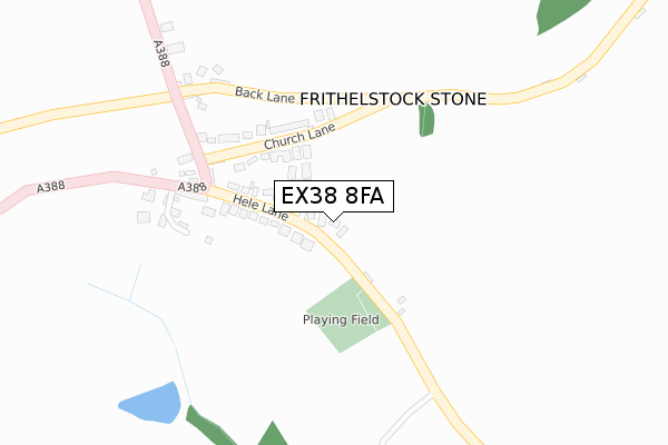
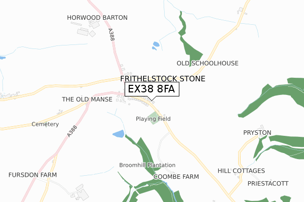
EX38 8FA is located in the Monkleigh & Putford electoral ward, within the local authority district of Torridge and the English Parliamentary constituency of Torridge and West Devon. The Sub Integrated Care Board (ICB) Location is NHS Devon ICB - 15N and the police force is Devon & Cornwall. This postcode has been in use since July 2019.


GetTheData
Source: OS Open Zoomstack (Ordnance Survey)
Licence: Open Government Licence (requires attribution)
Attribution: Contains OS data © Crown copyright and database right 2025
Source: Open Postcode Geo
Licence: Open Government Licence (requires attribution)
Attribution: Contains OS data © Crown copyright and database right 2025; Contains Royal Mail data © Royal Mail copyright and database right 2025; Source: Office for National Statistics licensed under the Open Government Licence v.3.0
| Easting | 245472 |
| Northing | 118582 |
| Latitude | 50.945903 |
| Longitude | -4.201095 |
GetTheData
Source: Open Postcode Geo
Licence: Open Government Licence
| Country | England |
| Postcode District | EX38 |
➜ See where EX38 is on a map ➜ Where is Frithelstock Stone? | |
GetTheData
Source: Land Registry Price Paid Data
Licence: Open Government Licence
| Ward | Monkleigh & Putford |
| Constituency | Torridge And West Devon |
GetTheData
Source: ONS Postcode Database
Licence: Open Government Licence
| Stone Farm (A388) | Frithelstock Stone | 248m |
| Stone Farm (A388) | Frithelstock Stone | 259m |
| Watergate Bridge (B3227) | Langtree | 1,703m |
| Watergate Bridge (B3227) | Langtree | 1,705m |
GetTheData
Source: NaPTAN
Licence: Open Government Licence
| Percentage of properties with Next Generation Access | 100.0% |
| Percentage of properties with Superfast Broadband | 100.0% |
| Percentage of properties with Ultrafast Broadband | 0.0% |
| Percentage of properties with Full Fibre Broadband | 0.0% |
Superfast Broadband is between 30Mbps and 300Mbps
Ultrafast Broadband is > 300Mbps
| Percentage of properties unable to receive 2Mbps | 0.0% |
| Percentage of properties unable to receive 5Mbps | 0.0% |
| Percentage of properties unable to receive 10Mbps | 0.0% |
| Percentage of properties unable to receive 30Mbps | 0.0% |
GetTheData
Source: Ofcom
Licence: Ofcom Terms of Use (requires attribution)
GetTheData
Source: ONS Postcode Database
Licence: Open Government Licence
| Last Collection | |||
|---|---|---|---|
| Location | Mon-Fri | Sat | Distance |
| Mill Street | 17:15 | 11:45 | 3,899m |
| Dartington Crystal | 16:30 | 11:45 | 3,979m |
| Torrington Delivery Office | 18:00 | 12:00 | 4,145m |
GetTheData
Source: Dracos
Licence: Creative Commons Attribution-ShareAlike
The below table lists the International Territorial Level (ITL) codes (formerly Nomenclature of Territorial Units for Statistics (NUTS) codes) and Local Administrative Units (LAU) codes for EX38 8FA:
| ITL 1 Code | Name |
|---|---|
| TLK | South West (England) |
| ITL 2 Code | Name |
| TLK4 | Devon |
| ITL 3 Code | Name |
| TLK43 | Devon CC |
| LAU 1 Code | Name |
| E07000046 | Torridge |
GetTheData
Source: ONS Postcode Directory
Licence: Open Government Licence
The below table lists the Census Output Area (OA), Lower Layer Super Output Area (LSOA), and Middle Layer Super Output Area (MSOA) for EX38 8FA:
| Code | Name | |
|---|---|---|
| OA | E00102814 | |
| LSOA | E01020296 | Torridge 005D |
| MSOA | E02004224 | Torridge 005 |
GetTheData
Source: ONS Postcode Directory
Licence: Open Government Licence
| EX38 8PE | Meadowstone Close | 71m |
| EX38 8JW | Hele Lane | 119m |
| EX38 8JN | Stone Park | 163m |
| EX38 8JL | Church Lane | 164m |
| EX38 8JP | 226m | |
| EX38 8JR | 295m | |
| EX38 8JZ | 544m | |
| EX38 8JY | 767m | |
| EX38 8JJ | 913m | |
| EX38 8JH | 1323m |
GetTheData
Source: Open Postcode Geo; Land Registry Price Paid Data
Licence: Open Government Licence