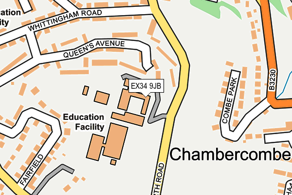
EX34 9JB is located in the Ilfracombe East electoral ward, within the local authority district of North Devon and the English Parliamentary constituency of North Devon. The Sub Integrated Care Board (ICB) Location is NHS Devon ICB - 15N and the police force is Devon & Cornwall. This postcode has been in use since January 1980.


GetTheData
Source: OS OpenMap – Local (Ordnance Survey)
Source: OS VectorMap District (Ordnance Survey)
Licence: Open Government Licence (requires attribution)
| Easting | 252324 |
| Northing | 147095 |
| Latitude | 51.203924 |
| Longitude | -4.115283 |
GetTheData
Source: Open Postcode Geo
Licence: Open Government Licence
| Country | England |
| Postcode District | EX34 |
➜ See where EX34 is on a map ➜ Where is Ilfracombe? | |
GetTheData
Source: Land Registry Price Paid Data
Licence: Open Government Licence
Elevation or altitude of EX34 9JB as distance above sea level:
| Metres | Feet | |
|---|---|---|
| Elevation | 120m | 394ft |
Elevation is measured from the approximate centre of the postcode, to the nearest point on an OS contour line from OS Terrain 50, which has contour spacing of ten vertical metres.
➜ How high above sea level am I? Find the elevation of your current position using your device's GPS.
GetTheData
Source: Open Postcode Elevation
Licence: Open Government Licence
| Ward | Ilfracombe East |
| Constituency | North Devon |
GetTheData
Source: ONS Postcode Database
Licence: Open Government Licence
| Academy (Worth Road) | Ilfracombe | 151m |
| Academy (Worth Road) | Ilfracombe | 155m |
| Fairfield (Princess Avenue) | Ilfracombe | 251m |
| Worth Road (Whittingham Road) | Ilfracombe | 263m |
| Whittingham Road | Ilfracombe | 264m |
GetTheData
Source: NaPTAN
Licence: Open Government Licence
GetTheData
Source: ONS Postcode Database
Licence: Open Government Licence


➜ Get more ratings from the Food Standards Agency
GetTheData
Source: Food Standards Agency
Licence: FSA terms & conditions
| Last Collection | |||
|---|---|---|---|
| Location | Mon-Fri | Sat | Distance |
| Portland Street Post Office | 17:30 | 12:00 | 558m |
| Fore Street | 17:45 | 12:00 | 688m |
| Old James Street P.o. | 17:45 | 12:00 | 739m |
GetTheData
Source: Dracos
Licence: Creative Commons Attribution-ShareAlike
The below table lists the International Territorial Level (ITL) codes (formerly Nomenclature of Territorial Units for Statistics (NUTS) codes) and Local Administrative Units (LAU) codes for EX34 9JB:
| ITL 1 Code | Name |
|---|---|
| TLK | South West (England) |
| ITL 2 Code | Name |
| TLK4 | Devon |
| ITL 3 Code | Name |
| TLK43 | Devon CC |
| LAU 1 Code | Name |
| E07000043 | North Devon |
GetTheData
Source: ONS Postcode Directory
Licence: Open Government Licence
The below table lists the Census Output Area (OA), Lower Layer Super Output Area (LSOA), and Middle Layer Super Output Area (MSOA) for EX34 9JB:
| Code | Name | |
|---|---|---|
| OA | E00101853 | |
| LSOA | E01020111 | North Devon 001A |
| MSOA | E02004175 | North Devon 001 |
GetTheData
Source: ONS Postcode Directory
Licence: Open Government Licence
| EX34 9ND | Fairfield | 148m |
| EX34 9LS | Queens Avenue | 154m |
| EX34 8AB | Marlborough Way | 185m |
| EX34 8JP | Marlborough Road | 213m |
| EX34 9NY | Combe Park | 235m |
| EX34 9LL | Whittingham Road | 243m |
| EX34 9JA | Worth Road | 246m |
| EX34 8PD | Marlborough Road | 249m |
| EX34 9LN | Queens Avenue | 253m |
| EX34 8JX | The Shields | 257m |
GetTheData
Source: Open Postcode Geo; Land Registry Price Paid Data
Licence: Open Government Licence