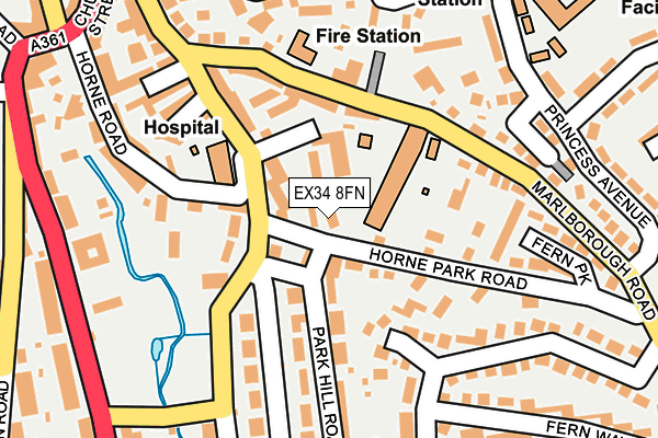
EX34 8FN is located in the Mortehoe electoral ward, within the local authority district of North Devon and the English Parliamentary constituency of North Devon. The Sub Integrated Care Board (ICB) Location is NHS Devon ICB - 15N and the police force is Devon & Cornwall. This postcode has been in use since July 2017.


GetTheData
Source: OS OpenMap – Local (Ordnance Survey)
Source: OS VectorMap District (Ordnance Survey)
Licence: Open Government Licence (requires attribution)
| Easting | 251756 |
| Northing | 144324 |
| Latitude | 51.178877 |
| Longitude | -4.122263 |
GetTheData
Source: Open Postcode Geo
Licence: Open Government Licence
| Country | England |
| Postcode District | EX34 |
➜ See where EX34 is on a map ➜ Where is Mullacott Cross? | |
GetTheData
Source: Land Registry Price Paid Data
Licence: Open Government Licence
| Ward | Mortehoe |
| Constituency | North Devon |
GetTheData
Source: ONS Postcode Database
Licence: Open Government Licence
| Mullacott Cross (A361) | Trimstone | 625m |
| Mullacott Cross (A361) | Trimstone | 636m |
| Mullacott Cross (B3343) | Trimstone | 732m |
| Mullacott Cross (B3343) | Trimstone | 736m |
| Twitchen Cross (A361) | Trimstone | 1,066m |
GetTheData
Source: NaPTAN
Licence: Open Government Licence
GetTheData
Source: ONS Postcode Database
Licence: Open Government Licence


➜ Get more ratings from the Food Standards Agency
GetTheData
Source: Food Standards Agency
Licence: FSA terms & conditions
| Last Collection | |||
|---|---|---|---|
| Location | Mon-Fri | Sat | Distance |
| Higher Slade | 16:45 | 11:00 | 1,742m |
| Tescos Store | 17:45 | 12:30 | 2,451m |
| Church Street Post Office | 17:30 | 11:30 | 3,019m |
GetTheData
Source: Dracos
Licence: Creative Commons Attribution-ShareAlike
The below table lists the International Territorial Level (ITL) codes (formerly Nomenclature of Territorial Units for Statistics (NUTS) codes) and Local Administrative Units (LAU) codes for EX34 8FN:
| ITL 1 Code | Name |
|---|---|
| TLK | South West (England) |
| ITL 2 Code | Name |
| TLK4 | Devon |
| ITL 3 Code | Name |
| TLK43 | Devon CC |
| LAU 1 Code | Name |
| E07000043 | North Devon |
GetTheData
Source: ONS Postcode Directory
Licence: Open Government Licence
The below table lists the Census Output Area (OA), Lower Layer Super Output Area (LSOA), and Middle Layer Super Output Area (MSOA) for EX34 8FN:
| Code | Name | |
|---|---|---|
| OA | E00101836 | |
| LSOA | E01020108 | North Devon 004B |
| MSOA | E02004178 | North Devon 004 |
GetTheData
Source: ONS Postcode Directory
Licence: Open Government Licence
| EX34 8ND | 434m | |
| EX34 8NE | 757m | |
| EX34 8NZ | 1017m | |
| EX34 8NA | 1095m | |
| EX34 8NW | 1134m | |
| EX34 8NX | Dennis Cottages | 1149m |
| EX34 8PQ | 1362m | |
| EX34 8NY | Mullacott Cross | 1498m |
| EX34 8LY | Saltmer Close | 1644m |
| EX34 8LH | Higher Slade Road | 1695m |
GetTheData
Source: Open Postcode Geo; Land Registry Price Paid Data
Licence: Open Government Licence