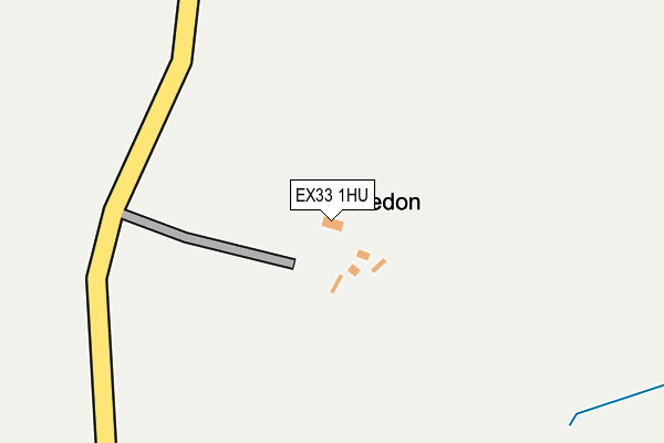
EX33 1HU is located in the Braunton East electoral ward, within the local authority district of North Devon and the English Parliamentary constituency of North Devon. The Sub Integrated Care Board (ICB) Location is NHS Devon ICB - 15N and the police force is Devon & Cornwall. This postcode has been in use since January 1980.


GetTheData
Source: OS OpenMap – Local (Ordnance Survey)
Source: OS VectorMap District (Ordnance Survey)
Licence: Open Government Licence (requires attribution)
| Easting | 247953 |
| Northing | 138589 |
| Latitude | 51.126346 |
| Longitude | -4.174182 |
GetTheData
Source: Open Postcode Geo
Licence: Open Government Licence
| Country | England |
| Postcode District | EX33 |
➜ See where EX33 is on a map | |
GetTheData
Source: Land Registry Price Paid Data
Licence: Open Government Licence
Elevation or altitude of EX33 1HU as distance above sea level:
| Metres | Feet | |
|---|---|---|
| Elevation | 110m | 361ft |
Elevation is measured from the approximate centre of the postcode, to the nearest point on an OS contour line from OS Terrain 50, which has contour spacing of ten vertical metres.
➜ How high above sea level am I? Find the elevation of your current position using your device's GPS.
GetTheData
Source: Open Postcode Elevation
Licence: Open Government Licence
| Ward | Braunton East |
| Constituency | North Devon |
GetTheData
Source: ONS Postcode Database
Licence: Open Government Licence
| Orchard Road (A361) | Knowle | 1,318m |
| Orchard Road (A361) | Knowle | 1,329m |
| The Garages (Homer Road) | Braunton | 1,482m |
| The Garages (Homer Road) | Braunton | 1,487m |
| Homer Crescent (Homer Road) | Braunton | 1,493m |
GetTheData
Source: NaPTAN
Licence: Open Government Licence
GetTheData
Source: ONS Postcode Database
Licence: Open Government Licence


➜ Get more ratings from the Food Standards Agency
GetTheData
Source: Food Standards Agency
Licence: FSA terms & conditions
| Last Collection | |||
|---|---|---|---|
| Location | Mon-Fri | Sat | Distance |
| Darracott | 15:15 | 09:00 | 1,018m |
| Georgeham Post Office | 15:15 | 10:30 | 1,919m |
| Caen Street | 17:30 | 12:15 | 2,132m |
GetTheData
Source: Dracos
Licence: Creative Commons Attribution-ShareAlike
The below table lists the International Territorial Level (ITL) codes (formerly Nomenclature of Territorial Units for Statistics (NUTS) codes) and Local Administrative Units (LAU) codes for EX33 1HU:
| ITL 1 Code | Name |
|---|---|
| TLK | South West (England) |
| ITL 2 Code | Name |
| TLK4 | Devon |
| ITL 3 Code | Name |
| TLK43 | Devon CC |
| LAU 1 Code | Name |
| E07000043 | North Devon |
GetTheData
Source: ONS Postcode Directory
Licence: Open Government Licence
The below table lists the Census Output Area (OA), Lower Layer Super Output Area (LSOA), and Middle Layer Super Output Area (MSOA) for EX33 1HU:
| Code | Name | |
|---|---|---|
| OA | E00101744 | |
| LSOA | E01020091 | North Devon 005B |
| MSOA | E02004179 | North Devon 005 |
GetTheData
Source: ONS Postcode Directory
Licence: Open Government Licence
| EX33 1HT | 888m | |
| EX33 1JF | 914m | |
| EX33 1HW | 972m | |
| EX33 1JY | 976m | |
| EX33 2LL | 1173m | |
| EX33 2EJ | Woodlands Close | 1245m |
| EX33 2NA | 1264m | |
| EX33 2LZ | Deane Close | 1270m |
| EX33 2EW | Corilhead Road | 1299m |
| EX33 2NS | Cottage Close | 1305m |
GetTheData
Source: Open Postcode Geo; Land Registry Price Paid Data
Licence: Open Government Licence