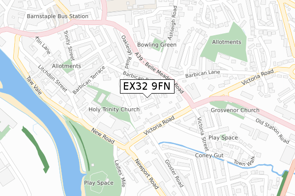
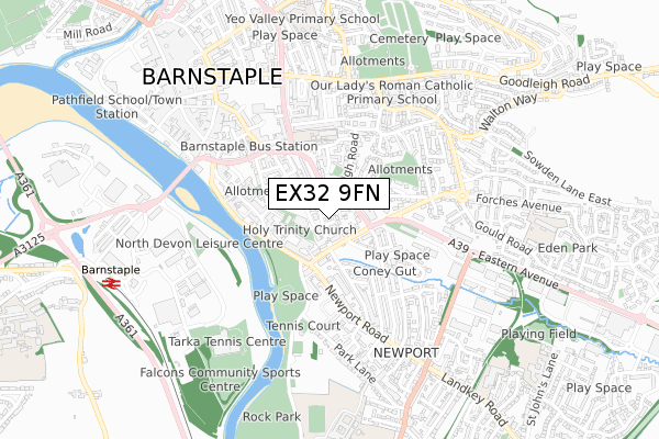
EX32 9FN is located in the Barnstaple Central electoral ward, within the local authority district of North Devon and the English Parliamentary constituency of North Devon. The Sub Integrated Care Board (ICB) Location is NHS Devon ICB - 15N and the police force is Devon & Cornwall. This postcode has been in use since April 2019.


GetTheData
Source: OS Open Zoomstack (Ordnance Survey)
Licence: Open Government Licence (requires attribution)
Attribution: Contains OS data © Crown copyright and database right 2025
Source: Open Postcode Geo
Licence: Open Government Licence (requires attribution)
Attribution: Contains OS data © Crown copyright and database right 2025; Contains Royal Mail data © Royal Mail copyright and database right 2025; Source: Office for National Statistics licensed under the Open Government Licence v.3.0
| Easting | 256352 |
| Northing | 132794 |
| Latitude | 51.076437 |
| Longitude | -4.051957 |
GetTheData
Source: Open Postcode Geo
Licence: Open Government Licence
| Country | England |
| Postcode District | EX32 |
➜ See where EX32 is on a map ➜ Where is Barnstaple? | |
GetTheData
Source: Land Registry Price Paid Data
Licence: Open Government Licence
| Ward | Barnstaple Central |
| Constituency | North Devon |
GetTheData
Source: ONS Postcode Database
Licence: Open Government Licence
2022 24 NOV £440,000 |
13, SANDERLING CLOSE, BARNSTAPLE, EX32 9FN 2020 4 JUN £280,000 |
17, SANDERLING CLOSE, BARNSTAPLE, EX32 9FN 2020 3 APR £325,000 |
2019 19 DEC £325,000 |
GetTheData
Source: HM Land Registry Price Paid Data
Licence: Contains HM Land Registry data © Crown copyright and database right 2025. This data is licensed under the Open Government Licence v3.0.
| Ashleigh Road (Barbican Road) | Barnstaple | 94m |
| Ashleigh Road (Barbican Road) | Barnstaple | 120m |
| Portmarsh Lane (Victoria Road) | Newport | 132m |
| Gloster Road (Victoria Road) | Newport | 143m |
| Gloster Road | Newport | 154m |
| Barnstaple Station | 0.8km |
GetTheData
Source: NaPTAN
Licence: Open Government Licence
| Percentage of properties with Next Generation Access | 100.0% |
| Percentage of properties with Superfast Broadband | 100.0% |
| Percentage of properties with Ultrafast Broadband | 0.0% |
| Percentage of properties with Full Fibre Broadband | 0.0% |
Superfast Broadband is between 30Mbps and 300Mbps
Ultrafast Broadband is > 300Mbps
| Percentage of properties unable to receive 2Mbps | 0.0% |
| Percentage of properties unable to receive 5Mbps | 0.0% |
| Percentage of properties unable to receive 10Mbps | 0.0% |
| Percentage of properties unable to receive 30Mbps | 0.0% |
GetTheData
Source: Ofcom
Licence: Ofcom Terms of Use (requires attribution)
GetTheData
Source: ONS Postcode Database
Licence: Open Government Licence


➜ Get more ratings from the Food Standards Agency
GetTheData
Source: Food Standards Agency
Licence: FSA terms & conditions
| Last Collection | |||
|---|---|---|---|
| Location | Mon-Fri | Sat | Distance |
| Infirmary | 18:15 | 13:00 | 226m |
| Trafalgar Lawn | 18:15 | 13:00 | 303m |
| The Square | 18:15 | 12:45 | 512m |
GetTheData
Source: Dracos
Licence: Creative Commons Attribution-ShareAlike
| Risk of EX32 9FN flooding from rivers and sea | Medium |
| ➜ EX32 9FN flood map | |
GetTheData
Source: Open Flood Risk by Postcode
Licence: Open Government Licence
The below table lists the International Territorial Level (ITL) codes (formerly Nomenclature of Territorial Units for Statistics (NUTS) codes) and Local Administrative Units (LAU) codes for EX32 9FN:
| ITL 1 Code | Name |
|---|---|
| TLK | South West (England) |
| ITL 2 Code | Name |
| TLK4 | Devon |
| ITL 3 Code | Name |
| TLK43 | Devon CC |
| LAU 1 Code | Name |
| E07000043 | North Devon |
GetTheData
Source: ONS Postcode Directory
Licence: Open Government Licence
The below table lists the Census Output Area (OA), Lower Layer Super Output Area (LSOA), and Middle Layer Super Output Area (MSOA) for EX32 9FN:
| Code | Name | |
|---|---|---|
| OA | E00101763 | |
| LSOA | E01020096 | North Devon 009A |
| MSOA | E02004183 | North Devon 009 |
GetTheData
Source: ONS Postcode Directory
Licence: Open Government Licence
| EX32 9HE | Barbican Close | 48m |
| EX32 9HW | Barbican Road | 56m |
| EX32 9HN | Carlton Terrace | 61m |
| EX32 9HL | Chester Terrace | 73m |
| EX32 9HP | Victoria Road | 96m |
| EX32 9HJ | Barbican Road | 115m |
| EX32 9HF | Victoria Road | 115m |
| EX32 9HS | Victoria Terrace | 146m |
| EX32 8JX | Ashleigh Road | 147m |
| EX32 8JG | Summerland Place | 154m |
GetTheData
Source: Open Postcode Geo; Land Registry Price Paid Data
Licence: Open Government Licence