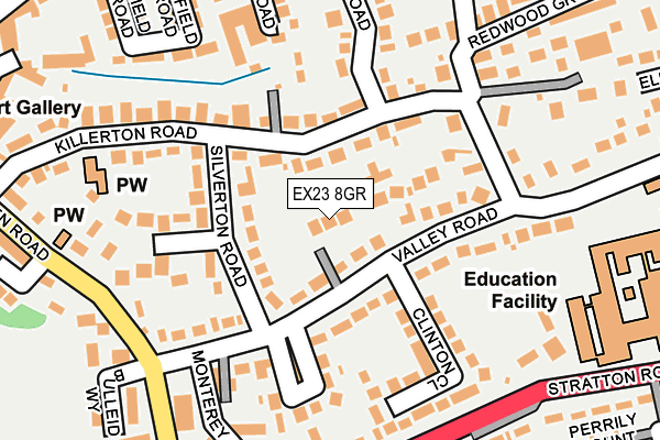
EX23 8GR is located in the Bude electoral ward, within the unitary authority of Cornwall and the English Parliamentary constituency of North Cornwall. The Sub Integrated Care Board (ICB) Location is NHS Cornwall and the Isles of Scilly ICB - 11N and the police force is Devon & Cornwall. This postcode has been in use since March 2017.


GetTheData
Source: OS OpenMap – Local (Ordnance Survey)
Source: OS VectorMap District (Ordnance Survey)
Licence: Open Government Licence (requires attribution)
| Easting | 221257 |
| Northing | 106066 |
| Latitude | 50.826463 |
| Longitude | -4.539339 |
GetTheData
Source: Open Postcode Geo
Licence: Open Government Licence
| Country | England |
| Postcode District | EX23 |
➜ See where EX23 is on a map ➜ Where is Bude? | |
GetTheData
Source: Land Registry Price Paid Data
Licence: Open Government Licence
| Ward | Bude |
| Constituency | North Cornwall |
GetTheData
Source: ONS Postcode Database
Licence: Open Government Licence
1, ORCHARD WAY, BUDE, EX23 8GR 2018 7 JUN £442,500 |
2, ORCHARD WAY, BUDE, EX23 8GR 2018 27 FEB £430,000 |
3, ORCHARD WAY, BUDE, EX23 8GR 2017 11 DEC £435,000 |
GetTheData
Source: HM Land Registry Price Paid Data
Licence: Contains HM Land Registry data © Crown copyright and database right 2025. This data is licensed under the Open Government Licence v3.0.
| Valley Road | Bude | 74m |
| Valley Road | Bude | 79m |
| Bude Junior School (Holnicote Road) | Bude | 182m |
| Esso Garage | Bude | 201m |
| Valley Road (Bencoolen Road) | Bude | 204m |
GetTheData
Source: NaPTAN
Licence: Open Government Licence
| Percentage of properties with Next Generation Access | 0.0% |
| Percentage of properties with Superfast Broadband | 0.0% |
| Percentage of properties with Ultrafast Broadband | 0.0% |
| Percentage of properties with Full Fibre Broadband | 0.0% |
Superfast Broadband is between 30Mbps and 300Mbps
Ultrafast Broadband is > 300Mbps
| Percentage of properties unable to receive 2Mbps | 0.0% |
| Percentage of properties unable to receive 5Mbps | 0.0% |
| Percentage of properties unable to receive 10Mbps | 0.0% |
| Percentage of properties unable to receive 30Mbps | 100.0% |
GetTheData
Source: Ofcom
Licence: Ofcom Terms of Use (requires attribution)
GetTheData
Source: ONS Postcode Database
Licence: Open Government Licence


➜ Get more ratings from the Food Standards Agency
GetTheData
Source: Food Standards Agency
Licence: FSA terms & conditions
| Last Collection | |||
|---|---|---|---|
| Location | Mon-Fri | Sat | Distance |
| Strand | 16:30 | 12:00 | 369m |
| Berries Avenue | 16:15 | 12:00 | 399m |
| King Street | 16:30 | 12:00 | 490m |
GetTheData
Source: Dracos
Licence: Creative Commons Attribution-ShareAlike
The below table lists the International Territorial Level (ITL) codes (formerly Nomenclature of Territorial Units for Statistics (NUTS) codes) and Local Administrative Units (LAU) codes for EX23 8GR:
| ITL 1 Code | Name |
|---|---|
| TLK | South West (England) |
| ITL 2 Code | Name |
| TLK3 | Cornwall and Isles of Scilly |
| ITL 3 Code | Name |
| TLK30 | Cornwall and Isles of Scilly |
| LAU 1 Code | Name |
| E06000052 | Cornwall |
GetTheData
Source: ONS Postcode Directory
Licence: Open Government Licence
The below table lists the Census Output Area (OA), Lower Layer Super Output Area (LSOA), and Middle Layer Super Output Area (MSOA) for EX23 8GR:
| Code | Name | |
|---|---|---|
| OA | E00095634 | |
| LSOA | E01018936 | Cornwall 001A |
| MSOA | E02003931 | Cornwall 001 |
GetTheData
Source: ONS Postcode Directory
Licence: Open Government Licence
| EX23 8EY | Silverton Road | 75m |
| EX23 8ER | Valley Road | 94m |
| EX23 8EN | Killerton Road | 103m |
| EX23 8EU | Warwick Road | 148m |
| EX23 8ET | Clinton Close | 156m |
| EX23 8EP | Valley Road | 157m |
| EX23 8TG | Silverton Close | 163m |
| EX23 8EW | Killerton Road | 181m |
| EX23 8AN | Stratton Road | 206m |
| EX23 8DJ | Fairfield Road | 215m |
GetTheData
Source: Open Postcode Geo; Land Registry Price Paid Data
Licence: Open Government Licence