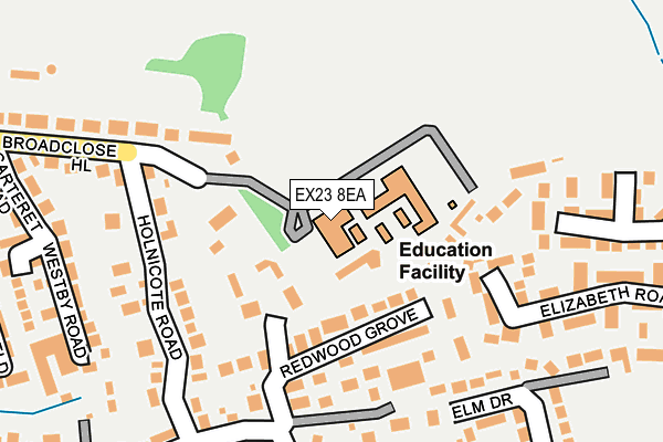
EX23 8EA is located in the Bude electoral ward, within the unitary authority of Cornwall and the English Parliamentary constituency of North Cornwall. The Sub Integrated Care Board (ICB) Location is NHS Cornwall and the Isles of Scilly ICB - 11N and the police force is Devon & Cornwall. This postcode has been in use since January 1980.


GetTheData
Source: OS OpenMap – Local (Ordnance Survey)
Source: OS VectorMap District (Ordnance Survey)
Licence: Open Government Licence (requires attribution)
| Easting | 221428 |
| Northing | 106365 |
| Latitude | 50.829207 |
| Longitude | -4.537026 |
GetTheData
Source: Open Postcode Geo
Licence: Open Government Licence
| Country | England |
| Postcode District | EX23 |
➜ See where EX23 is on a map ➜ Where is Bude? | |
GetTheData
Source: Land Registry Price Paid Data
Licence: Open Government Licence
Elevation or altitude of EX23 8EA as distance above sea level:
| Metres | Feet | |
|---|---|---|
| Elevation | 30m | 98ft |
Elevation is measured from the approximate centre of the postcode, to the nearest point on an OS contour line from OS Terrain 50, which has contour spacing of ten vertical metres.
➜ How high above sea level am I? Find the elevation of your current position using your device's GPS.
GetTheData
Source: Open Postcode Elevation
Licence: Open Government Licence
| Ward | Bude |
| Constituency | North Cornwall |
GetTheData
Source: ONS Postcode Database
Licence: Open Government Licence
| Bude Junior School (Holnicote Road) | Bude | 192m |
| Co-op (Broadclose Hill) | Bude | 393m |
| Valley Road | Bude | 415m |
| Valley Road | Bude | 418m |
| Co-op (King Street) | Bude | 419m |
GetTheData
Source: NaPTAN
Licence: Open Government Licence
GetTheData
Source: ONS Postcode Database
Licence: Open Government Licence


➜ Get more ratings from the Food Standards Agency
GetTheData
Source: Food Standards Agency
Licence: FSA terms & conditions
| Last Collection | |||
|---|---|---|---|
| Location | Mon-Fri | Sat | Distance |
| King Street | 16:30 | 12:00 | 466m |
| Strand | 16:30 | 12:00 | 494m |
| Berries Avenue | 16:15 | 12:00 | 704m |
GetTheData
Source: Dracos
Licence: Creative Commons Attribution-ShareAlike
The below table lists the International Territorial Level (ITL) codes (formerly Nomenclature of Territorial Units for Statistics (NUTS) codes) and Local Administrative Units (LAU) codes for EX23 8EA:
| ITL 1 Code | Name |
|---|---|
| TLK | South West (England) |
| ITL 2 Code | Name |
| TLK3 | Cornwall and Isles of Scilly |
| ITL 3 Code | Name |
| TLK30 | Cornwall and Isles of Scilly |
| LAU 1 Code | Name |
| E06000052 | Cornwall |
GetTheData
Source: ONS Postcode Directory
Licence: Open Government Licence
The below table lists the Census Output Area (OA), Lower Layer Super Output Area (LSOA), and Middle Layer Super Output Area (MSOA) for EX23 8EA:
| Code | Name | |
|---|---|---|
| OA | E00095634 | |
| LSOA | E01018936 | Cornwall 001A |
| MSOA | E02003931 | Cornwall 001 |
GetTheData
Source: ONS Postcode Directory
Licence: Open Government Licence
| EX23 8EB | Redwood Grove | 93m |
| EX23 8DR | Broadclose Court | 120m |
| EX23 8EJ | Holnicote Road | 157m |
| EX23 8EH | Holnicote Road | 177m |
| EX23 8EW | Killerton Road | 205m |
| EX23 8EZ | Elm Drive | 242m |
| EX23 8EQ | Broad Close Hill | 262m |
| EX23 8DE | Westby Road | 263m |
| EX23 8DU | Elm Lea | 264m |
| EX23 8DF | Blanchminster Road | 276m |
GetTheData
Source: Open Postcode Geo; Land Registry Price Paid Data
Licence: Open Government Licence