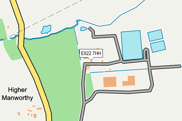
EX22 7HH is located in the Milton & Tamarside electoral ward, within the local authority district of Torridge and the English Parliamentary constituency of Torridge and West Devon. The Sub Integrated Care Board (ICB) Location is NHS Devon ICB - 15N and the police force is Devon & Cornwall. This postcode has been in use since June 2002.


GetTheData
Source: OS OpenMap – Local (Ordnance Survey)
Source: OS VectorMap District (Ordnance Survey)
Licence: Open Government Licence (requires attribution)
| Easting | 234438 |
| Northing | 105753 |
| Latitude | 50.827578 |
| Longitude | -4.352185 |
GetTheData
Source: Open Postcode Geo
Licence: Open Government Licence
| Country | England |
| Postcode District | EX22 |
➜ See where EX22 is on a map | |
GetTheData
Source: Land Registry Price Paid Data
Licence: Open Government Licence
Elevation or altitude of EX22 7HH as distance above sea level:
| Metres | Feet | |
|---|---|---|
| Elevation | 130m | 427ft |
Elevation is measured from the approximate centre of the postcode, to the nearest point on an OS contour line from OS Terrain 50, which has contour spacing of ten vertical metres.
➜ How high above sea level am I? Find the elevation of your current position using your device's GPS.
GetTheData
Source: Open Postcode Elevation
Licence: Open Government Licence
| Ward | Milton & Tamarside |
| Constituency | Torridge And West Devon |
GetTheData
Source: ONS Postcode Database
Licence: Open Government Licence
| Community Hospital (Dobles Lane) | Holsworthy | 1,035m |
| Community Hospital (Dobles Lane) | Holsworthy | 1,037m |
GetTheData
Source: NaPTAN
Licence: Open Government Licence
GetTheData
Source: ONS Postcode Database
Licence: Open Government Licence


➜ Get more ratings from the Food Standards Agency
GetTheData
Source: Food Standards Agency
Licence: FSA terms & conditions
| Last Collection | |||
|---|---|---|---|
| Location | Mon-Fri | Sat | Distance |
| Stanhope Close | 17:15 | 12:30 | 1,315m |
GetTheData
Source: Dracos
Licence: Creative Commons Attribution-ShareAlike
The below table lists the International Territorial Level (ITL) codes (formerly Nomenclature of Territorial Units for Statistics (NUTS) codes) and Local Administrative Units (LAU) codes for EX22 7HH:
| ITL 1 Code | Name |
|---|---|
| TLK | South West (England) |
| ITL 2 Code | Name |
| TLK4 | Devon |
| ITL 3 Code | Name |
| TLK43 | Devon CC |
| LAU 1 Code | Name |
| E07000046 | Torridge |
GetTheData
Source: ONS Postcode Directory
Licence: Open Government Licence
The below table lists the Census Output Area (OA), Lower Layer Super Output Area (LSOA), and Middle Layer Super Output Area (MSOA) for EX22 7HH:
| Code | Name | |
|---|---|---|
| OA | E00102807 | |
| LSOA | E01020293 | Torridge 008B |
| MSOA | E02004227 | Torridge 008 |
GetTheData
Source: ONS Postcode Directory
Licence: Open Government Licence
| EX22 7BL | 429m | |
| EX22 6JT | Dobles Lane | 692m |
| EX22 6ER | Waldon Way | 1051m |
| EX22 7BE | 1077m | |
| EX22 6LU | 1084m | |
| EX22 6HN | Dobles Lane | 1087m |
| EX22 6JR | Trewyn Road | 1152m |
| EX22 6EY | Craddock Close | 1173m |
| EX22 7BG | 1189m | |
| EX22 6HR | Park Close | 1208m |
GetTheData
Source: Open Postcode Geo; Land Registry Price Paid Data
Licence: Open Government Licence