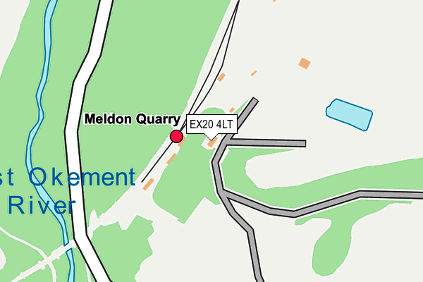
EX20 4LT is located in the Okehampton South electoral ward, within the local authority district of West Devon and the English Parliamentary constituency of Central Devon. The Sub Integrated Care Board (ICB) Location is NHS Devon ICB - 15N and the police force is Devon & Cornwall. This postcode has been in use since January 1980.


GetTheData
Source: OS OpenMap – Local (Ordnance Survey)
Source: OS VectorMap District (Ordnance Survey)
Licence: Open Government Licence (requires attribution)
| Easting | 256673 |
| Northing | 92493 |
| Latitude | 50.714348 |
| Longitude | -4.031528 |
GetTheData
Source: Open Postcode Geo
Licence: Open Government Licence
| Country | England |
| Postcode District | EX20 |
➜ See where EX20 is on a map | |
GetTheData
Source: Land Registry Price Paid Data
Licence: Open Government Licence
Elevation or altitude of EX20 4LT as distance above sea level:
| Metres | Feet | |
|---|---|---|
| Elevation | 270m | 886ft |
Elevation is measured from the approximate centre of the postcode, to the nearest point on an OS contour line from OS Terrain 50, which has contour spacing of ten vertical metres.
➜ How high above sea level am I? Find the elevation of your current position using your device's GPS.
GetTheData
Source: Open Postcode Elevation
Licence: Open Government Licence
| Ward | Okehampton South |
| Constituency | Central Devon |
GetTheData
Source: ONS Postcode Database
Licence: Open Government Licence
| Hughslade (Tavistock Road) | Meldon | 900m |
| Hughslade (Tavistock Road) | Meldon | 904m |
| Betty Cottles (Tavistock Road) | Meldon | 938m |
| Betty Cottles (Tavistock Road) | Meldon | 939m |
| Meldon Quarry Station (Dartmoor Railway) | Meldon | 107m |
| Okehampton Station | 3.2km |
GetTheData
Source: NaPTAN
Licence: Open Government Licence
GetTheData
Source: ONS Postcode Database
Licence: Open Government Licence


➜ Get more ratings from the Food Standards Agency
GetTheData
Source: Food Standards Agency
Licence: FSA terms & conditions
| Last Collection | |||
|---|---|---|---|
| Location | Mon-Fri | Sat | Distance |
| Place Farm | 12:15 | 10:45 | 2,529m |
| Moyes Meadow | 17:15 | 11:45 | 2,956m |
| Upcott | 17:15 | 11:45 | 3,377m |
GetTheData
Source: Dracos
Licence: Creative Commons Attribution-ShareAlike
The below table lists the International Territorial Level (ITL) codes (formerly Nomenclature of Territorial Units for Statistics (NUTS) codes) and Local Administrative Units (LAU) codes for EX20 4LT:
| ITL 1 Code | Name |
|---|---|
| TLK | South West (England) |
| ITL 2 Code | Name |
| TLK4 | Devon |
| ITL 3 Code | Name |
| TLK43 | Devon CC |
| LAU 1 Code | Name |
| E07000047 | West Devon |
GetTheData
Source: ONS Postcode Directory
Licence: Open Government Licence
The below table lists the Census Output Area (OA), Lower Layer Super Output Area (LSOA), and Middle Layer Super Output Area (MSOA) for EX20 4LT:
| Code | Name | |
|---|---|---|
| OA | E00103004 | |
| LSOA | E01020329 | West Devon 002C |
| MSOA | E02004230 | West Devon 002 |
GetTheData
Source: ONS Postcode Directory
Licence: Open Government Licence
| EX20 4LU | 789m | |
| EX20 4LR | Tavistock Road | 1087m |
| EX20 4LX | Tavistock Road | 1762m |
| EX20 1SW | Holsworthy Road | 2198m |
| EX20 1SF | Stoney Park Lane | 2244m |
| EX20 4HP | Prewley Cottages | 2347m |
| EX20 4HS | Cornridge View | 2420m |
| EX20 4HR | 2525m | |
| EX20 1QW | 2570m | |
| EX20 1SN | Northlew Road | 2612m |
GetTheData
Source: Open Postcode Geo; Land Registry Price Paid Data
Licence: Open Government Licence