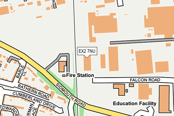
EX2 7NU is located in the St Loyes electoral ward, within the local authority district of Exeter and the English Parliamentary constituency of East Devon. The Sub Integrated Care Board (ICB) Location is NHS Devon ICB - 15N and the police force is Devon & Cornwall. This postcode has been in use since September 1991.


GetTheData
Source: OS OpenMap – Local (Ordnance Survey)
Source: OS VectorMap District (Ordnance Survey)
Licence: Open Government Licence (requires attribution)
| Easting | 296088 |
| Northing | 91890 |
| Latitude | 50.717318 |
| Longitude | -3.473297 |
GetTheData
Source: Open Postcode Geo
Licence: Open Government Licence
| Country | England |
| Postcode District | EX2 |
➜ See where EX2 is on a map ➜ Where is Exeter? | |
GetTheData
Source: Land Registry Price Paid Data
Licence: Open Government Licence
Elevation or altitude of EX2 7NU as distance above sea level:
| Metres | Feet | |
|---|---|---|
| Elevation | 30m | 98ft |
Elevation is measured from the approximate centre of the postcode, to the nearest point on an OS contour line from OS Terrain 50, which has contour spacing of ten vertical metres.
➜ How high above sea level am I? Find the elevation of your current position using your device's GPS.
GetTheData
Source: Open Postcode Elevation
Licence: Open Government Licence
| Ward | St Loyes |
| Constituency | East Devon |
GetTheData
Source: ONS Postcode Database
Licence: Open Government Licence
| Digby Arch (Sidmouth Road) | Digby | 133m |
| Digby Arch (Sidmouth Road) | Digby | 140m |
| Sowton P&r (Sidmouth Road) | Sandy Gate | 201m |
| Opp P&r Site (Sidmouth Road) | Sandy Gate | 264m |
| Sowton P&r | Sandy Gate | 277m |
| Digby & Sowton Station | 0.4km |
| Newcourt Station | 1.4km |
| Pinhoe Station | 2.3km |
GetTheData
Source: NaPTAN
Licence: Open Government Licence
GetTheData
Source: ONS Postcode Database
Licence: Open Government Licence


➜ Get more ratings from the Food Standards Agency
GetTheData
Source: Food Standards Agency
Licence: FSA terms & conditions
| Last Collection | |||
|---|---|---|---|
| Location | Mon-Fri | Sat | Distance |
| Kestrel Way | 19:30 | 482m | |
| Kestrel Way | 19:00 | 12:30 | 482m |
| Sowton Industrial Estate | 19:00 | 12:30 | 533m |
GetTheData
Source: Dracos
Licence: Creative Commons Attribution-ShareAlike
The below table lists the International Territorial Level (ITL) codes (formerly Nomenclature of Territorial Units for Statistics (NUTS) codes) and Local Administrative Units (LAU) codes for EX2 7NU:
| ITL 1 Code | Name |
|---|---|
| TLK | South West (England) |
| ITL 2 Code | Name |
| TLK4 | Devon |
| ITL 3 Code | Name |
| TLK43 | Devon CC |
| LAU 1 Code | Name |
| E07000041 | Exeter |
GetTheData
Source: ONS Postcode Directory
Licence: Open Government Licence
The below table lists the Census Output Area (OA), Lower Layer Super Output Area (LSOA), and Middle Layer Super Output Area (MSOA) for EX2 7NU:
| Code | Name | |
|---|---|---|
| OA | E00101374 | |
| LSOA | E01033234 | Exeter 011G |
| MSOA | E02004159 | Exeter 011 |
GetTheData
Source: ONS Postcode Directory
Licence: Open Government Licence
| EX2 7QF | Dart Walk | 173m |
| EX2 7RF | Cumberland Drive | 250m |
| EX2 7RD | Barle Close | 255m |
| EX2 7RJ | Norman Mews | 273m |
| EX2 7QE | Bathern Road | 298m |
| EX2 7PQ | Norman Place | 298m |
| EX2 7RL | Edwards Court | 319m |
| EX2 5GL | Apple Lane | 324m |
| EX2 7PZ | Coburg Green | 342m |
| EX2 7RH | Walsingham Road | 365m |
GetTheData
Source: Open Postcode Geo; Land Registry Price Paid Data
Licence: Open Government Licence