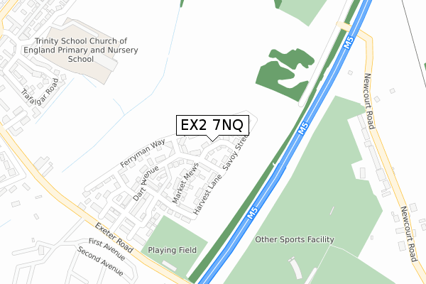
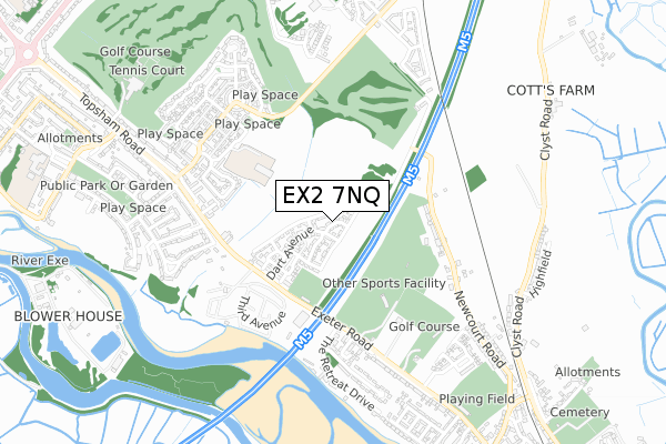
EX2 7NQ is located in the Topsham electoral ward, within the local authority district of Exeter and the English Parliamentary constituency of East Devon. The Sub Integrated Care Board (ICB) Location is NHS Devon ICB - 15N and the police force is Devon & Cornwall. This postcode has been in use since January 2018.


GetTheData
Source: OS Open Zoomstack (Ordnance Survey)
Licence: Open Government Licence (requires attribution)
Attribution: Contains OS data © Crown copyright and database right 2025
Source: Open Postcode Geo
Licence: Open Government Licence (requires attribution)
Attribution: Contains OS data © Crown copyright and database right 2025; Contains Royal Mail data © Royal Mail copyright and database right 2025; Source: Office for National Statistics licensed under the Open Government Licence v.3.0
| Easting | 295786 |
| Northing | 89385 |
| Latitude | 50.694734 |
| Longitude | -3.476879 |
GetTheData
Source: Open Postcode Geo
Licence: Open Government Licence
| Country | England |
| Postcode District | EX2 |
➜ See where EX2 is on a map | |
GetTheData
Source: Land Registry Price Paid Data
Licence: Open Government Licence
| Ward | Topsham |
| Constituency | East Devon |
GetTheData
Source: ONS Postcode Database
Licence: Open Government Licence
| Newport Park (Exeter Road) | Countess Wear | 322m |
| The Retreat Drive (Exeter Road) | Topsham | 327m |
| Newport Park (Exeter Road) | Countess Wear | 339m |
| The Retreat Drive (Exeter Road) | Topsham | 359m |
| Seabrook Avenue (Topsham Road) | Countess Wear | 531m |
| Newcourt Station | 1.2km |
| Topsham Station | 1.3km |
| Digby & Sowton Station | 2.2km |
GetTheData
Source: NaPTAN
Licence: Open Government Licence
| Percentage of properties with Next Generation Access | 100.0% |
| Percentage of properties with Superfast Broadband | 100.0% |
| Percentage of properties with Ultrafast Broadband | 100.0% |
| Percentage of properties with Full Fibre Broadband | 90.9% |
Superfast Broadband is between 30Mbps and 300Mbps
Ultrafast Broadband is > 300Mbps
| Percentage of properties unable to receive 2Mbps | 0.0% |
| Percentage of properties unable to receive 5Mbps | 0.0% |
| Percentage of properties unable to receive 10Mbps | 0.0% |
| Percentage of properties unable to receive 30Mbps | 0.0% |
GetTheData
Source: Ofcom
Licence: Ofcom Terms of Use (requires attribution)
GetTheData
Source: ONS Postcode Database
Licence: Open Government Licence


➜ Get more ratings from the Food Standards Agency
GetTheData
Source: Food Standards Agency
Licence: FSA terms & conditions
| Last Collection | |||
|---|---|---|---|
| Location | Mon-Fri | Sat | Distance |
| Newport Park | 18:00 | 11:45 | 429m |
| The Retreat | 18:00 | 11:15 | 466m |
| Higher Wear Road | 18:15 | 11:45 | 634m |
GetTheData
Source: Dracos
Licence: Creative Commons Attribution-ShareAlike
The below table lists the International Territorial Level (ITL) codes (formerly Nomenclature of Territorial Units for Statistics (NUTS) codes) and Local Administrative Units (LAU) codes for EX2 7NQ:
| ITL 1 Code | Name |
|---|---|
| TLK | South West (England) |
| ITL 2 Code | Name |
| TLK4 | Devon |
| ITL 3 Code | Name |
| TLK43 | Devon CC |
| LAU 1 Code | Name |
| E07000041 | Exeter |
GetTheData
Source: ONS Postcode Directory
Licence: Open Government Licence
The below table lists the Census Output Area (OA), Lower Layer Super Output Area (LSOA), and Middle Layer Super Output Area (MSOA) for EX2 7NQ:
| Code | Name | |
|---|---|---|
| OA | E00101408 | |
| LSOA | E01020033 | Exeter 015C |
| MSOA | E02004163 | Exeter 015 |
GetTheData
Source: ONS Postcode Directory
Licence: Open Government Licence
| EX2 7GZ | Mountbatten Drive | 99m |
| EX2 7DR | Topsham Road | 332m |
| EX3 0BU | Newcourt Road | 351m |
| EX2 7DU | Seabrook Mews | 462m |
| EX2 7DS | Topsham Road | 464m |
| EX2 7DT | Topsham Road | 476m |
| EX2 7GF | Trafalgar Road | 482m |
| EX2 7DP | Topsham Road | 498m |
| EX2 7GB | Vernon Crescent | 504m |
| EX2 7GS | Victory Drive | 539m |
GetTheData
Source: Open Postcode Geo; Land Registry Price Paid Data
Licence: Open Government Licence