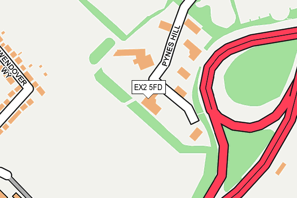
EX2 5FD is located in the Priory electoral ward, within the local authority district of Exeter and the English Parliamentary constituency of East Devon. The Sub Integrated Care Board (ICB) Location is NHS Devon ICB - 15N and the police force is Devon & Cornwall. This postcode has been in use since April 2008.


GetTheData
Source: OS OpenMap – Local (Ordnance Survey)
Source: OS VectorMap District (Ordnance Survey)
Licence: Open Government Licence (requires attribution)
| Easting | 294868 |
| Northing | 90635 |
| Latitude | 50.705817 |
| Longitude | -3.490214 |
GetTheData
Source: Open Postcode Geo
Licence: Open Government Licence
| Country | England |
| Postcode District | EX2 |
➜ See where EX2 is on a map ➜ Where is Exeter? | |
GetTheData
Source: Land Registry Price Paid Data
Licence: Open Government Licence
Elevation or altitude of EX2 5FD as distance above sea level:
| Metres | Feet | |
|---|---|---|
| Elevation | 40m | 131ft |
Elevation is measured from the approximate centre of the postcode, to the nearest point on an OS contour line from OS Terrain 50, which has contour spacing of ten vertical metres.
➜ How high above sea level am I? Find the elevation of your current position using your device's GPS.
GetTheData
Source: Open Postcode Elevation
Licence: Open Government Licence
| Ward | Priory |
| Constituency | East Devon |
GetTheData
Source: ONS Postcode Database
Licence: Open Government Licence
| Pynes Hill | Digby | 443m |
| Pynes Hill | Digby | 447m |
| Rosemoor Court (Pynes Hill) | Digby | 569m |
| Hawkins House (Pynes Hill) | Digby | 571m |
| Wesc Foundation (Topsham Road) | Countess Wear | 579m |
| Newcourt Station | 1.2km |
| Digby & Sowton Station | 1.5km |
| Topsham Station | 2.8km |
GetTheData
Source: NaPTAN
Licence: Open Government Licence
GetTheData
Source: ONS Postcode Database
Licence: Open Government Licence


➜ Get more ratings from the Food Standards Agency
GetTheData
Source: Food Standards Agency
Licence: FSA terms & conditions
| Last Collection | |||
|---|---|---|---|
| Location | Mon-Fri | Sat | Distance |
| Old Rydon Lane | 18:15 | 12:30 | 435m |
| Tesco | 18:30 | 13:15 | 469m |
| Southbrook Road | 17:45 | 12:15 | 568m |
GetTheData
Source: Dracos
Licence: Creative Commons Attribution-ShareAlike
The below table lists the International Territorial Level (ITL) codes (formerly Nomenclature of Territorial Units for Statistics (NUTS) codes) and Local Administrative Units (LAU) codes for EX2 5FD:
| ITL 1 Code | Name |
|---|---|
| TLK | South West (England) |
| ITL 2 Code | Name |
| TLK4 | Devon |
| ITL 3 Code | Name |
| TLK43 | Devon CC |
| LAU 1 Code | Name |
| E07000041 | Exeter |
GetTheData
Source: ONS Postcode Directory
Licence: Open Government Licence
The below table lists the Census Output Area (OA), Lower Layer Super Output Area (LSOA), and Middle Layer Super Output Area (MSOA) for EX2 5FD:
| Code | Name | |
|---|---|---|
| OA | E00101407 | |
| LSOA | E01020035 | Exeter 011D |
| MSOA | E02004159 | Exeter 011 |
GetTheData
Source: ONS Postcode Directory
Licence: Open Government Licence
| EX2 5JL | Pynes Hill | 268m |
| EX2 6JH | Tollards Road | 270m |
| EX2 6JQ | Wendover Way | 286m |
| EX2 6JG | Wendover Way | 296m |
| EX2 6JD | Swallowfield Road | 346m |
| EX2 6JE | Southbrook Road | 366m |
| EX2 6JF | Southbrook Road | 410m |
| EX2 7AW | Rydon Lane | 420m |
| EX2 7JZ | Old Rydon Lane | 440m |
| EX2 6JJ | Tollards Road | 442m |
GetTheData
Source: Open Postcode Geo; Land Registry Price Paid Data
Licence: Open Government Licence