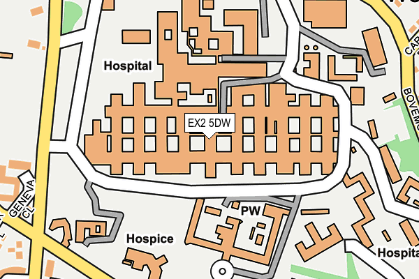
EX2 5DW is located in the Priory electoral ward, within the local authority district of Exeter and the English Parliamentary constituency of Exeter. The Sub Integrated Care Board (ICB) Location is NHS Devon ICB - 15N and the police force is Devon & Cornwall. This postcode has been in use since January 1980.


GetTheData
Source: OS OpenMap – Local (Ordnance Survey)
Source: OS VectorMap District (Ordnance Survey)
Licence: Open Government Licence (requires attribution)
| Easting | 293730 |
| Northing | 91869 |
| Latitude | 50.716703 |
| Longitude | -3.506680 |
GetTheData
Source: Open Postcode Geo
Licence: Open Government Licence
| Country | England |
| Postcode District | EX2 |
➜ See where EX2 is on a map ➜ Where is Exeter? | |
GetTheData
Source: Land Registry Price Paid Data
Licence: Open Government Licence
Elevation or altitude of EX2 5DW as distance above sea level:
| Metres | Feet | |
|---|---|---|
| Elevation | 40m | 131ft |
Elevation is measured from the approximate centre of the postcode, to the nearest point on an OS contour line from OS Terrain 50, which has contour spacing of ten vertical metres.
➜ How high above sea level am I? Find the elevation of your current position using your device's GPS.
GetTheData
Source: Open Postcode Elevation
Licence: Open Government Licence
| Ward | Priory |
| Constituency | Exeter |
GetTheData
Source: ONS Postcode Database
Licence: Open Government Licence
| R D & E Hospital | Wonford | 68m |
| R D & E Hospital Orthopedic | Wonford | 189m |
| R D & E Hospital Laundry | Wonford | 213m |
| R D & E Hospital (Barrack Road) | Wonford | 242m |
| R D & E Hospital (Barrack Road) | Wonford | 244m |
| Polsloe Bridge Station | 1.7km |
| St James Park (Devon) Station | 1.9km |
| Exeter Central Station | 2.2km |
GetTheData
Source: NaPTAN
Licence: Open Government Licence
GetTheData
Source: ONS Postcode Database
Licence: Open Government Licence


➜ Get more ratings from the Food Standards Agency
GetTheData
Source: Food Standards Agency
Licence: FSA terms & conditions
| Last Collection | |||
|---|---|---|---|
| Location | Mon-Fri | Sat | Distance |
| Gras Lawn | 17:00 | 12:15 | 491m |
| Heavitree Post Office | 19:15 | 12:00 | 524m |
| Victoria Park Road | 17:45 | 12:45 | 618m |
GetTheData
Source: Dracos
Licence: Creative Commons Attribution-ShareAlike
The below table lists the International Territorial Level (ITL) codes (formerly Nomenclature of Territorial Units for Statistics (NUTS) codes) and Local Administrative Units (LAU) codes for EX2 5DW:
| ITL 1 Code | Name |
|---|---|
| TLK | South West (England) |
| ITL 2 Code | Name |
| TLK4 | Devon |
| ITL 3 Code | Name |
| TLK43 | Devon CC |
| LAU 1 Code | Name |
| E07000041 | Exeter |
GetTheData
Source: ONS Postcode Directory
Licence: Open Government Licence
The below table lists the Census Output Area (OA), Lower Layer Super Output Area (LSOA), and Middle Layer Super Output Area (MSOA) for EX2 5DW:
| Code | Name | |
|---|---|---|
| OA | E00101281 | |
| LSOA | E01020013 | Exeter 013C |
| MSOA | E02004161 | Exeter 013 |
GetTheData
Source: ONS Postcode Directory
Licence: Open Government Licence
| EX2 5BJ | Meadow Way | 319m |
| EX2 5GU | Mansell Copse Walk | 328m |
| EX2 5GH | Meadow Way | 334m |
| EX2 5BN | Carlile Road | 340m |
| EX2 5BP | Bovemoors Lane | 344m |
| EX2 5DH | Kent Close | 349m |
| EX2 5EP | Church Street | 353m |
| EX2 5GS | Wagon Hill Way | 362m |
| EX2 4SD | Lister Close | 370m |
| EX2 6AE | Alice Templer Close | 370m |
GetTheData
Source: Open Postcode Geo; Land Registry Price Paid Data
Licence: Open Government Licence