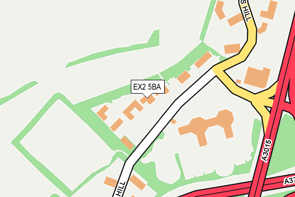
EX2 5BA is located in the Priory electoral ward, within the local authority district of Exeter and the English Parliamentary constituency of East Devon. The Sub Integrated Care Board (ICB) Location is NHS Devon ICB - 15N and the police force is Devon & Cornwall. This postcode has been in use since December 2001.


GetTheData
Source: OS OpenMap – Local (Ordnance Survey)
Source: OS VectorMap District (Ordnance Survey)
Licence: Open Government Licence (requires attribution)
| Easting | 294977 |
| Northing | 90952 |
| Latitude | 50.708686 |
| Longitude | -3.488761 |
GetTheData
Source: Open Postcode Geo
Licence: Open Government Licence
| Country | England |
| Postcode District | EX2 |
➜ See where EX2 is on a map ➜ Where is Exeter? | |
GetTheData
Source: Land Registry Price Paid Data
Licence: Open Government Licence
Elevation or altitude of EX2 5BA as distance above sea level:
| Metres | Feet | |
|---|---|---|
| Elevation | 50m | 164ft |
Elevation is measured from the approximate centre of the postcode, to the nearest point on an OS contour line from OS Terrain 50, which has contour spacing of ten vertical metres.
➜ How high above sea level am I? Find the elevation of your current position using your device's GPS.
GetTheData
Source: Open Postcode Elevation
Licence: Open Government Licence
| Ward | Priory |
| Constituency | East Devon |
GetTheData
Source: ONS Postcode Database
Licence: Open Government Licence
| Pynes Hill | Digby | 193m |
| Pynes Hill | Digby | 194m |
| Rosemoor Court (Pynes Hill) | Digby | 258m |
| Hawkins House (Pynes Hill) | Digby | 261m |
| Rydon House (Pynes Hill) | Digby | 383m |
| Newcourt Station | 1.2km |
| Digby & Sowton Station | 1.2km |
| Polsloe Bridge Station | 2.7km |
GetTheData
Source: NaPTAN
Licence: Open Government Licence
GetTheData
Source: ONS Postcode Database
Licence: Open Government Licence


➜ Get more ratings from the Food Standards Agency
GetTheData
Source: Food Standards Agency
Licence: FSA terms & conditions
| Last Collection | |||
|---|---|---|---|
| Location | Mon-Fri | Sat | Distance |
| Parkland Drive | 18:15 | 12:45 | 440m |
| Old Rydon Lane | 18:15 | 12:30 | 638m |
| Tesco | 18:30 | 13:15 | 655m |
GetTheData
Source: Dracos
Licence: Creative Commons Attribution-ShareAlike
The below table lists the International Territorial Level (ITL) codes (formerly Nomenclature of Territorial Units for Statistics (NUTS) codes) and Local Administrative Units (LAU) codes for EX2 5BA:
| ITL 1 Code | Name |
|---|---|
| TLK | South West (England) |
| ITL 2 Code | Name |
| TLK4 | Devon |
| ITL 3 Code | Name |
| TLK43 | Devon CC |
| LAU 1 Code | Name |
| E07000041 | Exeter |
GetTheData
Source: ONS Postcode Directory
Licence: Open Government Licence
The below table lists the Census Output Area (OA), Lower Layer Super Output Area (LSOA), and Middle Layer Super Output Area (MSOA) for EX2 5BA:
| Code | Name | |
|---|---|---|
| OA | E00101407 | |
| LSOA | E01020035 | Exeter 011D |
| MSOA | E02004159 | Exeter 011 |
GetTheData
Source: ONS Postcode Directory
Licence: Open Government Licence
| EX2 5JL | Pynes Hill | 83m |
| EX2 5AZ | Pynes Hill | 229m |
| EX2 5RT | Burnet Close | 378m |
| EX2 5RU | Lime Tree Close | 421m |
| EX2 6JQ | Wendover Way | 445m |
| EX2 6JG | Wendover Way | 479m |
| EX2 5RX | Parkland Drive | 494m |
| EX2 5AQ | Ludwell Lane | 501m |
| EX2 5RR | Betony Rise | 507m |
| EX2 5RS | Campion Gardens | 508m |
GetTheData
Source: Open Postcode Geo; Land Registry Price Paid Data
Licence: Open Government Licence