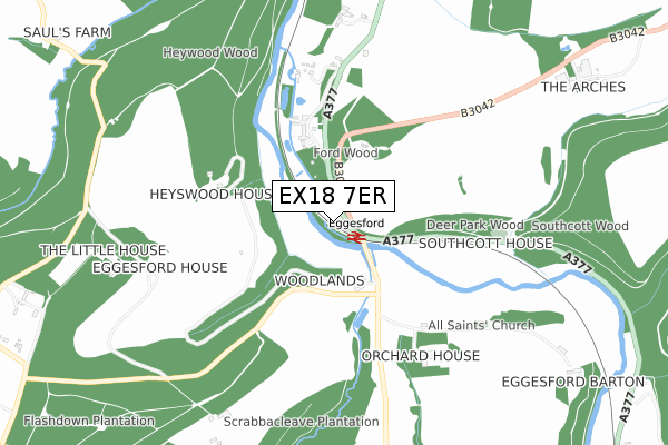
EX18 7ER is located in the Taw Vale electoral ward, within the local authority district of Mid Devon and the English Parliamentary constituency of Central Devon. The Sub Integrated Care Board (ICB) Location is NHS Devon ICB - 15N and the police force is Devon & Cornwall. This postcode has been in use since January 2020.


GetTheData
Source: OS Open Zoomstack (Ordnance Survey)
Licence: Open Government Licence (requires attribution)
Attribution: Contains OS data © Crown copyright and database right 2025
Source: Open Postcode Geo
Licence: Open Government Licence (requires attribution)
Attribution: Contains OS data © Crown copyright and database right 2025; Contains Royal Mail data © Royal Mail copyright and database right 2025; Source: Office for National Statistics licensed under the Open Government Licence v.3.0
| Easting | 268168 |
| Northing | 111515 |
| Latitude | 50.888028 |
| Longitude | -3.875660 |
GetTheData
Source: Open Postcode Geo
Licence: Open Government Licence
| Country | England |
| Postcode District | EX18 |
➜ See where EX18 is on a map | |
GetTheData
Source: Land Registry Price Paid Data
Licence: Open Government Licence
| Ward | Taw Vale |
| Constituency | Central Devon |
GetTheData
Source: ONS Postcode Database
Licence: Open Government Licence
| Rail Station (A377) | Eggesford | 90m |
| Rail Station (A377) | Eggesford | 99m |
| Eggesford Station | 0.1km |
| Lapford Station | 5.7km |
GetTheData
Source: NaPTAN
Licence: Open Government Licence
GetTheData
Source: ONS Postcode Database
Licence: Open Government Licence

➜ Get more ratings from the Food Standards Agency
GetTheData
Source: Food Standards Agency
Licence: FSA terms & conditions
| Last Collection | |||
|---|---|---|---|
| Location | Mon-Fri | Sat | Distance |
| Chulmleigh Post Office | 17:00 | 11:00 | 2,777m |
| Chawleigh Square | 14:45 | 10:30 | 3,159m |
GetTheData
Source: Dracos
Licence: Creative Commons Attribution-ShareAlike
The below table lists the International Territorial Level (ITL) codes (formerly Nomenclature of Territorial Units for Statistics (NUTS) codes) and Local Administrative Units (LAU) codes for EX18 7ER:
| ITL 1 Code | Name |
|---|---|
| TLK | South West (England) |
| ITL 2 Code | Name |
| TLK4 | Devon |
| ITL 3 Code | Name |
| TLK43 | Devon CC |
| LAU 1 Code | Name |
| E07000042 | Mid Devon |
GetTheData
Source: ONS Postcode Directory
Licence: Open Government Licence
The below table lists the Census Output Area (OA), Lower Layer Super Output Area (LSOA), and Middle Layer Super Output Area (MSOA) for EX18 7ER:
| Code | Name | |
|---|---|---|
| OA | E00101639 | |
| LSOA | E01020073 | Mid Devon 009B |
| MSOA | E02004172 | Mid Devon 009 |
GetTheData
Source: ONS Postcode Directory
Licence: Open Government Licence
| EX18 7JZ | 347m | |
| EX18 7QT | 458m | |
| EX18 7LB | Park Cottages | 632m |
| EX18 7JY | 781m | |
| EX18 7QU | 957m | |
| EX18 7LA | 1064m | |
| EX18 7QS | 1208m | |
| EX18 7JX | 1455m | |
| EX18 7LD | Forestry Houses | 1487m |
| EX18 7QZ | Fourways | 1536m |
GetTheData
Source: Open Postcode Geo; Land Registry Price Paid Data
Licence: Open Government Licence