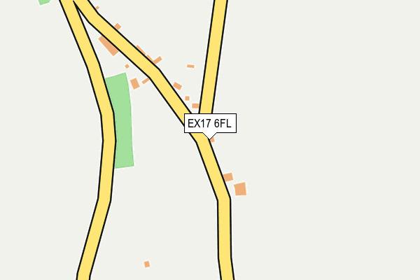
EX17 6FL is located in the Sandford & Creedy electoral ward, within the local authority district of Mid Devon and the English Parliamentary constituency of Central Devon. The Sub Integrated Care Board (ICB) Location is NHS Devon ICB - 15N and the police force is Devon & Cornwall. This postcode has been in use since May 2017.


GetTheData
Source: OS OpenMap – Local (Ordnance Survey)
Source: OS VectorMap District (Ordnance Survey)
Licence: Open Government Licence (requires attribution)
| Easting | 277257 |
| Northing | 106692 |
| Latitude | 50.846681 |
| Longitude | -3.744885 |
GetTheData
Source: Open Postcode Geo
Licence: Open Government Licence
| Country | England |
| Postcode District | EX17 |
➜ See where EX17 is on a map ➜ Where is Frost? | |
GetTheData
Source: Land Registry Price Paid Data
Licence: Open Government Licence
| Ward | Sandford & Creedy |
| Constituency | Central Devon |
GetTheData
Source: ONS Postcode Database
Licence: Open Government Licence
| Post Office (Fore Street) | Morchard Bishop | 914m |
| Post Office (Fore Street) | Morchard Bishop | 922m |
| Greenaway (Chumleigh Road) | Morchard Bishop | 1,229m |
| Greenaway (Chumleigh Road) | Morchard Bishop | 1,258m |
| Turning Ways (Chulmleigh Road) | Morchard Bishop | 1,520m |
| Morchard Road Station | 2.8km |
| Copplestone Station | 3.6km |
| Lapford Station | 4.8km |
GetTheData
Source: NaPTAN
Licence: Open Government Licence
| Percentage of properties with Next Generation Access | 100.0% |
| Percentage of properties with Superfast Broadband | 100.0% |
| Percentage of properties with Ultrafast Broadband | 0.0% |
| Percentage of properties with Full Fibre Broadband | 0.0% |
Superfast Broadband is between 30Mbps and 300Mbps
Ultrafast Broadband is > 300Mbps
| Percentage of properties unable to receive 2Mbps | 0.0% |
| Percentage of properties unable to receive 5Mbps | 0.0% |
| Percentage of properties unable to receive 10Mbps | 0.0% |
| Percentage of properties unable to receive 30Mbps | 0.0% |
GetTheData
Source: Ofcom
Licence: Ofcom Terms of Use (requires attribution)
GetTheData
Source: ONS Postcode Database
Licence: Open Government Licence
| Last Collection | |||
|---|---|---|---|
| Location | Mon-Fri | Sat | Distance |
| Morchard Bishop Post Office | 16:15 | 11:45 | 1,118m |
| Copplestone Post Office | 17:00 | 11:15 | 4,063m |
GetTheData
Source: Dracos
Licence: Creative Commons Attribution-ShareAlike
The below table lists the International Territorial Level (ITL) codes (formerly Nomenclature of Territorial Units for Statistics (NUTS) codes) and Local Administrative Units (LAU) codes for EX17 6FL:
| ITL 1 Code | Name |
|---|---|
| TLK | South West (England) |
| ITL 2 Code | Name |
| TLK4 | Devon |
| ITL 3 Code | Name |
| TLK43 | Devon CC |
| LAU 1 Code | Name |
| E07000042 | Mid Devon |
GetTheData
Source: ONS Postcode Directory
Licence: Open Government Licence
The below table lists the Census Output Area (OA), Lower Layer Super Output Area (LSOA), and Middle Layer Super Output Area (MSOA) for EX17 6FL:
| Code | Name | |
|---|---|---|
| OA | E00101618 | |
| LSOA | E01020070 | Mid Devon 010C |
| MSOA | E02004173 | Mid Devon 010 |
GetTheData
Source: ONS Postcode Directory
Licence: Open Government Licence
| EX17 6SG | Frost | 54m |
| EX17 6SF | Frost | 159m |
| EX17 6SE | 271m | |
| EX17 6SD | 574m | |
| EX17 6PL | 583m | |
| EX17 6SQ | 603m | |
| EX17 6RU | 722m | |
| EX17 6NW | 733m | |
| EX17 6PH | Church Street | 837m |
| EX17 6PJ | Church Street | 855m |
GetTheData
Source: Open Postcode Geo; Land Registry Price Paid Data
Licence: Open Government Licence