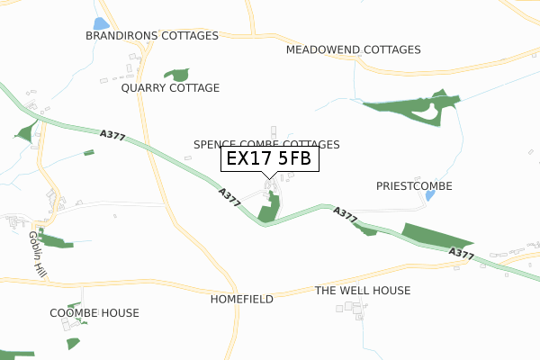
EX17 5FB is located in the Yeo electoral ward, within the local authority district of Mid Devon and the English Parliamentary constituency of Central Devon. The Sub Integrated Care Board (ICB) Location is NHS Devon ICB - 15N and the police force is Devon & Cornwall. This postcode has been in use since September 2019.


GetTheData
Source: OS Open Zoomstack (Ordnance Survey)
Licence: Open Government Licence (requires attribution)
Attribution: Contains OS data © Crown copyright and database right 2024
Source: Open Postcode Geo
Licence: Open Government Licence (requires attribution)
Attribution: Contains OS data © Crown copyright and database right 2024; Contains Royal Mail data © Royal Mail copyright and database right 2024; Source: Office for National Statistics licensed under the Open Government Licence v.3.0
| Easting | 279418 |
| Northing | 101728 |
| Latitude | 50.802517 |
| Longitude | -3.712569 |
GetTheData
Source: Open Postcode Geo
Licence: Open Government Licence
| Country | England |
| Postcode District | EX17 |
➜ See where EX17 is on a map | |
GetTheData
Source: Land Registry Price Paid Data
Licence: Open Government Licence
| Ward | Yeo |
| Constituency | Central Devon |
GetTheData
Source: ONS Postcode Database
Licence: Open Government Licence
| Raddon Down Cross | Colebrooke | 569m |
| Raddon Down Cross | Colebrooke | 591m |
| Barnstaple Cross (A377) | West Sandford | 920m |
| Barnstaple Cross (A377) | West Sandford | 930m |
| Yeoford Station | 3km |
| Copplestone Station | 3.1km |
| Crediton Station | 5.1km |
GetTheData
Source: NaPTAN
Licence: Open Government Licence
GetTheData
Source: ONS Postcode Database
Licence: Open Government Licence
| Last Collection | |||
|---|---|---|---|
| Location | Mon-Fri | Sat | Distance |
| Coleford | 15:15 | 09:45 | 2,336m |
| Copplestone Post Office | 17:00 | 11:15 | 2,545m |
| Alexandra Road | 17:30 | 12:00 | 3,054m |
GetTheData
Source: Dracos
Licence: Creative Commons Attribution-ShareAlike
The below table lists the International Territorial Level (ITL) codes (formerly Nomenclature of Territorial Units for Statistics (NUTS) codes) and Local Administrative Units (LAU) codes for EX17 5FB:
| ITL 1 Code | Name |
|---|---|
| TLK | South West (England) |
| ITL 2 Code | Name |
| TLK4 | Devon |
| ITL 3 Code | Name |
| TLK43 | Devon CC |
| LAU 1 Code | Name |
| E07000042 | Mid Devon |
GetTheData
Source: ONS Postcode Directory
Licence: Open Government Licence
The below table lists the Census Output Area (OA), Lower Layer Super Output Area (LSOA), and Middle Layer Super Output Area (MSOA) for EX17 5FB:
| Code | Name | |
|---|---|---|
| OA | E00101686 | |
| LSOA | E01020083 | Mid Devon 010D |
| MSOA | E02004173 | Mid Devon 010 |
GetTheData
Source: ONS Postcode Directory
Licence: Open Government Licence
| EX17 5BR | 583m | |
| EX17 4PH | Meadow End Cottages | 688m |
| EX17 2EW | 1014m | |
| EX17 5BU | Knowle Cottages | 1135m |
| EX17 5BX | 1159m | |
| EX17 4PJ | 1167m | |
| EX17 5BT | 1221m | |
| EX17 2EP | 1241m | |
| EX17 5PB | 1389m | |
| EX17 5BY | 1537m |
GetTheData
Source: Open Postcode Geo; Land Registry Price Paid Data
Licence: Open Government Licence