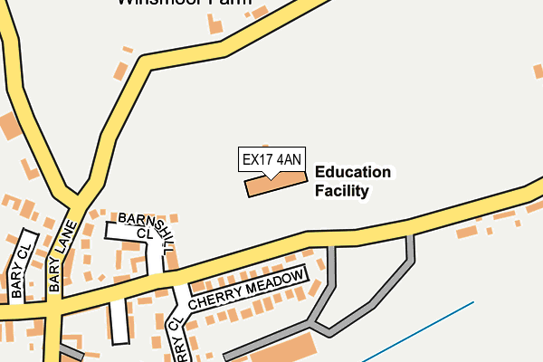
EX17 4AN is located in the Way electoral ward, within the local authority district of Mid Devon and the English Parliamentary constituency of Central Devon. The Sub Integrated Care Board (ICB) Location is NHS Devon ICB - 15N and the police force is Devon & Cornwall. This postcode has been in use since July 2010.


GetTheData
Source: OS OpenMap – Local (Ordnance Survey)
Source: OS VectorMap District (Ordnance Survey)
Licence: Open Government Licence (requires attribution)
| Easting | 287302 |
| Northing | 106367 |
| Latitude | 50.845814 |
| Longitude | -3.602145 |
GetTheData
Source: Open Postcode Geo
Licence: Open Government Licence
| Country | England |
| Postcode District | EX17 |
➜ See where EX17 is on a map ➜ Where is Cheriton Fitzpaine? | |
GetTheData
Source: Land Registry Price Paid Data
Licence: Open Government Licence
Elevation or altitude of EX17 4AN as distance above sea level:
| Metres | Feet | |
|---|---|---|
| Elevation | 120m | 394ft |
Elevation is measured from the approximate centre of the postcode, to the nearest point on an OS contour line from OS Terrain 50, which has contour spacing of ten vertical metres.
➜ How high above sea level am I? Find the elevation of your current position using your device's GPS.
GetTheData
Source: Open Postcode Elevation
Licence: Open Government Licence
| Ward | Way |
| Constituency | Central Devon |
GetTheData
Source: ONS Postcode Database
Licence: Open Government Licence
| Shelter | Cheriton Fitzpaine | 300m |
| Half Moon Inn | Cheriton Fitzpaine | 312m |
| White Cross | Cheriton Fitzpaine | 339m |
| White Cross | Cheriton Fitzpaine | 342m |
GetTheData
Source: NaPTAN
Licence: Open Government Licence
GetTheData
Source: ONS Postcode Database
Licence: Open Government Licence
The below table lists the International Territorial Level (ITL) codes (formerly Nomenclature of Territorial Units for Statistics (NUTS) codes) and Local Administrative Units (LAU) codes for EX17 4AN:
| ITL 1 Code | Name |
|---|---|
| TLK | South West (England) |
| ITL 2 Code | Name |
| TLK4 | Devon |
| ITL 3 Code | Name |
| TLK43 | Devon CC |
| LAU 1 Code | Name |
| E07000042 | Mid Devon |
GetTheData
Source: ONS Postcode Directory
Licence: Open Government Licence
The below table lists the Census Output Area (OA), Lower Layer Super Output Area (LSOA), and Middle Layer Super Output Area (MSOA) for EX17 4AN:
| Code | Name | |
|---|---|---|
| OA | E00101661 | |
| LSOA | E01020077 | Mid Devon 001D |
| MSOA | E02004164 | Mid Devon 001 |
GetTheData
Source: ONS Postcode Directory
Licence: Open Government Licence
| EX17 4JX | Cherry Meadow | 106m |
| EX17 4LJ | Barnshill Close | 166m |
| EX17 4HX | Barnshill Court | 193m |
| EX17 4JL | Landboat View | 219m |
| EX17 4JN | 223m | |
| EX17 4HY | Cherry Close | 226m |
| EX17 4HA | Landboat Cottages | 226m |
| EX17 4JJ | The Old Almshouses | 250m |
| EX17 4JP | 289m | |
| EX17 4JW | 291m |
GetTheData
Source: Open Postcode Geo; Land Registry Price Paid Data
Licence: Open Government Licence