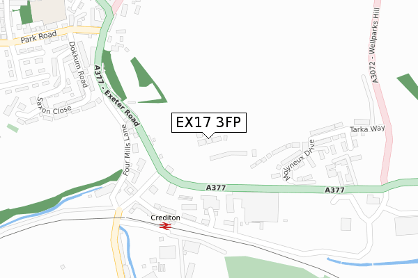
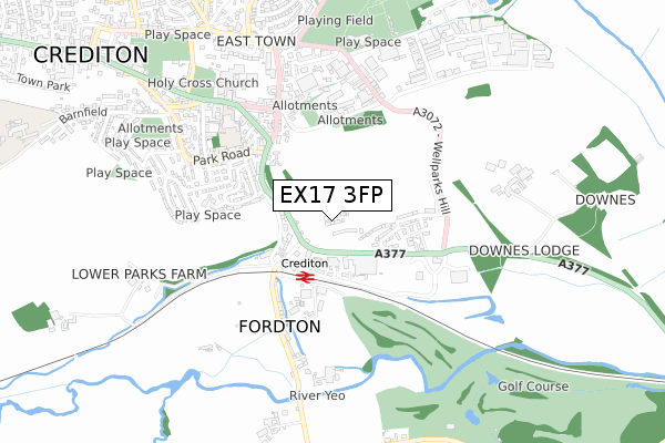
EX17 3FP is located in the Crediton Boniface electoral ward, within the local authority district of Mid Devon and the English Parliamentary constituency of Central Devon. The Sub Integrated Care Board (ICB) Location is NHS Devon ICB - 15N and the police force is Devon & Cornwall. This postcode has been in use since July 2019.


GetTheData
Source: OS Open Zoomstack (Ordnance Survey)
Licence: Open Government Licence (requires attribution)
Attribution: Contains OS data © Crown copyright and database right 2024
Source: Open Postcode Geo
Licence: Open Government Licence (requires attribution)
Attribution: Contains OS data © Crown copyright and database right 2024; Contains Royal Mail data © Royal Mail copyright and database right 2024; Source: Office for National Statistics licensed under the Open Government Licence v.3.0
| Easting | 284133 |
| Northing | 99704 |
| Latitude | 50.785286 |
| Longitude | -3.645048 |
GetTheData
Source: Open Postcode Geo
Licence: Open Government Licence
| Country | England |
| Postcode District | EX17 |
➜ See where EX17 is on a map ➜ Where is Crediton? | |
GetTheData
Source: Land Registry Price Paid Data
Licence: Open Government Licence
| Ward | Crediton Boniface |
| Constituency | Central Devon |
GetTheData
Source: ONS Postcode Database
Licence: Open Government Licence
2024 9 MAY £525,000 |
9, DOWNES CLOSE, CREDITON, EX17 3FP 2020 30 SEP £404,950 |
6, DOWNES CLOSE, CREDITON, EX17 3FP 2020 22 MAY £368,000 |
2020 27 MAR £414,950 |
7, DOWNES CLOSE, CREDITON, EX17 3FP 2019 20 DEC £399,000 |
5, DOWNES CLOSE, CREDITON, EX17 3FP 2019 20 DEC £424,950 |
4, DOWNES CLOSE, CREDITON, EX17 3FP 2019 16 DEC £372,950 |
3, DOWNES CLOSE, CREDITON, EX17 3FP 2019 29 NOV £299,950 |
2, DOWNES CLOSE, CREDITON, EX17 3FP 2019 29 NOV £299,950 |
1, DOWNES CLOSE, CREDITON, EX17 3FP 2019 21 NOV £372,950 |
GetTheData
Source: HM Land Registry Price Paid Data
Licence: Contains HM Land Registry data © Crown copyright and database right 2024. This data is licensed under the Open Government Licence v3.0.
| Station Cross (Exeter Road) | Crediton | 157m |
| Station Cross (Exeter Road) | Crediton | 165m |
| Tesco | Fordton | 235m |
| Railway Station (Fordton Terrace) | Fordton | 239m |
| Railway Station (Fordton Terrace) | Fordton | 246m |
| Crediton Station | 0.3km |
| Newton St Cyres Station | 4km |
GetTheData
Source: NaPTAN
Licence: Open Government Licence
| Percentage of properties with Next Generation Access | 100.0% |
| Percentage of properties with Superfast Broadband | 100.0% |
| Percentage of properties with Ultrafast Broadband | 14.3% |
| Percentage of properties with Full Fibre Broadband | 14.3% |
Superfast Broadband is between 30Mbps and 300Mbps
Ultrafast Broadband is > 300Mbps
| Percentage of properties unable to receive 2Mbps | 0.0% |
| Percentage of properties unable to receive 5Mbps | 0.0% |
| Percentage of properties unable to receive 10Mbps | 0.0% |
| Percentage of properties unable to receive 30Mbps | 0.0% |
GetTheData
Source: Ofcom
Licence: Ofcom Terms of Use (requires attribution)
GetTheData
Source: ONS Postcode Database
Licence: Open Government Licence


➜ Get more ratings from the Food Standards Agency
GetTheData
Source: Food Standards Agency
Licence: FSA terms & conditions
| Last Collection | |||
|---|---|---|---|
| Location | Mon-Fri | Sat | Distance |
| Railway Station | 16:45 | 12:00 | 242m |
| Exeter Road Post Office | 16:45 | 12:00 | 358m |
| Crediton Delivery Office | 18:15 | 12:30 | 582m |
GetTheData
Source: Dracos
Licence: Creative Commons Attribution-ShareAlike
The below table lists the International Territorial Level (ITL) codes (formerly Nomenclature of Territorial Units for Statistics (NUTS) codes) and Local Administrative Units (LAU) codes for EX17 3FP:
| ITL 1 Code | Name |
|---|---|
| TLK | South West (England) |
| ITL 2 Code | Name |
| TLK4 | Devon |
| ITL 3 Code | Name |
| TLK43 | Devon CC |
| LAU 1 Code | Name |
| E07000042 | Mid Devon |
GetTheData
Source: ONS Postcode Directory
Licence: Open Government Licence
The below table lists the Census Output Area (OA), Lower Layer Super Output Area (LSOA), and Middle Layer Super Output Area (MSOA) for EX17 3FP:
| Code | Name | |
|---|---|---|
| OA | E00101454 | |
| LSOA | E01020041 | Mid Devon 011A |
| MSOA | E02004174 | Mid Devon 011 |
GetTheData
Source: ONS Postcode Directory
Licence: Open Government Licence
| EX17 3BL | Exeter Road | 157m |
| EX17 3BN | Exeter Road | 169m |
| EX17 3BT | Four Mills Lane | 193m |
| EX17 3BU | Taw Vale Terrace | 214m |
| EX17 3BX | Station Road | 241m |
| EX17 3BW | Exeter Road | 243m |
| EX17 3PP | Station Approach | 257m |
| EX17 3BJ | Exeter Road | 306m |
| EX17 3BH | Exeter Road | 308m |
| EX17 3BZ | Fordton Trading Estate | 346m |
GetTheData
Source: Open Postcode Geo; Land Registry Price Paid Data
Licence: Open Government Licence