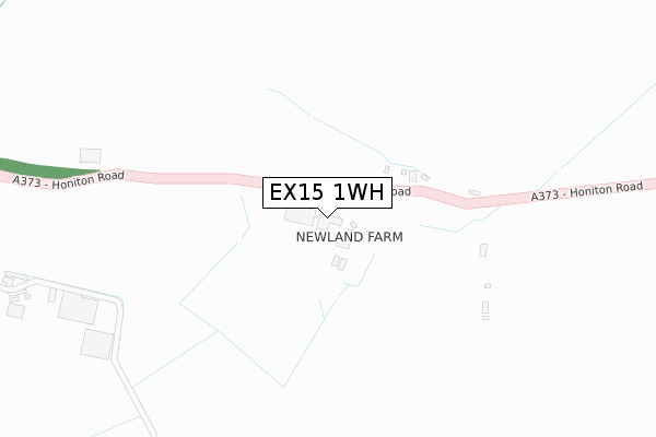
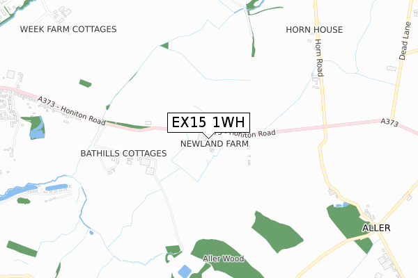
EX15 1WH is located in the Cullompton Vale electoral ward, within the local authority district of Mid Devon and the English Parliamentary constituency of Tiverton and Honiton. The Sub Integrated Care Board (ICB) Location is NHS Devon ICB - 15N and the police force is Devon & Cornwall. This postcode has been in use since November 2019.


GetTheData
Source: OS Open Zoomstack (Ordnance Survey)
Licence: Open Government Licence (requires attribution)
Attribution: Contains OS data © Crown copyright and database right 2025
Source: Open Postcode Geo
Licence: Open Government Licence (requires attribution)
Attribution: Contains OS data © Crown copyright and database right 2025; Contains Royal Mail data © Royal Mail copyright and database right 2025; Source: Office for National Statistics licensed under the Open Government Licence v.3.0
| Easting | 304313 |
| Northing | 107110 |
| Latitude | 50.855553 |
| Longitude | -3.360805 |
GetTheData
Source: Open Postcode Geo
Licence: Open Government Licence
| Country | England |
| Postcode District | EX15 |
➜ See where EX15 is on a map | |
GetTheData
Source: Land Registry Price Paid Data
Licence: Open Government Licence
| Ward | Cullompton Vale |
| Constituency | Tiverton And Honiton |
GetTheData
Source: ONS Postcode Database
Licence: Open Government Licence
| Stoneyford | Cullompton | 1,256m |
| Mole Valley Farmers (Honiton Road) | Cullompton | 1,429m |
| Mole Valley Farmers (Honiton Road) | Cullompton | 1,440m |
GetTheData
Source: NaPTAN
Licence: Open Government Licence
GetTheData
Source: ONS Postcode Database
Licence: Open Government Licence


➜ Get more ratings from the Food Standards Agency
GetTheData
Source: Food Standards Agency
Licence: FSA terms & conditions
| Last Collection | |||
|---|---|---|---|
| Location | Mon-Fri | Sat | Distance |
| St Andrews Estate | 17:30 | 12:00 | 1,743m |
| Tesco | 17:45 | 12:00 | 2,008m |
| St Georges Well | 17:45 | 12:00 | 2,404m |
GetTheData
Source: Dracos
Licence: Creative Commons Attribution-ShareAlike
The below table lists the International Territorial Level (ITL) codes (formerly Nomenclature of Territorial Units for Statistics (NUTS) codes) and Local Administrative Units (LAU) codes for EX15 1WH:
| ITL 1 Code | Name |
|---|---|
| TLK | South West (England) |
| ITL 2 Code | Name |
| TLK4 | Devon |
| ITL 3 Code | Name |
| TLK43 | Devon CC |
| LAU 1 Code | Name |
| E07000042 | Mid Devon |
GetTheData
Source: ONS Postcode Directory
Licence: Open Government Licence
The below table lists the Census Output Area (OA), Lower Layer Super Output Area (LSOA), and Middle Layer Super Output Area (MSOA) for EX15 1WH:
| Code | Name | |
|---|---|---|
| OA | E00101542 | |
| LSOA | E01020056 | Mid Devon 008C |
| MSOA | E02004171 | Mid Devon 008 |
GetTheData
Source: ONS Postcode Directory
Licence: Open Government Licence
| EX15 1QQ | 43m | |
| EX15 2AX | Horn Road | 844m |
| EX15 1PA | Honiton Road | 1026m |
| EX15 2BU | 1039m | |
| EX15 1NZ | Honiton Road | 1115m |
| EX15 1NX | Honiton Road | 1221m |
| EX15 1NJ | Culm Lea | 1263m |
| EX15 1NL | River Drive | 1389m |
| EX15 1NU | 1435m | |
| EX15 1RA | 1446m |
GetTheData
Source: Open Postcode Geo; Land Registry Price Paid Data
Licence: Open Government Licence