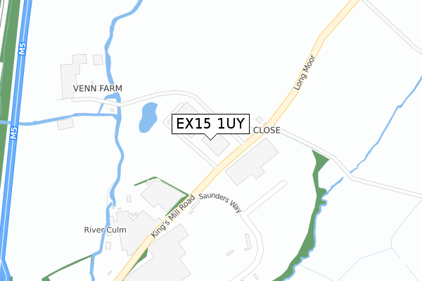
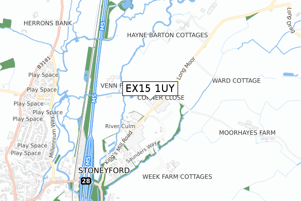
EX15 1UY is located in the Cullompton Vale electoral ward, within the local authority district of Mid Devon and the English Parliamentary constituency of Tiverton and Honiton. The Sub Integrated Care Board (ICB) Location is NHS Devon ICB - 15N and the police force is Devon & Cornwall. This postcode has been in use since August 2018.


GetTheData
Source: OS Open Zoomstack (Ordnance Survey)
Licence: Open Government Licence (requires attribution)
Attribution: Contains OS data © Crown copyright and database right 2025
Source: Open Postcode Geo
Licence: Open Government Licence (requires attribution)
Attribution: Contains OS data © Crown copyright and database right 2025; Contains Royal Mail data © Royal Mail copyright and database right 2025; Source: Office for National Statistics licensed under the Open Government Licence v.3.0
| Easting | 303248 |
| Northing | 108401 |
| Latitude | 50.866981 |
| Longitude | -3.376273 |
GetTheData
Source: Open Postcode Geo
Licence: Open Government Licence
| Country | England |
| Postcode District | EX15 |
➜ See where EX15 is on a map | |
GetTheData
Source: Land Registry Price Paid Data
Licence: Open Government Licence
| Ward | Cullompton Vale |
| Constituency | Tiverton And Honiton |
GetTheData
Source: ONS Postcode Database
Licence: Open Government Licence
| Plantagenet Drive (Millennium Way) | Cullompton | 802m |
| Plantagenet Drive (Millennium Way) | Cullompton | 807m |
| Norman Drive (Plantagenet Drive) | Cullompton | 856m |
| Millennium Way | Cullompton | 861m |
| Norman Drive (Plantagenet Drive) | Cullompton | 862m |
GetTheData
Source: NaPTAN
Licence: Open Government Licence
GetTheData
Source: ONS Postcode Database
Licence: Open Government Licence


➜ Get more ratings from the Food Standards Agency
GetTheData
Source: Food Standards Agency
Licence: FSA terms & conditions
| Last Collection | |||
|---|---|---|---|
| Location | Mon-Fri | Sat | Distance |
| St Georges Well | 17:45 | 12:00 | 1,213m |
| Cullompton Delivery Office | 18:15 | 12:30 | 1,220m |
| Tesco | 17:45 | 12:00 | 1,244m |
GetTheData
Source: Dracos
Licence: Creative Commons Attribution-ShareAlike
The below table lists the International Territorial Level (ITL) codes (formerly Nomenclature of Territorial Units for Statistics (NUTS) codes) and Local Administrative Units (LAU) codes for EX15 1UY:
| ITL 1 Code | Name |
|---|---|
| TLK | South West (England) |
| ITL 2 Code | Name |
| TLK4 | Devon |
| ITL 3 Code | Name |
| TLK43 | Devon CC |
| LAU 1 Code | Name |
| E07000042 | Mid Devon |
GetTheData
Source: ONS Postcode Directory
Licence: Open Government Licence
The below table lists the Census Output Area (OA), Lower Layer Super Output Area (LSOA), and Middle Layer Super Output Area (MSOA) for EX15 1UY:
| Code | Name | |
|---|---|---|
| OA | E00101542 | |
| LSOA | E01020056 | Mid Devon 008C |
| MSOA | E02004171 | Mid Devon 008 |
GetTheData
Source: ONS Postcode Directory
Licence: Open Government Licence
| EX15 1QN | 85m | |
| EX15 1QL | 484m | |
| EX15 1BS | Saunders Way | 631m |
| EX15 1QW | Hayne Barton Cottages | 656m |
| EX15 1XW | Plantagenet Drive | 823m |
| EX15 1XF | York Place | 855m |
| EX15 1XJ | Stuart Crescent | 858m |
| EX15 1XQ | Norman Drive | 866m |
| EX15 1XL | Windsor Close | 868m |
| EX15 1XG | Tudor Grove | 874m |
GetTheData
Source: Open Postcode Geo; Land Registry Price Paid Data
Licence: Open Government Licence