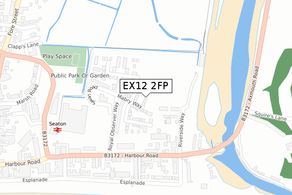
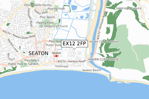
EX12 2FP is located in the Seaton electoral ward, within the local authority district of East Devon and the English Parliamentary constituency of Tiverton and Honiton. The Sub Integrated Care Board (ICB) Location is NHS Devon ICB - 15N and the police force is Devon & Cornwall. This postcode has been in use since May 2019.


GetTheData
Source: OS Open Zoomstack (Ordnance Survey)
Licence: Open Government Licence (requires attribution)
Attribution: Contains OS data © Crown copyright and database right 2025
Source: Open Postcode Geo
Licence: Open Government Licence (requires attribution)
Attribution: Contains OS data © Crown copyright and database right 2025; Contains Royal Mail data © Royal Mail copyright and database right 2025; Source: Office for National Statistics licensed under the Open Government Licence v.3.0
| Easting | 325013 |
| Northing | 90156 |
| Latitude | 50.706174 |
| Longitude | -3.063314 |
GetTheData
Source: Open Postcode Geo
Licence: Open Government Licence
| Country | England |
| Postcode District | EX12 |
➜ See where EX12 is on a map ➜ Where is Seaton? | |
GetTheData
Source: Land Registry Price Paid Data
Licence: Open Government Licence
| Ward | Seaton |
| Constituency | Tiverton And Honiton |
GetTheData
Source: ONS Postcode Database
Licence: Open Government Licence
7, TURNSTONE AVENUE, SEATON, EX12 2FP 2020 16 NOV £436,100 |
1, TURNSTONE AVENUE, SEATON, EX12 2FP 2020 26 JUN £439,995 |
11, TURNSTONE AVENUE, SEATON, EX12 2FP 2019 20 DEC £328,995 |
5, TURNSTONE AVENUE, SEATON, EX12 2FP 2019 24 OCT £440,995 |
9, TURNSTONE AVENUE, SEATON, EX12 2FP 2019 28 JUN £370,995 |
3, TURNSTONE AVENUE, SEATON, EX12 2FP 2019 30 MAY £369,995 |
GetTheData
Source: HM Land Registry Price Paid Data
Licence: Contains HM Land Registry data © Crown copyright and database right 2025. This data is licensed under the Open Government Licence v3.0.
| East Walk (Esplanade) | Seaton | 289m |
| Harbour Road | Seaton | 289m |
| Harbour Road | Seaton | 291m |
| Beach Road (Esplanade) | Seaton | 354m |
| Tramway Station | Seaton | 382m |
| Seaton Terminus (Seaton Tramway) (Underfleet) | Seaton | 348m |
GetTheData
Source: NaPTAN
Licence: Open Government Licence
| Percentage of properties with Next Generation Access | 100.0% |
| Percentage of properties with Superfast Broadband | 100.0% |
| Percentage of properties with Ultrafast Broadband | 75.0% |
| Percentage of properties with Full Fibre Broadband | 75.0% |
Superfast Broadband is between 30Mbps and 300Mbps
Ultrafast Broadband is > 300Mbps
| Percentage of properties unable to receive 2Mbps | 0.0% |
| Percentage of properties unable to receive 5Mbps | 0.0% |
| Percentage of properties unable to receive 10Mbps | 0.0% |
| Percentage of properties unable to receive 30Mbps | 0.0% |
GetTheData
Source: Ofcom
Licence: Ofcom Terms of Use (requires attribution)
GetTheData
Source: ONS Postcode Database
Licence: Open Government Licence


➜ Get more ratings from the Food Standards Agency
GetTheData
Source: Food Standards Agency
Licence: FSA terms & conditions
| Last Collection | |||
|---|---|---|---|
| Location | Mon-Fri | Sat | Distance |
| Harbour Road | 17:30 | 11:30 | 204m |
| Esplanade | 17:30 | 11:30 | 397m |
| The Square | 17:30 | 11:30 | 554m |
GetTheData
Source: Dracos
Licence: Creative Commons Attribution-ShareAlike
| Risk of EX12 2FP flooding from rivers and sea | Low |
| ➜ EX12 2FP flood map | |
GetTheData
Source: Open Flood Risk by Postcode
Licence: Open Government Licence
The below table lists the International Territorial Level (ITL) codes (formerly Nomenclature of Territorial Units for Statistics (NUTS) codes) and Local Administrative Units (LAU) codes for EX12 2FP:
| ITL 1 Code | Name |
|---|---|
| TLK | South West (England) |
| ITL 2 Code | Name |
| TLK4 | Devon |
| ITL 3 Code | Name |
| TLK43 | Devon CC |
| LAU 1 Code | Name |
| E07000040 | East Devon |
GetTheData
Source: ONS Postcode Directory
Licence: Open Government Licence
The below table lists the Census Output Area (OA), Lower Layer Super Output Area (LSOA), and Middle Layer Super Output Area (MSOA) for EX12 2FP:
| Code | Name | |
|---|---|---|
| OA | E00100965 | |
| LSOA | E01019947 | East Devon 010B |
| MSOA | E02004138 | East Devon 010 |
GetTheData
Source: ONS Postcode Directory
Licence: Open Government Licence
| EX12 2FT | Shearwater Way | 144m |
| EX12 2US | Swan Road | 169m |
| EX12 2NJ | Harbour Road | 185m |
| EX12 2XJ | Harbour Mews | 187m |
| EX12 2NQ | Harbour Road | 196m |
| EX12 2GA | Harbour Road | 213m |
| EX12 2NF | Burrow Road | 249m |
| EX12 2NS | Bay Court | 253m |
| EX12 2NB | Harbour Road | 260m |
| EX12 2NN | Trevelyan Road | 264m |
GetTheData
Source: Open Postcode Geo; Land Registry Price Paid Data
Licence: Open Government Licence