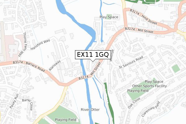
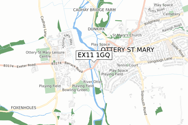
EX11 1GQ is located in the Ottery St Mary electoral ward, within the local authority district of East Devon and the English Parliamentary constituency of East Devon. The Sub Integrated Care Board (ICB) Location is NHS Devon ICB - 15N and the police force is Devon & Cornwall. This postcode has been in use since August 2017.


GetTheData
Source: OS Open Zoomstack (Ordnance Survey)
Licence: Open Government Licence (requires attribution)
Attribution: Contains OS data © Crown copyright and database right 2024
Source: Open Postcode Geo
Licence: Open Government Licence (requires attribution)
Attribution: Contains OS data © Crown copyright and database right 2024; Contains Royal Mail data © Royal Mail copyright and database right 2024; Source: Office for National Statistics licensed under the Open Government Licence v.3.0
| Easting | 309415 |
| Northing | 95224 |
| Latitude | 50.749515 |
| Longitude | -3.285404 |
GetTheData
Source: Open Postcode Geo
Licence: Open Government Licence
| Country | England |
| Postcode District | EX11 |
➜ See where EX11 is on a map ➜ Where is Ottery St Mary? | |
GetTheData
Source: Land Registry Price Paid Data
Licence: Open Government Licence
| Ward | Ottery St Mary |
| Constituency | East Devon |
GetTheData
Source: ONS Postcode Database
Licence: Open Government Licence
21, TUMBLING WEIR WAY, OTTERY ST MARY, EX11 1GQ 2019 13 JUN £480,000 |
10, TUMBLING WEIR WAY, OTTERY ST MARY, EX11 1GQ 2018 21 DEC £465,000 |
10, TUMBLING WEIR WAY, OTTERY ST MARY, EX11 1GQ 2018 19 NOV £450,000 |
21, TUMBLING WEIR WAY, OTTERY ST MARY, EX11 1GQ 2018 19 NOV £450,000 |
6, TUMBLING WEIR WAY, OTTERY ST MARY, EX11 1GQ 2018 24 SEP £350,000 |
15, TUMBLING WEIR WAY, OTTERY ST MARY, EX11 1GQ 2018 29 JUN £479,500 |
19, TUMBLING WEIR WAY, OTTERY ST MARY, EX11 1GQ 2018 1 MAR £415,000 |
GetTheData
Source: HM Land Registry Price Paid Data
Licence: Contains HM Land Registry data © Crown copyright and database right 2024. This data is licensed under the Open Government Licence v3.0.
| Bridge Cottage (Mill Street) | Ottery St Mary | 141m |
| Millcroft (Mill Street) | Ottery St Mary | 150m |
| Millcroft (Mill Street) | Ottery St Mary | 150m |
| Bridge Cottage (Mill Street) | Ottery St Mary | 168m |
| Industrial Estate (Barrack Road) | Ottery St Mary | 215m |
| Feniton Station | 4.1km |
| Whimple Station | 5.3km |
GetTheData
Source: NaPTAN
Licence: Open Government Licence
| Percentage of properties with Next Generation Access | 100.0% |
| Percentage of properties with Superfast Broadband | 100.0% |
| Percentage of properties with Ultrafast Broadband | 0.0% |
| Percentage of properties with Full Fibre Broadband | 0.0% |
Superfast Broadband is between 30Mbps and 300Mbps
Ultrafast Broadband is > 300Mbps
| Median download speed | 67.0Mbps |
| Average download speed | 58.9Mbps |
| Maximum download speed | 80.00Mbps |
| Median upload speed | 18.4Mbps |
| Average upload speed | 14.9Mbps |
| Maximum upload speed | 20.00Mbps |
| Percentage of properties unable to receive 2Mbps | 0.0% |
| Percentage of properties unable to receive 5Mbps | 0.0% |
| Percentage of properties unable to receive 10Mbps | 0.0% |
| Percentage of properties unable to receive 30Mbps | 0.0% |
GetTheData
Source: Ofcom
Licence: Ofcom Terms of Use (requires attribution)
GetTheData
Source: ONS Postcode Database
Licence: Open Government Licence


➜ Get more ratings from the Food Standards Agency
GetTheData
Source: Food Standards Agency
Licence: FSA terms & conditions
| Last Collection | |||
|---|---|---|---|
| Location | Mon-Fri | Sat | Distance |
| Ottery St Mary Post Office | 18:30 | 12:30 | 419m |
| Ridgeway | 17:30 | 12:00 | 747m |
| Escott | 15:15 | 07:00 | 2,656m |
GetTheData
Source: Dracos
Licence: Creative Commons Attribution-ShareAlike
| Risk of EX11 1GQ flooding from rivers and sea | Medium |
| ➜ EX11 1GQ flood map | |
GetTheData
Source: Open Flood Risk by Postcode
Licence: Open Government Licence
The below table lists the International Territorial Level (ITL) codes (formerly Nomenclature of Territorial Units for Statistics (NUTS) codes) and Local Administrative Units (LAU) codes for EX11 1GQ:
| ITL 1 Code | Name |
|---|---|
| TLK | South West (England) |
| ITL 2 Code | Name |
| TLK4 | Devon |
| ITL 3 Code | Name |
| TLK43 | Devon CC |
| LAU 1 Code | Name |
| E07000040 | East Devon |
GetTheData
Source: ONS Postcode Directory
Licence: Open Government Licence
The below table lists the Census Output Area (OA), Lower Layer Super Output Area (LSOA), and Middle Layer Super Output Area (MSOA) for EX11 1GQ:
| Code | Name | |
|---|---|---|
| OA | E00100946 | |
| LSOA | E01019942 | East Devon 008C |
| MSOA | E02004136 | East Devon 008 |
GetTheData
Source: ONS Postcode Directory
Licence: Open Government Licence
| EX11 1AL | Victoria Terrace | 55m |
| EX11 1YD | Millcroft | 85m |
| EX11 1AH | Mill Street | 96m |
| EX11 1AN | Mill Street | 124m |
| EX11 1YA | Riverside View | 127m |
| EX11 1AF | Mill Street | 132m |
| EX11 1YB | Windrush Rise | 154m |
| EX11 1XY | Hillcrest | 164m |
| EX11 1AJ | Mill Street | 166m |
| EX11 1BH | Spencer Court | 199m |
GetTheData
Source: Open Postcode Geo; Land Registry Price Paid Data
Licence: Open Government Licence