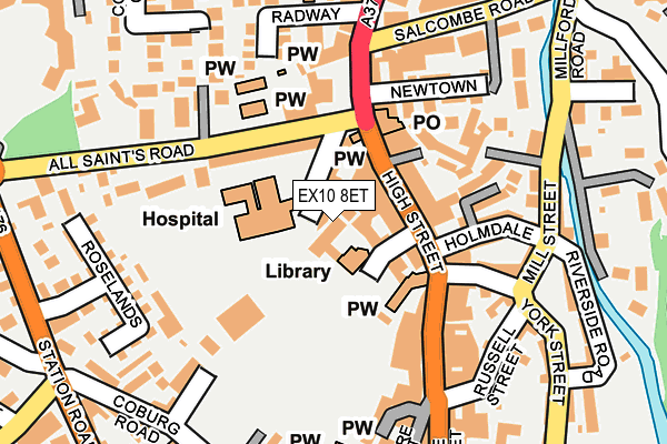
EX10 8ET is located in the Sidmouth Town electoral ward, within the local authority district of East Devon and the English Parliamentary constituency of East Devon. The Sub Integrated Care Board (ICB) Location is NHS Devon ICB - 15N and the police force is Devon & Cornwall. This postcode has been in use since January 1980.


GetTheData
Source: OS OpenMap – Local (Ordnance Survey)
Source: OS VectorMap District (Ordnance Survey)
Licence: Open Government Licence (requires attribution)
| Easting | 312579 |
| Northing | 87595 |
| Latitude | 50.681422 |
| Longitude | -3.238744 |
GetTheData
Source: Open Postcode Geo
Licence: Open Government Licence
| Country | England |
| Postcode District | EX10 |
➜ See where EX10 is on a map ➜ Where is Sidmouth? | |
GetTheData
Source: Land Registry Price Paid Data
Licence: Open Government Licence
Elevation or altitude of EX10 8ET as distance above sea level:
| Metres | Feet | |
|---|---|---|
| Elevation | 10m | 33ft |
Elevation is measured from the approximate centre of the postcode, to the nearest point on an OS contour line from OS Terrain 50, which has contour spacing of ten vertical metres.
➜ How high above sea level am I? Find the elevation of your current position using your device's GPS.
GetTheData
Source: Open Postcode Elevation
Licence: Open Government Licence
| Ward | Sidmouth Town |
| Constituency | East Devon |
GetTheData
Source: ONS Postcode Database
Licence: Open Government Licence
| All Saints Church (All Saints Road) | Sidmouth | 92m |
| All Saints Church (All Saints Road) | Sidmouth | 95m |
| Salcombe Road | Sidmouth | 193m |
| Salcombe Road | Sidmouth | 201m |
| Post Office (Vicarage Road) | Sidmouth | 218m |
GetTheData
Source: NaPTAN
Licence: Open Government Licence
GetTheData
Source: ONS Postcode Database
Licence: Open Government Licence

➜ Get more ratings from the Food Standards Agency
GetTheData
Source: Food Standards Agency
Licence: FSA terms & conditions
| Last Collection | |||
|---|---|---|---|
| Location | Mon-Fri | Sat | Distance |
| High Street | 18:00 | 12:00 | 133m |
| Sidmouth Delivery Office | 18:30 | 12:30 | 195m |
| Market Post Office | 18:00 | 12:00 | 319m |
GetTheData
Source: Dracos
Licence: Creative Commons Attribution-ShareAlike
The below table lists the International Territorial Level (ITL) codes (formerly Nomenclature of Territorial Units for Statistics (NUTS) codes) and Local Administrative Units (LAU) codes for EX10 8ET:
| ITL 1 Code | Name |
|---|---|
| TLK | South West (England) |
| ITL 2 Code | Name |
| TLK4 | Devon |
| ITL 3 Code | Name |
| TLK43 | Devon CC |
| LAU 1 Code | Name |
| E07000040 | East Devon |
GetTheData
Source: ONS Postcode Directory
Licence: Open Government Licence
The below table lists the Census Output Area (OA), Lower Layer Super Output Area (LSOA), and Middle Layer Super Output Area (MSOA) for EX10 8ET:
| Code | Name | |
|---|---|---|
| OA | E00101013 | |
| LSOA | E01019956 | East Devon 012A |
| MSOA | E02004140 | East Devon 012 |
GetTheData
Source: ONS Postcode Directory
Licence: Open Government Licence
| EX10 8EN | May Terrace | 16m |
| EX10 8EP | Blackmore View | 30m |
| EX10 8LB | High Street | 37m |
| EX10 8LA | Blackmore Drive | 39m |
| EX10 8LD | High Street | 55m |
| EX10 8EF | High Street | 76m |
| EX10 8EG | High Street | 82m |
| EX10 8ER | All Saints Road | 87m |
| EX10 8EQ | High Street | 91m |
| EX10 8EE | High Street | 96m |
GetTheData
Source: Open Postcode Geo; Land Registry Price Paid Data
Licence: Open Government Licence