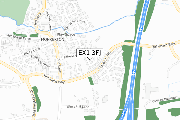
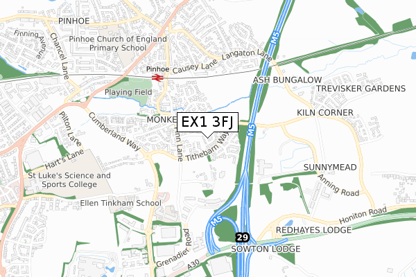
EX1 3FJ is located in the Pinhoe electoral ward, within the local authority district of Exeter and the English Parliamentary constituency of Exeter. The Sub Integrated Care Board (ICB) Location is NHS Devon ICB - 15N and the police force is Devon & Cornwall. This postcode has been in use since August 2019.


GetTheData
Source: OS Open Zoomstack (Ordnance Survey)
Licence: Open Government Licence (requires attribution)
Attribution: Contains OS data © Crown copyright and database right 2024
Source: Open Postcode Geo
Licence: Open Government Licence (requires attribution)
Attribution: Contains OS data © Crown copyright and database right 2024; Contains Royal Mail data © Royal Mail copyright and database right 2024; Source: Office for National Statistics licensed under the Open Government Licence v.3.0
| Easting | 296701 |
| Northing | 93796 |
| Latitude | 50.734552 |
| Longitude | -3.465165 |
GetTheData
Source: Open Postcode Geo
Licence: Open Government Licence
| Country | England |
| Postcode District | EX1 |
➜ See where EX1 is on a map ➜ Where is Exeter? | |
GetTheData
Source: Land Registry Price Paid Data
Licence: Open Government Licence
| Ward | Pinhoe |
| Constituency | Exeter |
GetTheData
Source: ONS Postcode Database
Licence: Open Government Licence
4, BATTLE ABBEY WAY, EXETER, EX1 3FJ 2022 31 OCT £400,000 |
4A, BATTLE ABBEY WAY, EXETER, EX1 3FJ 2021 23 DEC £370,000 |
6, BATTLE ABBEY WAY, EXETER, EX1 3FJ 2019 28 JUN £270,000 |
1, BATTLE ABBEY WAY, EXETER, EX1 3FJ 2019 28 JUN £270,000 |
11, BATTLE ABBEY WAY, EXETER, EX1 3FJ 2019 28 JUN £205,000 |
GetTheData
Source: HM Land Registry Price Paid Data
Licence: Contains HM Land Registry data © Crown copyright and database right 2024. This data is licensed under the Open Government Licence v3.0.
| Grasslands Drive (Pinn Lane) | Monkerton | 274m |
| Grasslands Drive (Pinn Lane) | Monkerton | 330m |
| Doctors Surgery (Pinn Lane) | Pinhoe | 432m |
| Doctors Surgery (Pinn Lane) | Pinhoe | 442m |
| Railway Station (Causey Lane) | Pinhoe | 475m |
| Pinhoe Station | 0.5km |
| Digby & Sowton Station | 2.4km |
| Polsloe Bridge Station | 2.6km |
GetTheData
Source: NaPTAN
Licence: Open Government Licence
| Percentage of properties with Next Generation Access | 84.6% |
| Percentage of properties with Superfast Broadband | 84.6% |
| Percentage of properties with Ultrafast Broadband | 84.6% |
| Percentage of properties with Full Fibre Broadband | 84.6% |
Superfast Broadband is between 30Mbps and 300Mbps
Ultrafast Broadband is > 300Mbps
| Percentage of properties unable to receive 2Mbps | 0.0% |
| Percentage of properties unable to receive 5Mbps | 0.0% |
| Percentage of properties unable to receive 10Mbps | 0.0% |
| Percentage of properties unable to receive 30Mbps | 7.7% |
GetTheData
Source: Ofcom
Licence: Ofcom Terms of Use (requires attribution)
GetTheData
Source: ONS Postcode Database
Licence: Open Government Licence


➜ Get more ratings from the Food Standards Agency
GetTheData
Source: Food Standards Agency
Licence: FSA terms & conditions
| Last Collection | |||
|---|---|---|---|
| Location | Mon-Fri | Sat | Distance |
| Monkerton | 18:15 | 12:45 | 247m |
| Langaton Lane | 18:15 | 13:00 | 525m |
| Pinhoe Post Office | 19:00 | 12:00 | 746m |
GetTheData
Source: Dracos
Licence: Creative Commons Attribution-ShareAlike
The below table lists the International Territorial Level (ITL) codes (formerly Nomenclature of Territorial Units for Statistics (NUTS) codes) and Local Administrative Units (LAU) codes for EX1 3FJ:
| ITL 1 Code | Name |
|---|---|
| TLK | South West (England) |
| ITL 2 Code | Name |
| TLK4 | Devon |
| ITL 3 Code | Name |
| TLK43 | Devon CC |
| LAU 1 Code | Name |
| E07000041 | Exeter |
GetTheData
Source: ONS Postcode Directory
Licence: Open Government Licence
The below table lists the Census Output Area (OA), Lower Layer Super Output Area (LSOA), and Middle Layer Super Output Area (MSOA) for EX1 3FJ:
| Code | Name | |
|---|---|---|
| OA | E00101250 | |
| LSOA | E01020004 | Exeter 003D |
| MSOA | E02004151 | Exeter 003 |
GetTheData
Source: ONS Postcode Directory
Licence: Open Government Licence
| EX1 3RH | Tithe Barn Lane | 49m |
| EX1 3XP | Tithebarn Copse | 106m |
| EX1 3RQ | Tithe Barn Lane | 134m |
| EX1 3XT | Farmhouse Avenue | 158m |
| EX1 3XU | Farmhouse Avenue | 164m |
| EX1 3RL | Gipsy Lane | 185m |
| EX1 3XR | Babblebrook Mews | 193m |
| EX1 3RG | Pinn Lane | 202m |
| EX1 3XS | Hutchings Mead | 212m |
| EX1 3XX | Grasslands Drive | 215m |
GetTheData
Source: Open Postcode Geo; Land Registry Price Paid Data
Licence: Open Government Licence