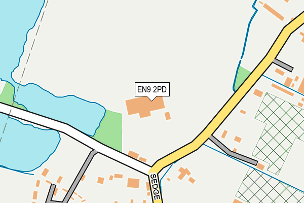
EN9 2PD is located in the Lower Nazeing electoral ward, within the local authority district of Epping Forest and the English Parliamentary constituency of Harlow. The Sub Integrated Care Board (ICB) Location is NHS Hertfordshire and West Essex ICB - 07H and the police force is Essex. This postcode has been in use since January 1980.


GetTheData
Source: OS OpenMap – Local (Ordnance Survey)
Source: OS VectorMap District (Ordnance Survey)
Licence: Open Government Licence (requires attribution)
| Easting | 539017 |
| Northing | 207329 |
| Latitude | 51.747424 |
| Longitude | 0.012344 |
GetTheData
Source: Open Postcode Geo
Licence: Open Government Licence
| Country | England |
| Postcode District | EN9 |
➜ See where EN9 is on a map ➜ Where is Lower Nazeing? | |
GetTheData
Source: Land Registry Price Paid Data
Licence: Open Government Licence
Elevation or altitude of EN9 2PD as distance above sea level:
| Metres | Feet | |
|---|---|---|
| Elevation | 30m | 98ft |
Elevation is measured from the approximate centre of the postcode, to the nearest point on an OS contour line from OS Terrain 50, which has contour spacing of ten vertical metres.
➜ How high above sea level am I? Find the elevation of your current position using your device's GPS.
GetTheData
Source: Open Postcode Elevation
Licence: Open Government Licence
| Ward | Lower Nazeing |
| Constituency | Harlow |
GetTheData
Source: ONS Postcode Database
Licence: Open Government Licence
| Meadgate Road (Sedge Green) | Hamlet Hill | 119m |
| Meadgate Road (Sedge Green) | Hamlet Hill | 125m |
| Dobbs Weir Road (Sedge Green) | Roydon | 662m |
| Dobbs Weir Road (Sedge Green) | Roydon | 665m |
| Fish & Eels (Dobb's Weir Road) | Roydon | 895m |
| Broxbourne Station | 1.6km |
| Rye House Station | 2.5km |
| Roydon Station | 3.5km |
GetTheData
Source: NaPTAN
Licence: Open Government Licence
GetTheData
Source: ONS Postcode Database
Licence: Open Government Licence


➜ Get more ratings from the Food Standards Agency
GetTheData
Source: Food Standards Agency
Licence: FSA terms & conditions
| Last Collection | |||
|---|---|---|---|
| Location | Mon-Fri | Sat | Distance |
| North Street | 17:00 | 11:30 | 767m |
| Dobbs Weir | 18:00 | 08:00 | 926m |
| Nazeingbury P.o | 17:45 | 11:30 | 1,316m |
GetTheData
Source: Dracos
Licence: Creative Commons Attribution-ShareAlike
| Risk of EN9 2PD flooding from rivers and sea | Low |
| ➜ EN9 2PD flood map | |
GetTheData
Source: Open Flood Risk by Postcode
Licence: Open Government Licence
The below table lists the International Territorial Level (ITL) codes (formerly Nomenclature of Territorial Units for Statistics (NUTS) codes) and Local Administrative Units (LAU) codes for EN9 2PD:
| ITL 1 Code | Name |
|---|---|
| TLH | East |
| ITL 2 Code | Name |
| TLH3 | Essex |
| ITL 3 Code | Name |
| TLH35 | West Essex |
| LAU 1 Code | Name |
| E07000072 | Epping Forest |
GetTheData
Source: ONS Postcode Directory
Licence: Open Government Licence
The below table lists the Census Output Area (OA), Lower Layer Super Output Area (LSOA), and Middle Layer Super Output Area (MSOA) for EN9 2PD:
| Code | Name | |
|---|---|---|
| OA | E00110700 | |
| LSOA | E01021792 | Epping Forest 002B |
| MSOA | E02004528 | Epping Forest 002 |
GetTheData
Source: ONS Postcode Directory
Licence: Open Government Licence
| EN9 2PA | Sedge Green | 257m |
| CM19 5JS | Sedge Green | 358m |
| EN9 2JQ | Nursery Road | 479m |
| EN9 2NX | Pecks Hill | 530m |
| EN9 2JF | Nursery Road | 536m |
| EN9 2NY | Pecks Hill | 576m |
| EN11 0BH | Eldon Road | 589m |
| CM19 5JX | Dobbs Weir Road | 621m |
| EN11 0BG | Derby Road | 661m |
| EN11 0FA | Picardy Close | 690m |
GetTheData
Source: Open Postcode Geo; Land Registry Price Paid Data
Licence: Open Government Licence