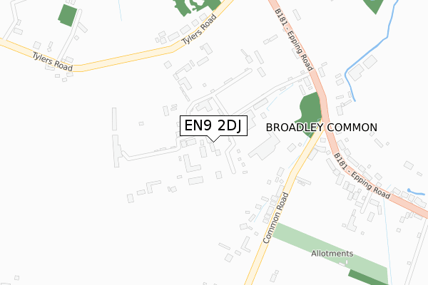
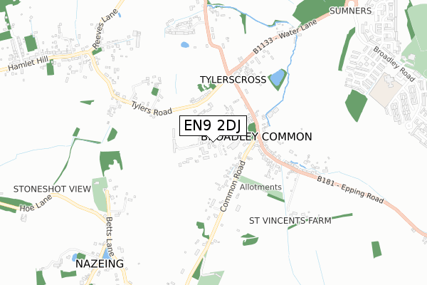
EN9 2DJ is located in the Broadley Common, Epping Upland and Nazeing electoral ward, within the local authority district of Epping Forest and the English Parliamentary constituency of Epping Forest. The Sub Integrated Care Board (ICB) Location is NHS Hertfordshire and West Essex ICB - 07H and the police force is Essex. This postcode has been in use since August 2019.


GetTheData
Source: OS Open Zoomstack (Ordnance Survey)
Licence: Open Government Licence (requires attribution)
Attribution: Contains OS data © Crown copyright and database right 2025
Source: Open Postcode Geo
Licence: Open Government Licence (requires attribution)
Attribution: Contains OS data © Crown copyright and database right 2025; Contains Royal Mail data © Royal Mail copyright and database right 2025; Source: Office for National Statistics licensed under the Open Government Licence v.3.0
| Easting | 542063 |
| Northing | 207214 |
| Latitude | 51.745627 |
| Longitude | 0.056390 |
GetTheData
Source: Open Postcode Geo
Licence: Open Government Licence
| Country | England |
| Postcode District | EN9 |
➜ See where EN9 is on a map ➜ Where is Broadley Common? | |
GetTheData
Source: Land Registry Price Paid Data
Licence: Open Government Licence
| Ward | Broadley Common, Epping Upland And Nazeing |
| Constituency | Epping Forest |
GetTheData
Source: ONS Postcode Database
Licence: Open Government Licence
| The Black Swan (Common Road) | Broadley Common | 221m |
| The Black Swan (Common Road) | Broadley Common | 227m |
| Ada Cole Stables (Epping Road) | Broadley Common | 276m |
| Ada Cole Stables (Epping Road) | Broadley Common | 283m |
| Tylers Cross Nursery (Tyler Road) | Tylers Cross | 372m |
| Roydon Station | 3.6km |
| Rye House Station | 4.4km |
| Broxbourne Station | 4.7km |
GetTheData
Source: NaPTAN
Licence: Open Government Licence
GetTheData
Source: ONS Postcode Database
Licence: Open Government Licence


➜ Get more ratings from the Food Standards Agency
GetTheData
Source: Food Standards Agency
Licence: FSA terms & conditions
| Last Collection | |||
|---|---|---|---|
| Location | Mon-Fri | Sat | Distance |
| Bell Common P.o. | 18:00 | 12:00 | 1,390m |
| Parsole Road | 17:00 | 12:00 | 1,613m |
| St Leonards | 17:15 | 11:30 | 1,835m |
GetTheData
Source: Dracos
Licence: Creative Commons Attribution-ShareAlike
The below table lists the International Territorial Level (ITL) codes (formerly Nomenclature of Territorial Units for Statistics (NUTS) codes) and Local Administrative Units (LAU) codes for EN9 2DJ:
| ITL 1 Code | Name |
|---|---|
| TLH | East |
| ITL 2 Code | Name |
| TLH3 | Essex |
| ITL 3 Code | Name |
| TLH35 | West Essex |
| LAU 1 Code | Name |
| E07000072 | Epping Forest |
GetTheData
Source: ONS Postcode Directory
Licence: Open Government Licence
The below table lists the Census Output Area (OA), Lower Layer Super Output Area (LSOA), and Middle Layer Super Output Area (MSOA) for EN9 2DJ:
| Code | Name | |
|---|---|---|
| OA | E00110433 | |
| LSOA | E01021741 | Epping Forest 002A |
| MSOA | E02004528 | Epping Forest 002 |
GetTheData
Source: ONS Postcode Directory
Licence: Open Government Licence
| EN9 2DQ | Broadley Terrace | 209m |
| EN9 2DH | Epping Road | 273m |
| EN9 2DF | Common Road | 347m |
| EN9 2DG | Sibley Row | 352m |
| EN9 2DL | Epping Road | 395m |
| CM19 5LJ | Tylers Road | 411m |
| CM19 5DR | Water Lane | 611m |
| EN9 2DB | Betts Lane | 712m |
| CM19 5LG | Tylers Road | 737m |
| EN9 2DE | Nazeing Common | 782m |
GetTheData
Source: Open Postcode Geo; Land Registry Price Paid Data
Licence: Open Government Licence