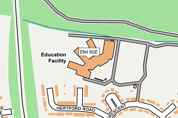
EN4 9GE is located in the East Barnet electoral ward, within the London borough of Barnet and the English Parliamentary constituency of Chipping Barnet. The Sub Integrated Care Board (ICB) Location is NHS North Central London ICB - 93C and the police force is Metropolitan Police. This postcode has been in use since June 2010.


GetTheData
Source: OS OpenMap – Local (Ordnance Survey)
Source: OS VectorMap District (Ordnance Survey)
Licence: Open Government Licence (requires attribution)
| Easting | 526554 |
| Northing | 196872 |
| Latitude | 51.656397 |
| Longitude | -0.171902 |
GetTheData
Source: Open Postcode Geo
Licence: Open Government Licence
| Country | England |
| Postcode District | EN4 |
➜ See where EN4 is on a map ➜ Where is London? | |
GetTheData
Source: Land Registry Price Paid Data
Licence: Open Government Licence
Elevation or altitude of EN4 9GE as distance above sea level:
| Metres | Feet | |
|---|---|---|
| Elevation | 70m | 230ft |
Elevation is measured from the approximate centre of the postcode, to the nearest point on an OS contour line from OS Terrain 50, which has contour spacing of ten vertical metres.
➜ How high above sea level am I? Find the elevation of your current position using your device's GPS.
GetTheData
Source: Open Postcode Elevation
Licence: Open Government Licence
| Ward | East Barnet |
| Constituency | Chipping Barnet |
GetTheData
Source: ONS Postcode Database
Licence: Open Government Licence
| Hertford Road | New Barnet | 192m |
| Lawton Road New Barnet | New Barnet | 348m |
| Lawton Road New Barnet | New Barnet | 374m |
| Castlewood Road | New Barnet | 451m |
| Castlewood Road | New Barnet | 456m |
| New Barnet Station | 0.9km |
| Hadley Wood Station | 1.4km |
| Oakleigh Park Station | 2.1km |
GetTheData
Source: NaPTAN
Licence: Open Government Licence
GetTheData
Source: ONS Postcode Database
Licence: Open Government Licence


➜ Get more ratings from the Food Standards Agency
GetTheData
Source: Food Standards Agency
Licence: FSA terms & conditions
| Last Collection | |||
|---|---|---|---|
| Location | Mon-Fri | Sat | Distance |
| Tudor Road | 17:30 | 12:00 | 728m |
| Bulwer Road P.o | 18:30 | 12:00 | 748m |
| Sation Approach | 18:45 | 12:00 | 793m |
GetTheData
Source: Dracos
Licence: Creative Commons Attribution-ShareAlike
The below table lists the International Territorial Level (ITL) codes (formerly Nomenclature of Territorial Units for Statistics (NUTS) codes) and Local Administrative Units (LAU) codes for EN4 9GE:
| ITL 1 Code | Name |
|---|---|
| TLI | London |
| ITL 2 Code | Name |
| TLI7 | Outer London - West and North West |
| ITL 3 Code | Name |
| TLI71 | Barnet |
| LAU 1 Code | Name |
| E09000003 | Barnet |
GetTheData
Source: ONS Postcode Directory
Licence: Open Government Licence
The below table lists the Census Output Area (OA), Lower Layer Super Output Area (LSOA), and Middle Layer Super Output Area (MSOA) for EN4 9GE:
| Code | Name | |
|---|---|---|
| OA | E00000865 | |
| LSOA | E01000167 | Barnet 002A |
| MSOA | E02000025 | Barnet 002 |
GetTheData
Source: ONS Postcode Directory
Licence: Open Government Licence
| EN4 9BG | Hertford Close | 105m |
| EN4 9AX | Westbrook Square | 124m |
| EN4 9AY | Hertford Road | 151m |
| EN4 9BQ | Hertford Road | 174m |
| EN4 9AS | Westbrook Crescent | 211m |
| EN4 9BH | Hertford Road | 214m |
| EN4 9AT | Westbrook Crescent | 253m |
| EN4 9BT | Armstrong Crescent | 256m |
| EN4 9AP | Westbrook Crescent | 288m |
| EN4 9AR | Westbrook Crescent | 293m |
GetTheData
Source: Open Postcode Geo; Land Registry Price Paid Data
Licence: Open Government Licence