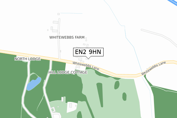
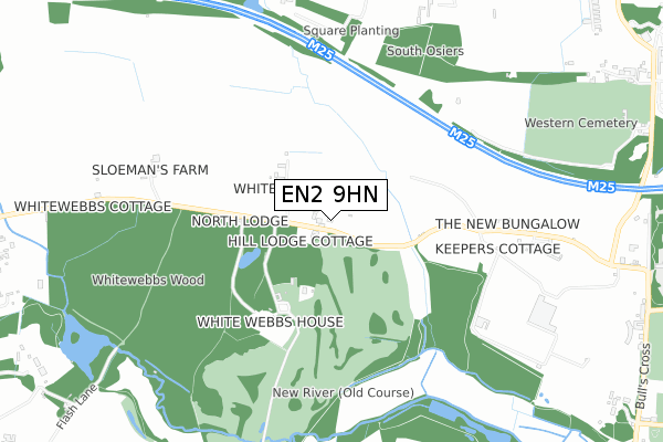
EN2 9HN is located in the Whitewebbs electoral ward, within the London borough of Enfield and the English Parliamentary constituency of Enfield North. The Sub Integrated Care Board (ICB) Location is NHS North Central London ICB - 93C and the police force is Metropolitan Police. This postcode has been in use since January 1980.


GetTheData
Source: OS Open Zoomstack (Ordnance Survey)
Licence: Open Government Licence (requires attribution)
Attribution: Contains OS data © Crown copyright and database right 2025
Source: Open Postcode Geo
Licence: Open Government Licence (requires attribution)
Attribution: Contains OS data © Crown copyright and database right 2025; Contains Royal Mail data © Royal Mail copyright and database right 2025; Source: Office for National Statistics licensed under the Open Government Licence v.3.0
| Easting | 533102 |
| Northing | 199857 |
| Latitude | 51.681712 |
| Longitude | -0.076136 |
GetTheData
Source: Open Postcode Geo
Licence: Open Government Licence
| Country | England |
| Postcode District | EN2 |
➜ See where EN2 is on a map | |
GetTheData
Source: Land Registry Price Paid Data
Licence: Open Government Licence
Elevation or altitude of EN2 9HN as distance above sea level:
| Metres | Feet | |
|---|---|---|
| Elevation | 50m | 164ft |
Elevation is measured from the approximate centre of the postcode, to the nearest point on an OS contour line from OS Terrain 50, which has contour spacing of ten vertical metres.
➜ How high above sea level am I? Find the elevation of your current position using your device's GPS.
GetTheData
Source: Open Postcode Elevation
Licence: Open Government Licence
| Ward | Whitewebbs |
| Constituency | Enfield North |
GetTheData
Source: ONS Postcode Database
Licence: Open Government Licence
| Browning Road Clay Hill | Clay Hill | 1,293m |
| Browning Road Clay Hill | Clay Hill | 1,302m |
| Clay Hill House | Clay Hill | 1,305m |
| Clay Hill | Clay Hill | 1,310m |
| Clay Hill House | Clay Hill | 1,320m |
| Crews Hill Station | 2.1km |
| Turkey Street Station | 2.2km |
| Gordon Hill Station | 2.4km |
GetTheData
Source: NaPTAN
Licence: Open Government Licence
GetTheData
Source: ONS Postcode Database
Licence: Open Government Licence


➜ Get more ratings from the Food Standards Agency
GetTheData
Source: Food Standards Agency
Licence: FSA terms & conditions
| Last Collection | |||
|---|---|---|---|
| Location | Mon-Fri | Sat | Distance |
| Bulls Cross | 17:30 | 12:00 | 1,262m |
| Clay Hill | 17:30 | 12:00 | 1,360m |
| Rosewood Drive | 17:30 | 12:00 | 1,547m |
GetTheData
Source: Dracos
Licence: Creative Commons Attribution-ShareAlike
The below table lists the International Territorial Level (ITL) codes (formerly Nomenclature of Territorial Units for Statistics (NUTS) codes) and Local Administrative Units (LAU) codes for EN2 9HN:
| ITL 1 Code | Name |
|---|---|
| TLI | London |
| ITL 2 Code | Name |
| TLI5 | Outer London - East and North East |
| ITL 3 Code | Name |
| TLI54 | Enfield |
| LAU 1 Code | Name |
| E09000010 | Enfield |
GetTheData
Source: ONS Postcode Directory
Licence: Open Government Licence
The below table lists the Census Output Area (OA), Lower Layer Super Output Area (LSOA), and Middle Layer Super Output Area (MSOA) for EN2 9HN:
| Code | Name | |
|---|---|---|
| OA | E00007029 | |
| LSOA | E01001412 | Enfield 004C |
| MSOA | E02000280 | Enfield 004 |
GetTheData
Source: ONS Postcode Directory
Licence: Open Government Licence
| EN2 9HJ | Whitewebbs Lane | 0m |
| EN2 9HS | Whitewebbs Road | 328m |
| EN2 9HH | Whitewebbs Lane | 445m |
| EN2 9HL | Whitewebbs Lane | 760m |
| EN2 9HW | Whitewebbs Road | 903m |
| EN2 9JN | Whitewebbs Park | 1097m |
| EN7 5HU | Old Park Ride | 1126m |
| EN2 9JL | Clay Hill | 1196m |
| EN7 5HS | Bulls Cross Ride | 1216m |
| EN2 9HE | Bulls Cross | 1228m |
GetTheData
Source: Open Postcode Geo; Land Registry Price Paid Data
Licence: Open Government Licence