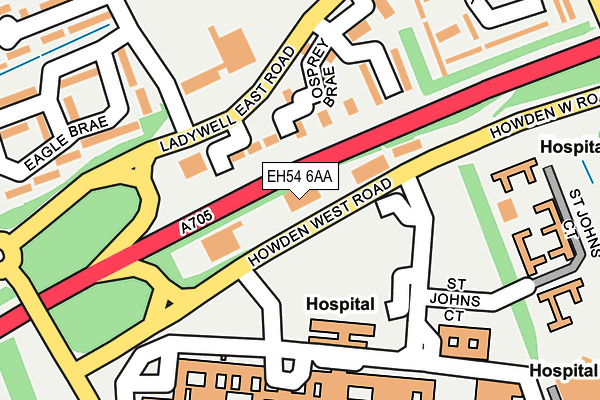
EH54 6AA is located in the Livingston South electoral ward, within the council area of West Lothian and the Scottish Parliamentary constituency of Livingston. The Community Health Partnership is West Lothian Community Health & Care Partnership and the police force is Scotland. This postcode has been in use since January 1980.


GetTheData
Source: OS OpenMap – Local (Ordnance Survey)
Source: OS VectorMap District (Ordnance Survey)
Licence: Open Government Licence (requires attribution)
| Easting | 304820 |
| Northing | 667810 |
| Latitude | 55.893976 |
| Longitude | -3.523539 |
GetTheData
Source: Open Postcode Geo
Licence: Open Government Licence
| Country | Scotland |
| Postcode District | EH54 |
➜ See where EH54 is on a map ➜ Where is Livingston? | |
GetTheData
Source: Land Registry Price Paid Data
Licence: Open Government Licence
| Ward | Livingston South |
| Constituency | Livingston |
GetTheData
Source: ONS Postcode Database
Licence: Open Government Licence
| Eagle Brae (Ladywell East) | Ladywell | 107m |
| Eagle Brae (Ladywell East) | Ladywell | 117m |
| St Johns Hospital (Hospital Grounds) | Howden | 136m |
| St Johns Hospital (Hospital Grounds) | Howden | 167m |
| Braehead Roundabout (Alderstone Road) | Howden | 311m |
| Livingston North Station | 1.5km |
| Livingston South Station | 2.8km |
| Uphall Station | 3.1km |
GetTheData
Source: NaPTAN
Licence: Open Government Licence
GetTheData
Source: ONS Postcode Database
Licence: Open Government Licence


➜ Get more ratings from the Food Standards Agency
GetTheData
Source: Food Standards Agency
Licence: FSA terms & conditions
| Last Collection | |||
|---|---|---|---|
| Location | Mon-Fri | Sat | Distance |
| St Johns Hospital | 16:45 | 11:30 | 193m |
| Eagle Brae | 17:00 | 11:00 | 245m |
| Livingston Delivery Office | 18:30 | 12:30 | 469m |
GetTheData
Source: Dracos
Licence: Creative Commons Attribution-ShareAlike
The below table lists the International Territorial Level (ITL) codes (formerly Nomenclature of Territorial Units for Statistics (NUTS) codes) and Local Administrative Units (LAU) codes for EH54 6AA:
| ITL 1 Code | Name |
|---|---|
| TLM | Scotland |
| ITL 2 Code | Name |
| TLM7 | Eastern Scotland |
| ITL 3 Code | Name |
| TLM78 | West Lothian |
| LAU 1 Code | Name |
| S30000012 | West Lothian |
GetTheData
Source: ONS Postcode Directory
Licence: Open Government Licence
The below table lists the Census Output Area (OA), Lower Layer Super Output Area (LSOA), and Middle Layer Super Output Area (MSOA) for EH54 6AA:
| Code | Name | |
|---|---|---|
| OA | S00134859 | |
| LSOA | S01013309 | Howden - 01 |
| MSOA | S02002488 | Howden |
GetTheData
Source: ONS Postcode Directory
Licence: Open Government Licence