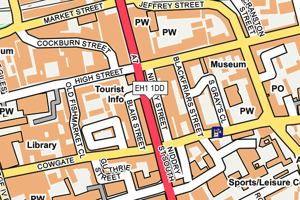
EH1 1DD is located in the City Centre electoral ward, within the council area of City of Edinburgh and the Scottish Parliamentary constituency of Edinburgh East. The Community Health Partnership is Edinburgh Community Health Partnership and the police force is Scotland. This postcode has been in use since August 2009.


GetTheData
Source: OS OpenMap – Local (Ordnance Survey)
Source: OS VectorMap District (Ordnance Survey)
Licence: Open Government Licence (requires attribution)
| Easting | 325965 |
| Northing | 673587 |
| Latitude | 55.949585 |
| Longitude | -3.187102 |
GetTheData
Source: Open Postcode Geo
Licence: Open Government Licence
| Country | Scotland |
| Postcode District | EH1 |
➜ See where EH1 is on a map ➜ Where is Edinburgh? | |
GetTheData
Source: Land Registry Price Paid Data
Licence: Open Government Licence
| Ward | City Centre |
| Constituency | Edinburgh East |
GetTheData
Source: ONS Postcode Database
Licence: Open Government Licence
| South Bridge | Old Town | 29m |
| South Bridge | Old Town | 57m |
| South Bridge | Old Town | 66m |
| Museum Of Childhood (High Street) | Canongate | 115m |
| South Bridge | Old Town | 124m |
| St Andrew Square (Edinburgh Trams) (St Andrew Street) | Edinburgh | 647m |
| Princes Street (Edinburgh Trams) (Princes Street) | Edinburgh | 748m |
| York Place (Edinburgh Trams) (York Place) | Edinburgh | 780m |
| Edinburgh Station | 0.3km |
| Haymarket Station | 2km |
| Slateford Station | 4.3km |
GetTheData
Source: NaPTAN
Licence: Open Government Licence
GetTheData
Source: ONS Postcode Database
Licence: Open Government Licence


➜ Get more ratings from the Food Standards Agency
GetTheData
Source: Food Standards Agency
Licence: FSA terms & conditions
| Last Collection | |||
|---|---|---|---|
| Location | Mon-Fri | Sat | Distance |
| Hunter Square | 18:30 | 12:00 | 46m |
| 80 High Street | 18:30 | 12:15 | 76m |
| Chambers Street | 18:30 | 12:00 | 187m |
GetTheData
Source: Dracos
Licence: Creative Commons Attribution-ShareAlike
The below table lists the International Territorial Level (ITL) codes (formerly Nomenclature of Territorial Units for Statistics (NUTS) codes) and Local Administrative Units (LAU) codes for EH1 1DD:
| ITL 1 Code | Name |
|---|---|
| TLM | Scotland |
| ITL 2 Code | Name |
| TLM7 | Eastern Scotland |
| ITL 3 Code | Name |
| TLM75 | City of Edinburgh |
| LAU 1 Code | Name |
| S30000008 | City of Edinburgh |
GetTheData
Source: ONS Postcode Directory
Licence: Open Government Licence
The below table lists the Census Output Area (OA), Lower Layer Super Output Area (LSOA), and Middle Layer Super Output Area (MSOA) for EH1 1DD:
| Code | Name | |
|---|---|---|
| OA | S00103316 | |
| LSOA | S01008679 | Old Town, Princes Street and Leith Street - 06 |
| MSOA | S02001622 | Old Town, Princes Street and Leith Street |
GetTheData
Source: ONS Postcode Directory
Licence: Open Government Licence