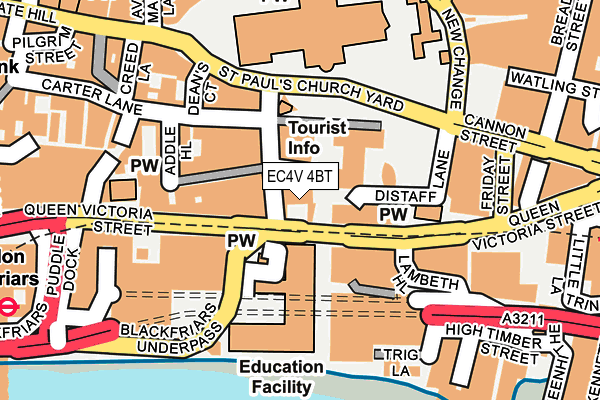
EC4V 4BT is located in the Castle Baynard electoral ward, within the London borough of City of London and the English Parliamentary constituency of Cities of London and Westminster. The Sub Integrated Care Board (ICB) Location is NHS North East London ICB - A3A8R and the police force is City of London. This postcode has been in use since January 1980.


GetTheData
Source: OS OpenMap – Local (Ordnance Survey)
Source: OS VectorMap District (Ordnance Survey)
Licence: Open Government Licence (requires attribution)
| Easting | 532034 |
| Northing | 180970 |
| Latitude | 51.512237 |
| Longitude | -0.098702 |
GetTheData
Source: Open Postcode Geo
Licence: Open Government Licence
| Country | England |
| Postcode District | EC4V |
➜ See where EC4V is on a map ➜ Where is City of London? | |
GetTheData
Source: Land Registry Price Paid Data
Licence: Open Government Licence
Elevation or altitude of EC4V 4BT as distance above sea level:
| Metres | Feet | |
|---|---|---|
| Elevation | 10m | 33ft |
Elevation is measured from the approximate centre of the postcode, to the nearest point on an OS contour line from OS Terrain 50, which has contour spacing of ten vertical metres.
➜ How high above sea level am I? Find the elevation of your current position using your device's GPS.
GetTheData
Source: Open Postcode Elevation
Licence: Open Government Licence
| Ward | Castle Baynard |
| Constituency | Cities Of London And Westminster |
GetTheData
Source: ONS Postcode Database
Licence: Open Government Licence
| Millennium Bridge (Queen Victoria Street) | City Of London | 66m |
| Millennium Bridge (Queen Victoria Street) | City Of London | 72m |
| St Paul's Cathedral | St Pauls | 130m |
| St Pauls Churchyard | City Of London | 140m |
| St Paul's Cathedral (St Paul's Churchyard) | St Pauls | 143m |
| St. Paul's Underground Station | St Pauls | 310m |
| Mansion House Underground Station | Mansion House | 326m |
| Blackfriars Underground Station | Blackfriars | 352m |
| Cannon Street Underground Station | Cannon Street | 580m |
| Bank Underground Station | Bank | 689m |
| London Blackfriars Station | 0.3km |
| City Thameslink Station | 0.4km |
| London Cannon Street Station | 0.6km |
GetTheData
Source: NaPTAN
Licence: Open Government Licence
GetTheData
Source: ONS Postcode Database
Licence: Open Government Licence


➜ Get more ratings from the Food Standards Agency
GetTheData
Source: Food Standards Agency
Licence: FSA terms & conditions
| Last Collection | |||
|---|---|---|---|
| Location | Mon-Fri | Sat | Distance |
| Queen Victoria Street (Godliman St) (R) | 18:30 | 12:00 | 28m |
| Queen Victoria Street | 18:30 | 12:00 | 28m |
| St Pauls Churchyard | 18:30 | 12:00 | 224m |
GetTheData
Source: Dracos
Licence: Creative Commons Attribution-ShareAlike
The below table lists the International Territorial Level (ITL) codes (formerly Nomenclature of Territorial Units for Statistics (NUTS) codes) and Local Administrative Units (LAU) codes for EC4V 4BT:
| ITL 1 Code | Name |
|---|---|
| TLI | London |
| ITL 2 Code | Name |
| TLI3 | Inner London - West |
| ITL 3 Code | Name |
| TLI31 | Camden and City of London |
| LAU 1 Code | Name |
| E09000001 | City of London |
GetTheData
Source: ONS Postcode Directory
Licence: Open Government Licence
The below table lists the Census Output Area (OA), Lower Layer Super Output Area (LSOA), and Middle Layer Super Output Area (MSOA) for EC4V 4BT:
| Code | Name | |
|---|---|---|
| OA | E00000024 | |
| LSOA | E01032739 | City of London 001F |
| MSOA | E02000001 | City of London 001 |
GetTheData
Source: ONS Postcode Directory
Licence: Open Government Licence
| EC4V 5AA | Deans Court | 135m |
| EC4V 5AH | Wardrobe Place | 175m |
| EC4V 3QQ | Trig Lane | 195m |
| EC4V 5BY | St Andrews Hill | 197m |
| EC4V 5DE | St Andrews Hill | 198m |
| EC4V 5DR | Burgon Street | 209m |
| EC4V 5DT | Friar Street | 221m |
| EC4V 3PA | High Timber Street | 231m |
| EC4V 5EA | Carter Lane | 234m |
| EC4V 5EH | Ireland Yard | 237m |
GetTheData
Source: Open Postcode Geo; Land Registry Price Paid Data
Licence: Open Government Licence