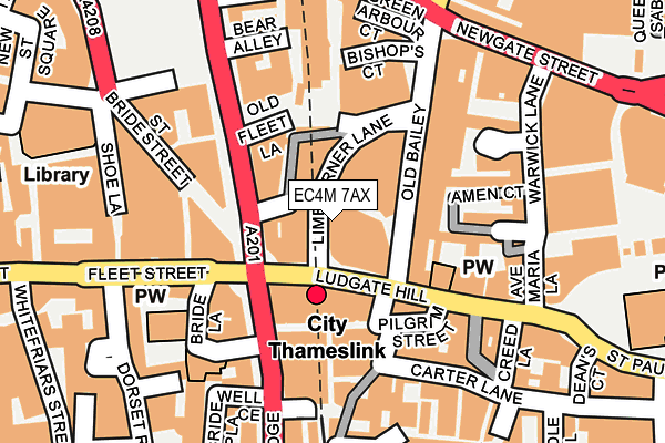
EC4M 7AX is located in the Farringdon Within electoral ward, within the London borough of City of London and the English Parliamentary constituency of Cities of London and Westminster. The Sub Integrated Care Board (ICB) Location is NHS North East London ICB - A3A8R and the police force is City of London. This postcode has been in use since April 2015.


GetTheData
Source: OS OpenMap – Local (Ordnance Survey)
Source: OS VectorMap District (Ordnance Survey)
Licence: Open Government Licence (requires attribution)
| Easting | 531705 |
| Northing | 181220 |
| Latitude | 51.514562 |
| Longitude | -0.103322 |
GetTheData
Source: Open Postcode Geo
Licence: Open Government Licence
| Country | England |
| Postcode District | EC4M |
➜ See where EC4M is on a map ➜ Where is City of London? | |
GetTheData
Source: Land Registry Price Paid Data
Licence: Open Government Licence
Elevation or altitude of EC4M 7AX as distance above sea level:
| Metres | Feet | |
|---|---|---|
| Elevation | 10m | 33ft |
Elevation is measured from the approximate centre of the postcode, to the nearest point on an OS contour line from OS Terrain 50, which has contour spacing of ten vertical metres.
➜ How high above sea level am I? Find the elevation of your current position using your device's GPS.
GetTheData
Source: Open Postcode Elevation
Licence: Open Government Licence
| Ward | Farringdon Within |
| Constituency | Cities Of London And Westminster |
GetTheData
Source: ONS Postcode Database
Licence: Open Government Licence
| City Thameslink Stn Ludgate Circus (Ludgate Hill) | City Of London | 56m |
| Fleet St City Thameslink (Farringdon Street) | City Of London | 84m |
| Fleet St City Thameslink (Farringdon Street) | City Of London | 102m |
| Ludgate Hill Old Bailey (Ludgate Hill) | City Of London | 122m |
| Apothecary Street (New Bridge Street) | Blackfriars | 151m |
| Blackfriars Underground Station | Blackfriars | 332m |
| St. Paul's Underground Station | St Pauls | 403m |
| Farringdon Underground Station | Farringdon | 642m |
| Mansion House Underground Station | Mansion House | 703m |
| Chancery Lane Underground Station | Chancery Lane | 703m |
| City Thameslink Station | 0.1km |
| London Blackfriars Station | 0.3km |
| Farringdon (London) Station | 0.6km |
GetTheData
Source: NaPTAN
Licence: Open Government Licence
GetTheData
Source: ONS Postcode Database
Licence: Open Government Licence


➜ Get more ratings from the Food Standards Agency
GetTheData
Source: Food Standards Agency
Licence: FSA terms & conditions
| Last Collection | |||
|---|---|---|---|
| Location | Mon-Fri | Sat | Distance |
| New Bridge Street (Pilgrim St) | 18:30 | 12:00 | 121m |
| Old Bailey Criminal Court | 17:00 | 159m | |
| St Pauls Churchyard | 18:30 | 12:00 | 199m |
GetTheData
Source: Dracos
Licence: Creative Commons Attribution-ShareAlike
The below table lists the International Territorial Level (ITL) codes (formerly Nomenclature of Territorial Units for Statistics (NUTS) codes) and Local Administrative Units (LAU) codes for EC4M 7AX:
| ITL 1 Code | Name |
|---|---|
| TLI | London |
| ITL 2 Code | Name |
| TLI3 | Inner London - West |
| ITL 3 Code | Name |
| TLI31 | Camden and City of London |
| LAU 1 Code | Name |
| E09000001 | City of London |
GetTheData
Source: ONS Postcode Directory
Licence: Open Government Licence
The below table lists the Census Output Area (OA), Lower Layer Super Output Area (LSOA), and Middle Layer Super Output Area (MSOA) for EC4M 7AX:
| Code | Name | |
|---|---|---|
| OA | E00000026 | |
| LSOA | E01032740 | City of London 001G |
| MSOA | E02000001 | City of London 001 |
GetTheData
Source: ONS Postcode Directory
Licence: Open Government Licence
| EC4Y 1DE | Fleet Street | 119m |
| EC4V 6AB | New Bridge Street | 125m |
| EC4M 7DE | Ludgate Hill | 125m |
| EC4A 4AX | Poppins Court | 129m |
| EC4Y 8DU | Bride Court | 132m |
| EC4Y 8DT | Bride Lane | 136m |
| EC4A 4AB | Farringdon Street | 137m |
| EC4V 5EG | Carter Lane | 141m |
| EC4V 6DX | Ludgate Broadway | 143m |
| EC4Y 8DX | Bride Lane | 149m |
GetTheData
Source: Open Postcode Geo; Land Registry Price Paid Data
Licence: Open Government Licence