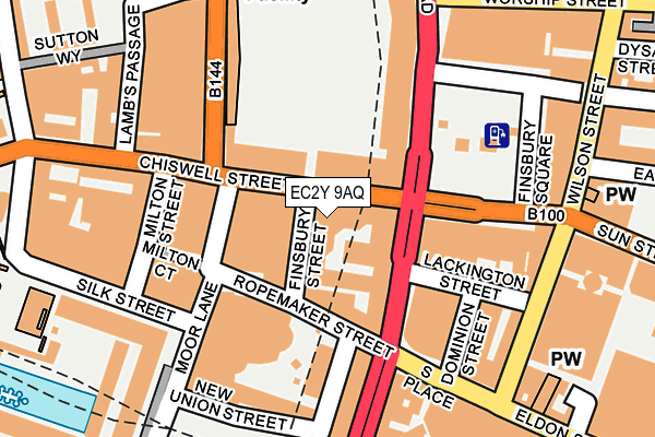
EC2Y 9AQ lies on Finsbury Street in London. EC2Y 9AQ is located in the Bunhill electoral ward, within the London borough of Islington and the English Parliamentary constituency of Islington South and Finsbury. The Sub Integrated Care Board (ICB) Location is NHS North Central London ICB - 93C and the police force is Metropolitan Police. This postcode has been in use since February 2017.


GetTheData
Source: OS OpenMap – Local (Ordnance Survey)
Source: OS VectorMap District (Ordnance Survey)
Licence: Open Government Licence (requires attribution)
| Easting | 532723 |
| Northing | 181892 |
| Latitude | 51.520363 |
| Longitude | -0.088406 |
GetTheData
Source: Open Postcode Geo
Licence: Open Government Licence
| Street | Finsbury Street |
| Town/City | London |
| Country | England |
| Postcode District | EC2Y |
➜ See where EC2Y is on a map ➜ Where is London? | |
GetTheData
Source: Land Registry Price Paid Data
Licence: Open Government Licence
| Ward | Bunhill |
| Constituency | Islington South And Finsbury |
GetTheData
Source: ONS Postcode Database
Licence: Open Government Licence
| Finsbury Street | City Of London | 24m |
| Finsbury Street | City Of London | 32m |
| Finsbury Square (Finsbury Pavement) | Old Street | 82m |
| Finsbury Square | Old Street | 82m |
| Finsbury Square | Old Street | 127m |
| Moorgate Underground Station | Moorgate | 243m |
| Liverpool Street Underground Station | Liverpool Street | 493m |
| Old Street Underground Station | Old Street | 614m |
| Barbican Underground Station | Barbican | 664m |
| Bank Underground Station | Bank | 773m |
| Moorgate Station | 0.2km |
| London Liverpool Street Station | 0.6km |
| Old Street Station | 0.6km |
GetTheData
Source: NaPTAN
Licence: Open Government Licence
GetTheData
Source: ONS Postcode Database
Licence: Open Government Licence


➜ Get more ratings from the Food Standards Agency
GetTheData
Source: Food Standards Agency
Licence: FSA terms & conditions
| Last Collection | |||
|---|---|---|---|
| Location | Mon-Fri | Sat | Distance |
| Finsbury Pavement (Lack'n St) | 18:30 | 12:00 | 87m |
| South Place (Dominion St) | 18:30 | 12:00 | 176m |
| City Road (Opp Worship St) | 18:30 | 12:00 | 231m |
GetTheData
Source: Dracos
Licence: Creative Commons Attribution-ShareAlike
The below table lists the International Territorial Level (ITL) codes (formerly Nomenclature of Territorial Units for Statistics (NUTS) codes) and Local Administrative Units (LAU) codes for EC2Y 9AQ:
| ITL 1 Code | Name |
|---|---|
| TLI | London |
| ITL 2 Code | Name |
| TLI4 | Inner London - East |
| ITL 3 Code | Name |
| TLI43 | Haringey and Islington |
| LAU 1 Code | Name |
| E09000019 | Islington |
GetTheData
Source: ONS Postcode Directory
Licence: Open Government Licence
The below table lists the Census Output Area (OA), Lower Layer Super Output Area (LSOA), and Middle Layer Super Output Area (MSOA) for EC2Y 9AQ:
| Code | Name | |
|---|---|---|
| OA | E00013428 | |
| LSOA | E01002704 | Islington 023D |
| MSOA | E02000576 | Islington 023 |
GetTheData
Source: ONS Postcode Directory
Licence: Open Government Licence
| EC1Y 4YY | Chiswell Street | 103m |
| EC2Y 9AP | Moor Lane | 131m |
| EC2Y 9AZ | Moor Lane | 131m |
| EC2Y 9BA | Moor Lane | 131m |
| EC2Y 9BB | Moor Lane | 131m |
| EC2A 1AN | Finsbury Square | 169m |
| EC1Y 2AA | City Road | 204m |
| EC2Y 8AT | Barbican | 218m |
| EC2Y 8AU | Barbican | 218m |
| EC1Y 2AF | City Road | 221m |
GetTheData
Source: Open Postcode Geo; Land Registry Price Paid Data
Licence: Open Government Licence