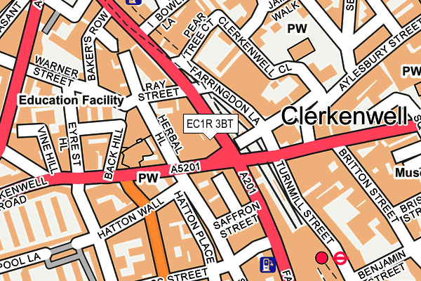
EC1R 3BT is located in the Clerkenwell electoral ward, within the London borough of Islington and the English Parliamentary constituency of Islington South and Finsbury. The Sub Integrated Care Board (ICB) Location is NHS North Central London ICB - 93C and the police force is Metropolitan Police. This postcode has been in use since December 2000.


GetTheData
Source: OS OpenMap – Local (Ordnance Survey)
Source: OS VectorMap District (Ordnance Survey)
Licence: Open Government Licence (requires attribution)
| Easting | 531391 |
| Northing | 182088 |
| Latitude | 51.522433 |
| Longitude | -0.107547 |
GetTheData
Source: Open Postcode Geo
Licence: Open Government Licence
| Country | England |
| Postcode District | EC1R |
➜ See where EC1R is on a map ➜ Where is London? | |
GetTheData
Source: Land Registry Price Paid Data
Licence: Open Government Licence
Elevation or altitude of EC1R 3BT as distance above sea level:
| Metres | Feet | |
|---|---|---|
| Elevation | 10m | 33ft |
Elevation is measured from the approximate centre of the postcode, to the nearest point on an OS contour line from OS Terrain 50, which has contour spacing of ten vertical metres.
➜ How high above sea level am I? Find the elevation of your current position using your device's GPS.
GetTheData
Source: Open Postcode Elevation
Licence: Open Government Licence
| Ward | Clerkenwell |
| Constituency | Islington South And Finsbury |
GetTheData
Source: ONS Postcode Database
Licence: Open Government Licence
| Clerkenwell Road Farringdon Rd (Farringdon Road) | Clerkenwell | 27m |
| Hatton Garden | Holborn | 79m |
| Clerkenwell Road Farringdon Rd (Farringdon Road) | Clerkenwell | 92m |
| Hatton Garden | Holborn | 108m |
| Clerkenwell Green | Clerkenwell | 136m |
| Farringdon Underground Station | Farringdon | 304m |
| Chancery Lane Underground Station | Chancery Lane | 544m |
| Barbican Underground Station | Barbican | 705m |
| Holborn Underground Station | Holborn | 1,047m |
| St. Paul's Underground Station | St Pauls | 1,084m |
| Farringdon (London) Station | 0.3km |
| City Thameslink Station | 1km |
| London Blackfriars Station | 1.2km |
GetTheData
Source: NaPTAN
Licence: Open Government Licence
GetTheData
Source: ONS Postcode Database
Licence: Open Government Licence


➜ Get more ratings from the Food Standards Agency
GetTheData
Source: Food Standards Agency
Licence: FSA terms & conditions
| Last Collection | |||
|---|---|---|---|
| Location | Mon-Fri | Sat | Distance |
| Hatton Garden (St Cross St) | 18:30 | 12:00 | 178m |
| Rosebery Avenue (Laystall St) | 18:30 | 12:00 | 305m |
| St John Square (Albemarle Way) | 18:30 | 12:00 | 313m |
GetTheData
Source: Dracos
Licence: Creative Commons Attribution-ShareAlike
The below table lists the International Territorial Level (ITL) codes (formerly Nomenclature of Territorial Units for Statistics (NUTS) codes) and Local Administrative Units (LAU) codes for EC1R 3BT:
| ITL 1 Code | Name |
|---|---|
| TLI | London |
| ITL 2 Code | Name |
| TLI4 | Inner London - East |
| ITL 3 Code | Name |
| TLI43 | Haringey and Islington |
| LAU 1 Code | Name |
| E09000019 | Islington |
GetTheData
Source: ONS Postcode Directory
Licence: Open Government Licence
The below table lists the Census Output Area (OA), Lower Layer Super Output Area (LSOA), and Middle Layer Super Output Area (MSOA) for EC1R 3BT:
| Code | Name | |
|---|---|---|
| OA | E00013545 | |
| LSOA | E01002724 | Islington 022D |
| MSOA | E02000575 | Islington 022 |
GetTheData
Source: ONS Postcode Directory
Licence: Open Government Licence
| EC1R 5XB | Herbal Hill | 30m |
| EC1R 3BU | Farringdon Road | 30m |
| EC1R 5BL | Clerkenwell Road | 51m |
| EC1R 3BX | Farringdon Road | 61m |
| EC1M 3LL | Farringdon Road | 81m |
| EC1N 8QX | Saffron Hill | 93m |
| EC1R 0AA | Clerkenwell Close | 111m |
| EC1M 3JU | Farringdon Road | 127m |
| EC1N 8HP | Hatton Garden | 128m |
| EC1N 8RU | Hatton Place | 132m |
GetTheData
Source: Open Postcode Geo; Land Registry Price Paid Data
Licence: Open Government Licence