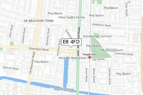
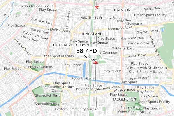
E8 4FD is located in the De Beauvoir electoral ward, within the London borough of Hackney and the English Parliamentary constituency of Hackney South and Shoreditch. The Sub Integrated Care Board (ICB) Location is NHS North East London ICB - A3A8R and the police force is Metropolitan Police. This postcode has been in use since June 2019.


GetTheData
Source: OS Open Zoomstack (Ordnance Survey)
Licence: Open Government Licence (requires attribution)
Attribution: Contains OS data © Crown copyright and database right 2025
Source: Open Postcode Geo
Licence: Open Government Licence (requires attribution)
Attribution: Contains OS data © Crown copyright and database right 2025; Contains Royal Mail data © Royal Mail copyright and database right 2025; Source: Office for National Statistics licensed under the Open Government Licence v.3.0
| Easting | 533434 |
| Northing | 184016 |
| Latitude | 51.539282 |
| Longitude | -0.077360 |
GetTheData
Source: Open Postcode Geo
Licence: Open Government Licence
| Country | England |
| Postcode District | E8 |
➜ See where E8 is on a map ➜ Where is London? | |
GetTheData
Source: Land Registry Price Paid Data
Licence: Open Government Licence
| Ward | De Beauvoir |
| Constituency | Hackney South And Shoreditch |
GetTheData
Source: ONS Postcode Database
Licence: Open Government Licence
| Haggerston Station Downham Rd (Kingsland Road) | De Beauvoir Town | 84m |
| Haggerston Station Downham Rd (Kingsland Road) | De Beauvoir Town | 97m |
| Haggerston Station Downham Rd (Kingsland Road) | De Beauvoir Town | 144m |
| Middleton Road De Beauvoir Town (Kingsland Road) | De Beauvoir Town | 229m |
| Middleton Road De Beauvoir Town (Kingsland Road) | De Beauvoir Town | 248m |
| Haggerston Station | 0.1km |
| Dalston Junction Station | 0.8km |
| Hoxton Station | 0.9km |
GetTheData
Source: NaPTAN
Licence: Open Government Licence
GetTheData
Source: ONS Postcode Database
Licence: Open Government Licence


➜ Get more ratings from the Food Standards Agency
GetTheData
Source: Food Standards Agency
Licence: FSA terms & conditions
| Last Collection | |||
|---|---|---|---|
| Location | Mon-Fri | Sat | Distance |
| Haggerston Road | 18:30 | 11:30 | 111m |
| De Beauvoir Sq/Mortimer Road | 18:30 | 12:00 | 296m |
| 416 Kingsalnd Road E8 | 18:30 | 12:00 | 298m |
GetTheData
Source: Dracos
Licence: Creative Commons Attribution-ShareAlike
The below table lists the International Territorial Level (ITL) codes (formerly Nomenclature of Territorial Units for Statistics (NUTS) codes) and Local Administrative Units (LAU) codes for E8 4FD:
| ITL 1 Code | Name |
|---|---|
| TLI | London |
| ITL 2 Code | Name |
| TLI4 | Inner London - East |
| ITL 3 Code | Name |
| TLI41 | Hackney and Newham |
| LAU 1 Code | Name |
| E09000012 | Hackney |
GetTheData
Source: ONS Postcode Directory
Licence: Open Government Licence
The below table lists the Census Output Area (OA), Lower Layer Super Output Area (LSOA), and Middle Layer Super Output Area (MSOA) for E8 4FD:
| Code | Name | |
|---|---|---|
| OA | E00008724 | |
| LSOA | E01001750 | Hackney 021C |
| MSOA | E02000365 | Hackney 021 |
GetTheData
Source: ONS Postcode Directory
Licence: Open Government Licence
| N1 5EN | Enfield Road | 49m |
| N1 5BF | Downham Road | 51m |
| N1 5AA | Downham Road | 53m |
| E8 4DE | Kingsland Road | 76m |
| E8 4DL | Kingsland Road | 77m |
| N1 5ER | Enfield Road | 92m |
| N1 5AE | Hertford Road | 96m |
| N1 5SH | Hertford Road | 104m |
| N1 5QT | Hertford Road | 108m |
| N1 5AG | Hertford Road | 111m |
GetTheData
Source: Open Postcode Geo; Land Registry Price Paid Data
Licence: Open Government Licence