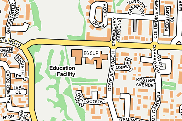
E6 5UP is located in the Beckton electoral ward, within the London borough of Newham and the English Parliamentary constituency of West Ham. The Sub Integrated Care Board (ICB) Location is NHS North East London ICB - A3A8R and the police force is Metropolitan Police. This postcode has been in use since June 1998.


GetTheData
Source: OS OpenMap – Local (Ordnance Survey)
Source: OS VectorMap District (Ordnance Survey)
Licence: Open Government Licence (requires attribution)
| Easting | 541993 |
| Northing | 181658 |
| Latitude | 51.516006 |
| Longitude | 0.044995 |
GetTheData
Source: Open Postcode Geo
Licence: Open Government Licence
| Country | England |
| Postcode District | E6 |
➜ See where E6 is on a map ➜ Where is London? | |
GetTheData
Source: Land Registry Price Paid Data
Licence: Open Government Licence
Elevation or altitude of E6 5UP as distance above sea level:
| Metres | Feet | |
|---|---|---|
| Elevation | 10m | 33ft |
Elevation is measured from the approximate centre of the postcode, to the nearest point on an OS contour line from OS Terrain 50, which has contour spacing of ten vertical metres.
➜ How high above sea level am I? Find the elevation of your current position using your device's GPS.
GetTheData
Source: Open Postcode Elevation
Licence: Open Government Licence
| Ward | Beckton |
| Constituency | West Ham |
GetTheData
Source: ONS Postcode Database
Licence: Open Government Licence
| Beckton District Park (Tollgate Road) | Beckton | 79m |
| Dove Approach (Tollgate Road) | Beckton | 116m |
| Beckton District Park | Beckton | 135m |
| Dove Approach (Tollgate Road) | Beckton | 153m |
| Fulmer Road (Stansfeld Road) | Custom House | 274m |
| Royal Albert Dlr Station (Road Parallel To Royal Albert Way) | Royal Albert | 854m |
| Beckton Park Dlr Station (Royal Albert Way) | Beckton Park | 1,058m |
| Prince Regent Dlr Station (Victoria Dock Road) | Prince Regent | 1,062m |
| Beckton Dlr Station (Woolwich Manor Road) | Beckton | 1,157m |
| London City Airport Dlr Station (Hartmann Road) | Silvertown | 1,425m |
| Woolwich Dockyard Station | 2.8km |
| West Ham Station | 3.1km |
| Woolwich Arsenal Station | 3.4km |
GetTheData
Source: NaPTAN
Licence: Open Government Licence
GetTheData
Source: ONS Postcode Database
Licence: Open Government Licence


➜ Get more ratings from the Food Standards Agency
GetTheData
Source: Food Standards Agency
Licence: FSA terms & conditions
| Last Collection | |||
|---|---|---|---|
| Location | Mon-Fri | Sat | Distance |
| Tollgate Road | 17:30 | 11:30 | 83m |
| Remington Road | 17:30 | 11:30 | 221m |
| Jasper Road | 17:30 | 11:30 | 488m |
GetTheData
Source: Dracos
Licence: Creative Commons Attribution-ShareAlike
| Risk of E6 5UP flooding from rivers and sea | Low |
| ➜ E6 5UP flood map | |
GetTheData
Source: Open Flood Risk by Postcode
Licence: Open Government Licence
The below table lists the International Territorial Level (ITL) codes (formerly Nomenclature of Territorial Units for Statistics (NUTS) codes) and Local Administrative Units (LAU) codes for E6 5UP:
| ITL 1 Code | Name |
|---|---|
| TLI | London |
| ITL 2 Code | Name |
| TLI4 | Inner London - East |
| ITL 3 Code | Name |
| TLI41 | Hackney and Newham |
| LAU 1 Code | Name |
| E09000025 | Newham |
GetTheData
Source: ONS Postcode Directory
Licence: Open Government Licence
The below table lists the Census Output Area (OA), Lower Layer Super Output Area (LSOA), and Middle Layer Super Output Area (MSOA) for E6 5UP:
| Code | Name | |
|---|---|---|
| OA | E00017775 | |
| LSOA | E01003513 | Newham 035D |
| MSOA | E02000748 | Newham 035 |
GetTheData
Source: ONS Postcode Directory
Licence: Open Government Licence
| E6 5TJ | Dove Approach | 84m |
| E6 5TP | Osprey Close | 113m |
| E6 5SY | Greencroft Close | 118m |
| E6 5ST | Neatscourt Road | 126m |
| E6 5SU | Woodhatch Close | 141m |
| E6 5UG | Dewberry Gardens | 143m |
| E6 5TL | Mavis Walk | 144m |
| E6 5SS | Crayford Close | 161m |
| E6 5XA | Robin Crescent | 170m |
| E6 5TN | Pintail Close | 184m |
GetTheData
Source: Open Postcode Geo; Land Registry Price Paid Data
Licence: Open Government Licence